
A complex and busy weather day is setting up across Texas as we face a multitude of weather hazards as an upper level low moves into our state. We’re dry this morning but we’ll start to see precipitation develop this afternoon and increase in coverage/intensity tonight. Most folks will see precipitation tonight and on Thursday. A high-end winter storm is now forecast across the Texas Panhandle and South Plains where the western Panhandle and northwest South Plains could see up to a foot of snow. 3 to 8 inches of snow is expected across the central Panhandle into South Plains including Lubbock and Amarillo. 1 to 5 inches of snow will be possible across the eastern Panhandle and eastern South Plains into Rolling Plains. 1 to 4 inches of snow is expected in the Permian Basin and Trans-Pecos into the Davis Mountains.
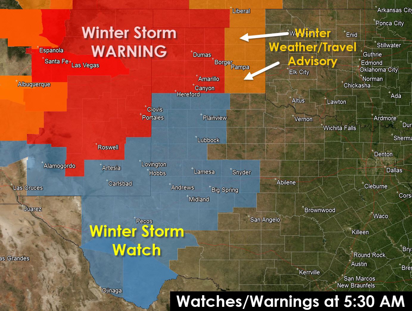
This winter storm will feature several differences compared to the past few events this month. The first is we will not be dealing with a winter mix. It will either be rain or snow because of a cold core upper level low. Temperatures above the surface will be quite cold versus our previous events where we had a layer of warm air a few thousand feet above the ground. Because we have such cold air moving across parts of Texas associated with the upper level low it will be imperative to monitor the track of this low. Areas under this low may end up changing over to a wet snow even if surface temperatures are in the mid 30s (above freezing). Those warmer temperatures would keep roads just wet but would allow for accumulation of snow on grassy surfaces. Unfortunately these cold core upper level lows are one of the most difficult to deal with in a forecast. For that reason we could end up having to deal with major forecasts changes today across some areas. Right now the forecast for Graham is mainly rain with a little snow mix. If temperatures end up being 2 degrees cooler like some models are saying there could be upwards of 5-10 inches of snow. I’m not saying Graham or western North Texas will get that much snow if things turn colder but there is a lot of moisture to work with and if we end up with colder temperatures we could easily go from a cold rain to a major winter storm in parts of Northwest and western North Texas. That’s why you need to check back for forecast updates since if it looks like its going to be colder than there will be some big changes to the forecast.
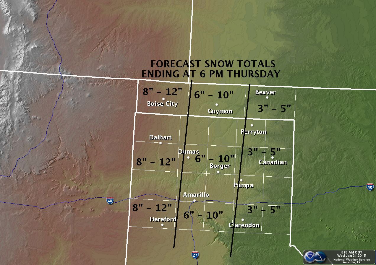
With all that said here is the current snow accumulation forecast from the National Weather Service. These numbers are just a forecast and with the many factors going into the forecast I do expect there will need to be adjustment in the snow forecast throughout the day so this graphic will change somewhat.

In fact here’s an updated accumulation forecast for the Texas Panhandle issued shortly after I made the comprehensive snow graphic. Do note that we’re talking about 6-12 inches of snow across much of the Texas Panhandle including Amarillo. That’ll no doubt cause major problems on Interstate 40 and most roads by tonight and on Thursday.
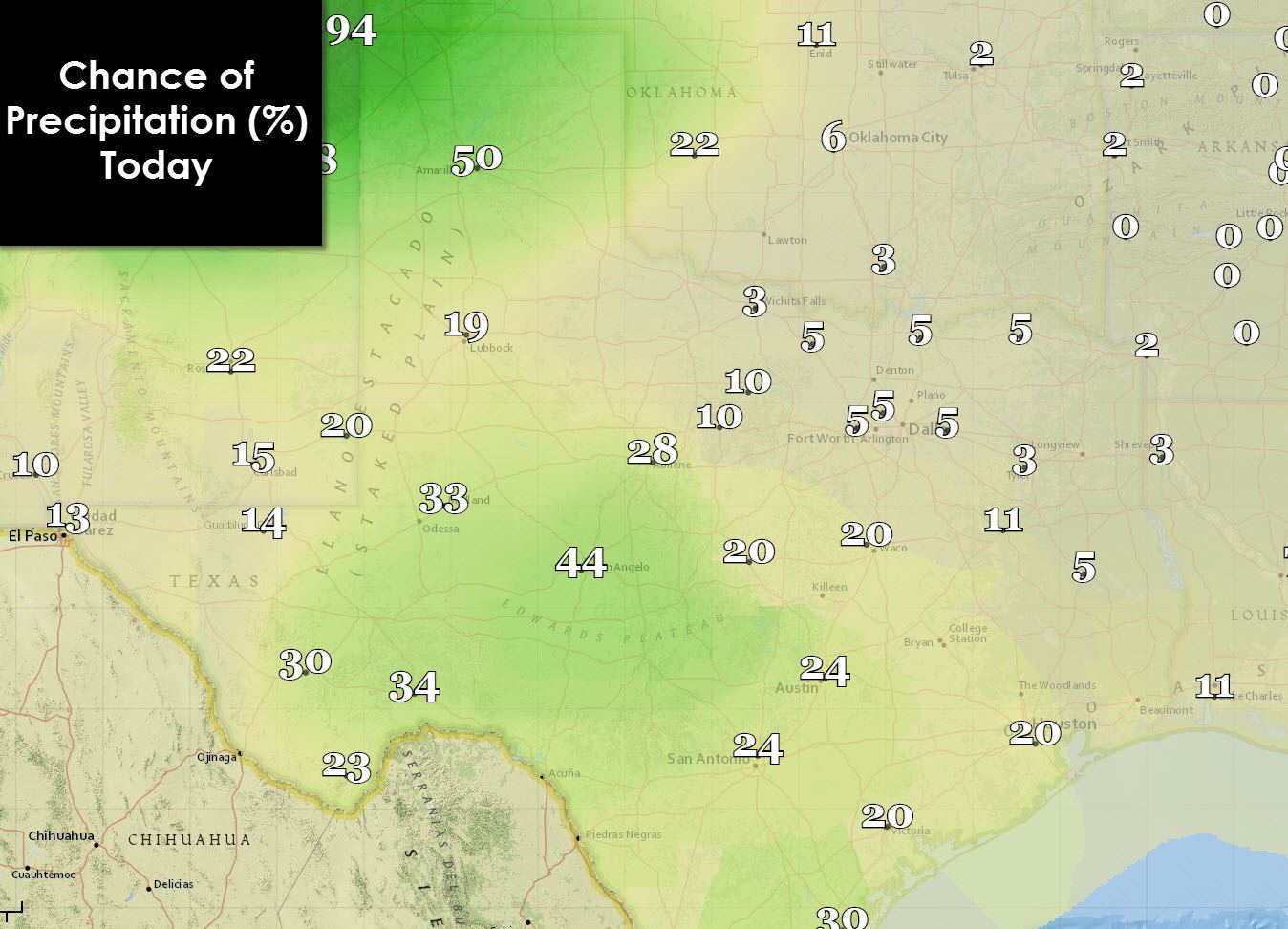
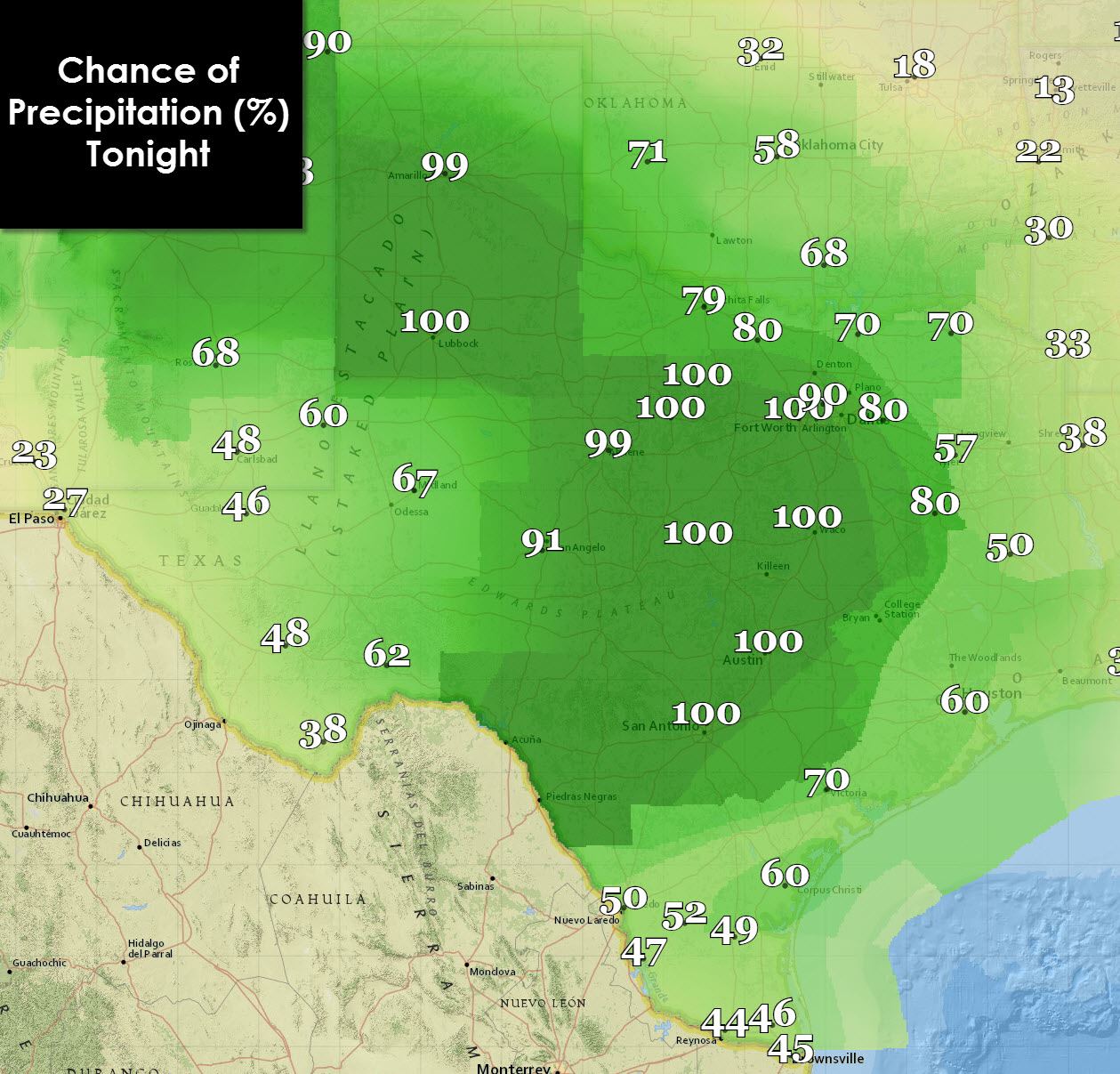
Here’s the graphical representation of precipitation chances for the state today, tonight, and on Thursday. We’ll start seeing precipitation increase early this afternoon across the Texas Panhandle, northwestern South Plains, south into the Permian Basin, Concho Valley, and South-Central Texas. By this evening we’ll see a large area of rain move into North and Central Texas while snow increases in coverage and intensity across the Panhandle, South Plains, Permian Basin, and Trans-Pecos. On Thursday most of the state will experience precipitation as the upper level low is right over the state.

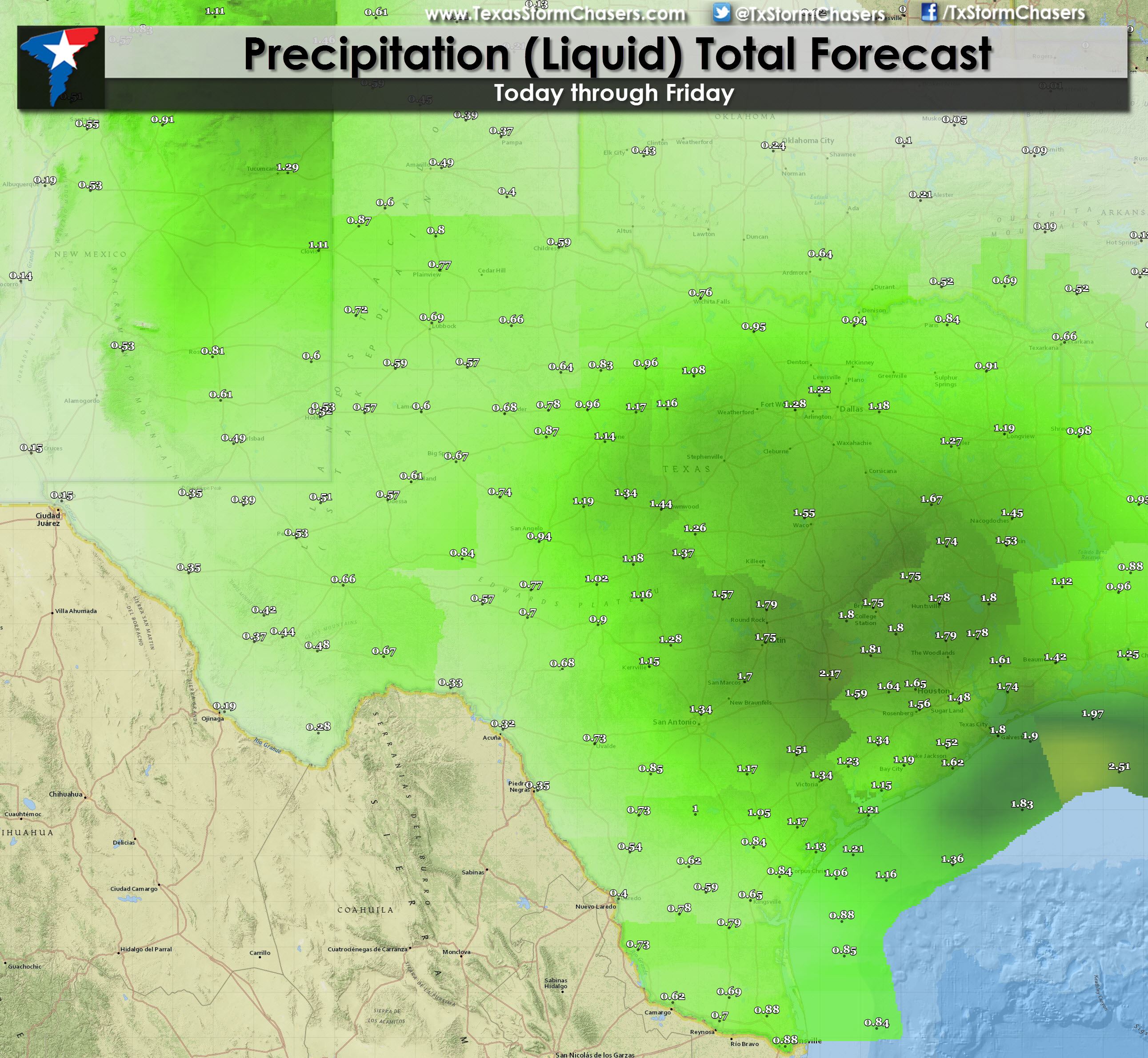
Central Texas, South Texas, East Texas, and Southeast Texas will all experience beneficial rains beginning tonight and continuing into Thursday night with widespread accumulations of 0.75″ to 2″ of rain. No severe weather or winter weather is expected in these areas but do expect a cold and wet couple of days ahead. Here’s a look at forecast liquid precipitation forecast through Friday for Texas. This includes rain accumulations and the liquid equivalent of snow accumulations. The image is quite large so you’ll likely need to enlarge it and zoom in to your location.
 Finally for a more detailed look at the precipitation’s timing here are a series of graphics from the 06Z North American Model. While the radar may not look exactly like this later today it gives a good idea of the general evolution of the storm system. Timestamps are in the top-left corner of the graphics and are in central time.
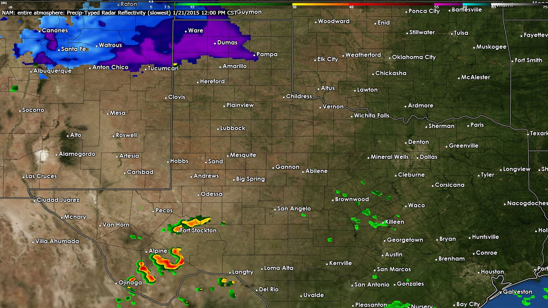
06Z NAM – Simulated Radar at 12 PM Today
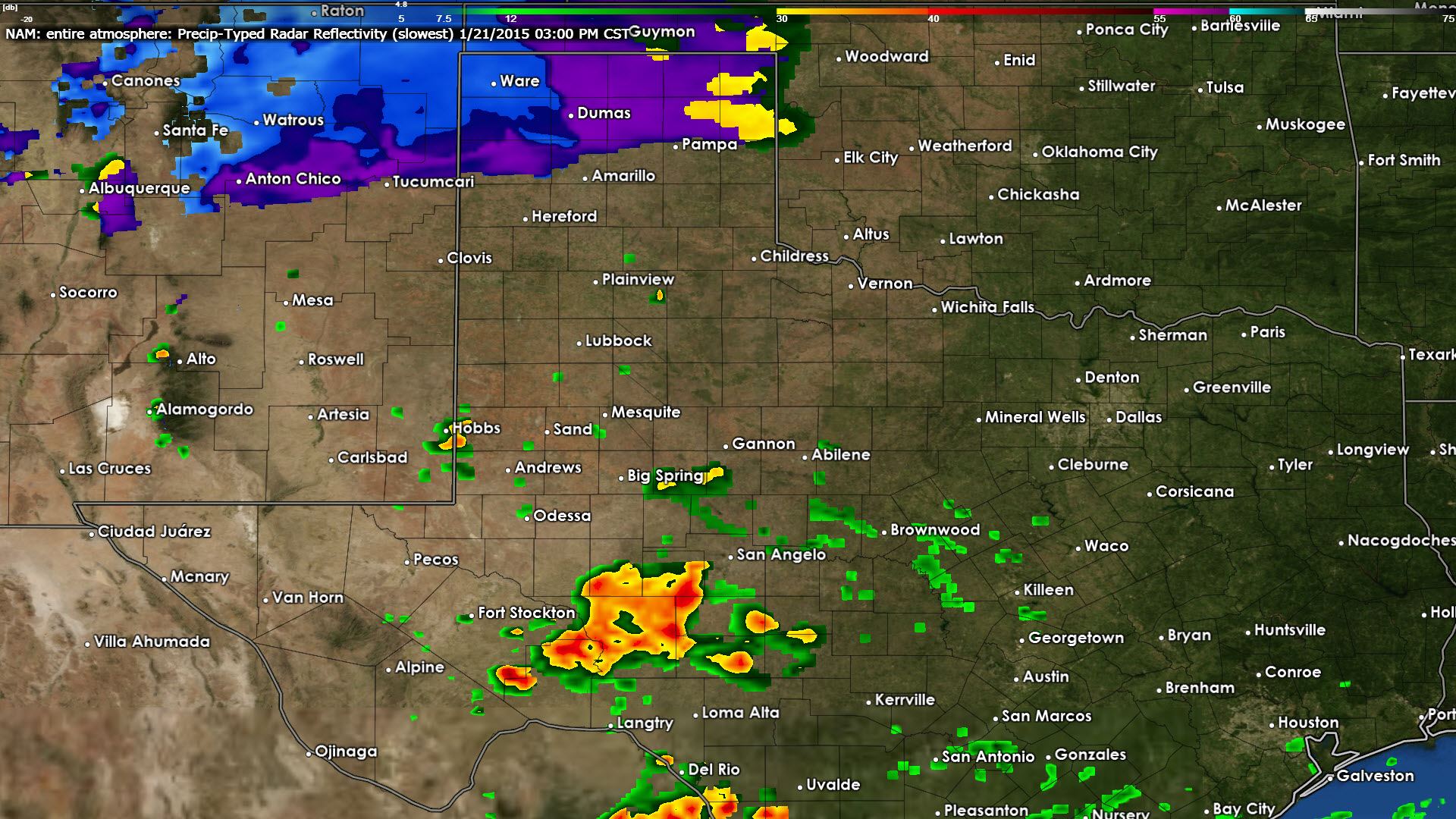
06Z NAM – Simulated Radar at 3 PM Today
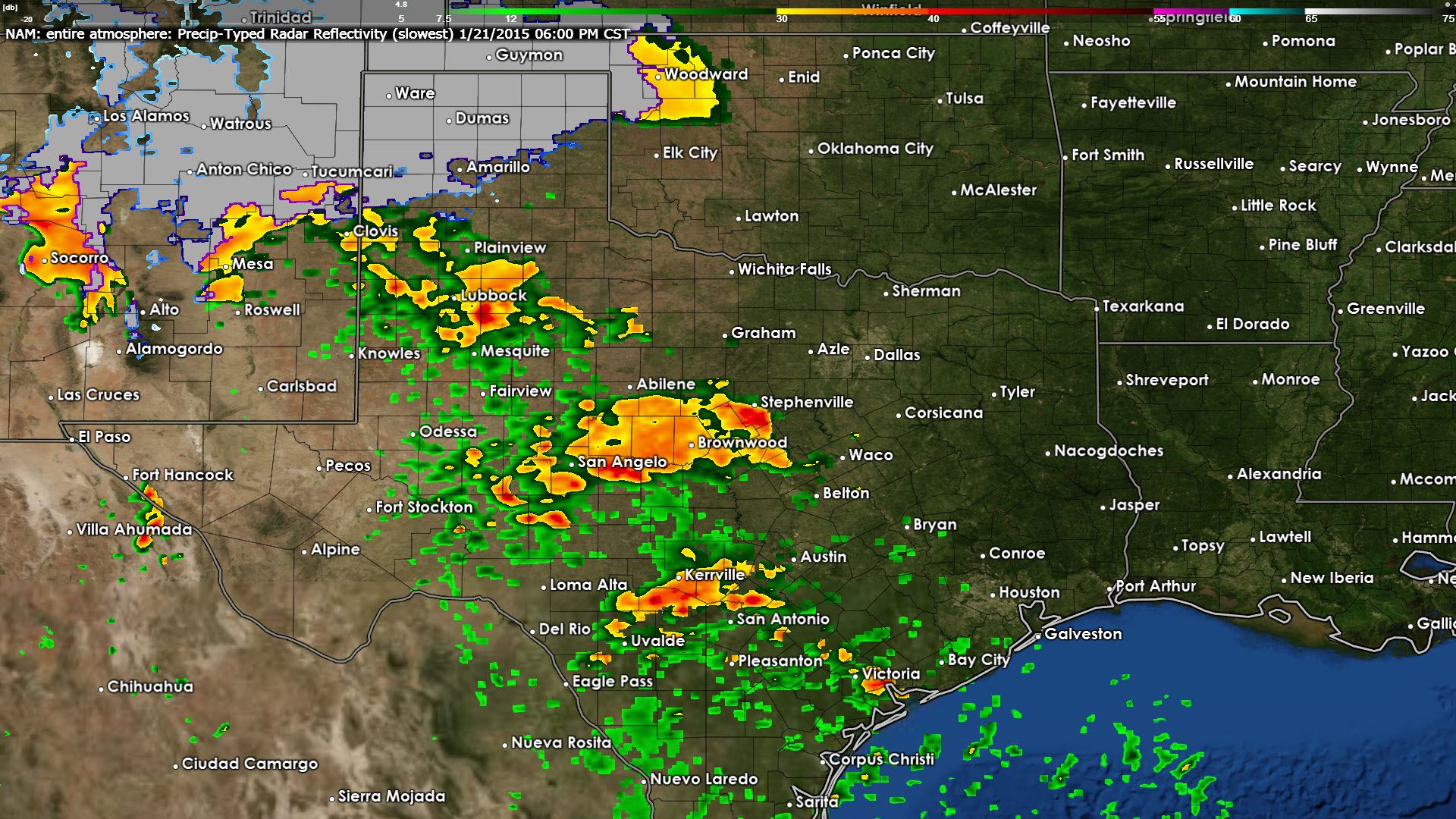
06Z NAM – Simulated Radar at 6 PM Today

06Z NAM – Simulated Radar at 9 PM Today
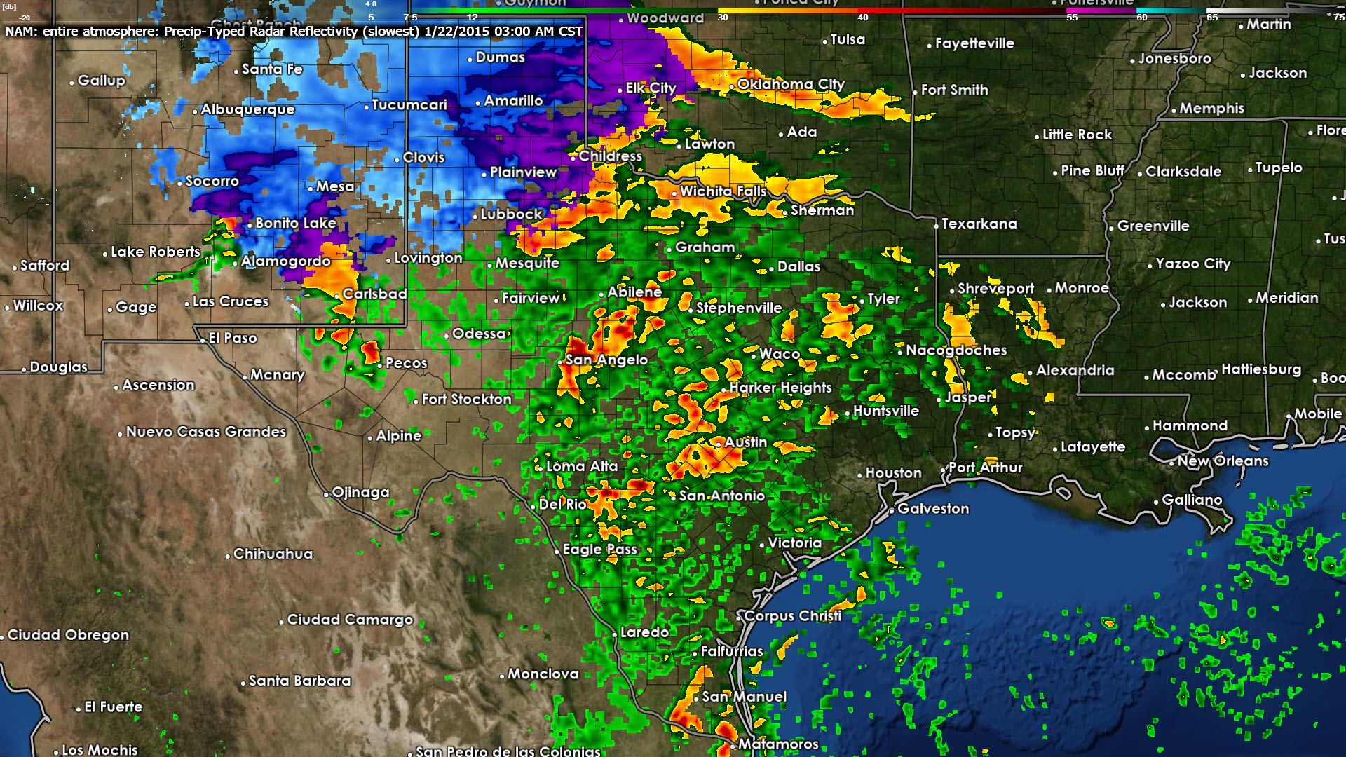
06Z NAM – Simulated Radar at 3 AM Thursday
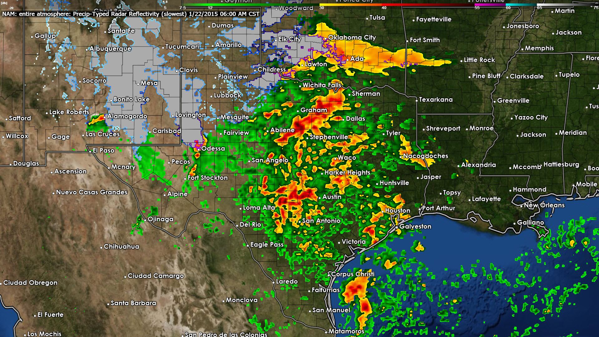
06Z NAM – Simulated Radar at 6 AM Thursday


0 Comments