
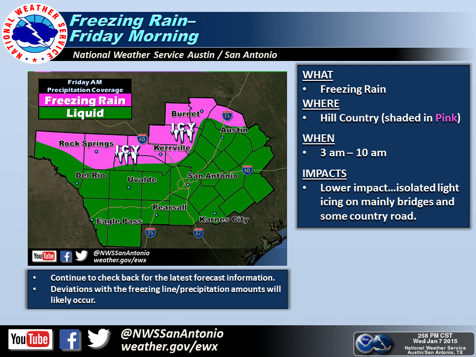
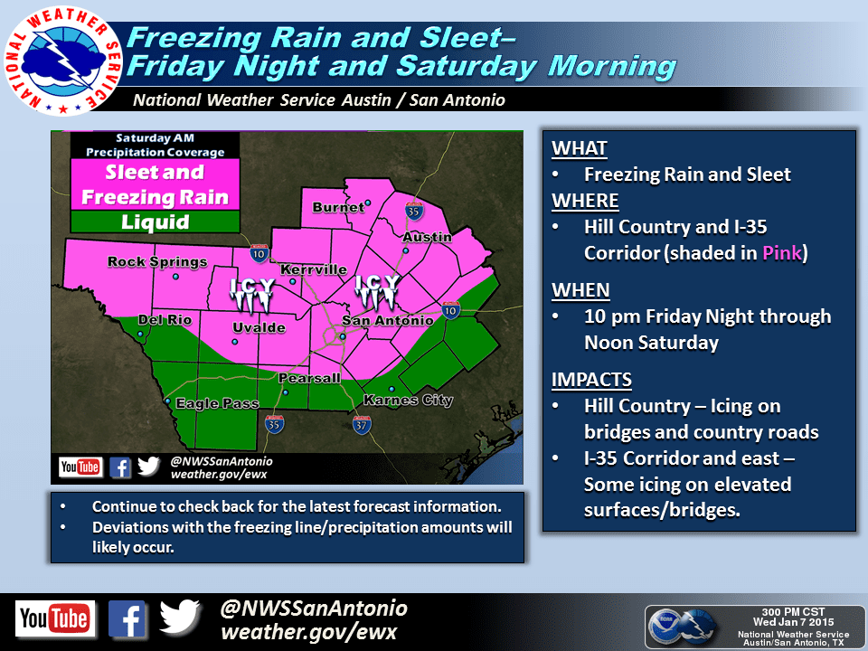
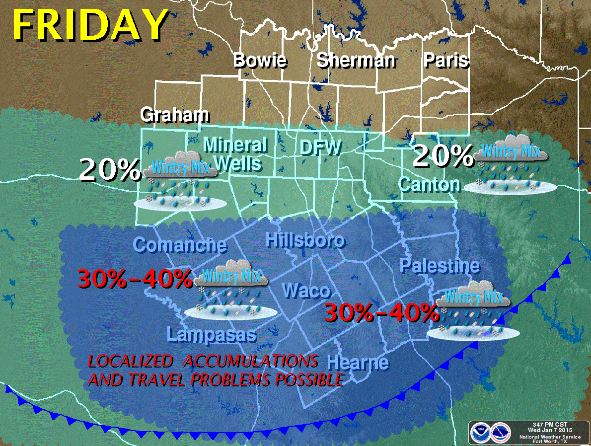
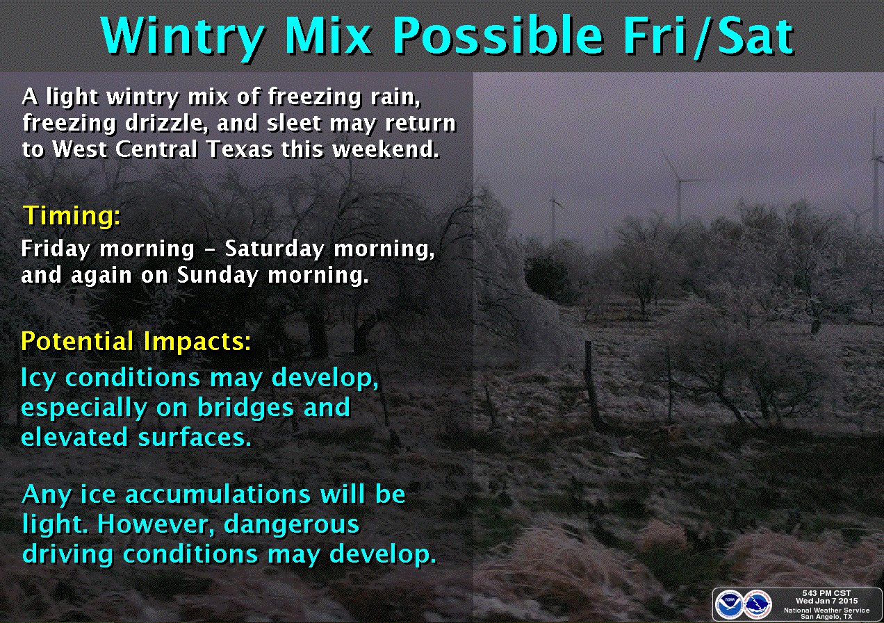
Good evening and welcome to what will be the coldest night most of Texas has seen this season. We’re going to have several bouts of cold air over the next week as reinforcements hots of arctic air continue to push into Texas. We’ll also have brief warm ups which unlike our neighbors to the north will create difficulties with forecasting precipitation type. This is a low confidence forecast and thus I stress you should check back for updates on Thursday and into the weekend. Since we’re still 24+ hours out no one forecast solution is locked in. With that said lets show you what we’re thinking now. A weak storm system will bring the chance for light precipitation during the morning and early afternoon hours on Friday. As of now the best chance (relatively speaking) for precipitation will be across Central and Southeast Texas where moisture levels will be highest. It’s looking like for the D/FW Metroplex (Interstate 20) and points north the airmass will be too dry to support any precipitation. Depending on where the freezing line is during the morning on Friday we do expect there will be some frezing rain and sleet across Central Texas, south of the D/FW Metroplex but likely north of the Austin metro. While overall accumulations are expected to by light any sort of freezing rain that falls could create a layer of ice on bridges/overpasses. Just 0.01″ of freezing rain can turn bridges into skating rinks so some travel impacts will be possible. I’m publishing this just before we start receiving the first of our evening weather model data so please check back on Thursday as we continue to make forecast refinements. Another round of precipitation and potential winter weather will be possible on Saturday as another storm system moves into the region. Considering that is still 48+ hours out I don’t want to focus on that yet but it too could cause light accumulations of ice and travel headaches across parts of the state. Check back on Thursday for the latest forecast updates!


0 Comments