
Good Morning Texas! Welcome to your Thursday morning edition of the Texas Weather Roundup. It’s been a long night for me as I’ve been covering the significant winter storm that impacted the Texas Panhandle last night and this morning. Amarillo ended up with 13 inches of snow with a majority of that falling in about 2.5 hours. 4 inches of snow fell in just one hour which is absolutely insane and rarely seen anywhere in North America. I wouldn’t be shocked if a paper ends up getting written regarding the meteorological event that occurred in the Panhandle (specifically Amarillo) last night. We’ve got dozens of snow pictures over on our Twitter account which you can access on the right sidebar (desktop site) or below this post if you’re on your phone. Be sure to follow us on Twitter at TxStormChasers since that is the best way to talk with us in real time. Enough about what happened last night – lets talk about what’s going to happen today!
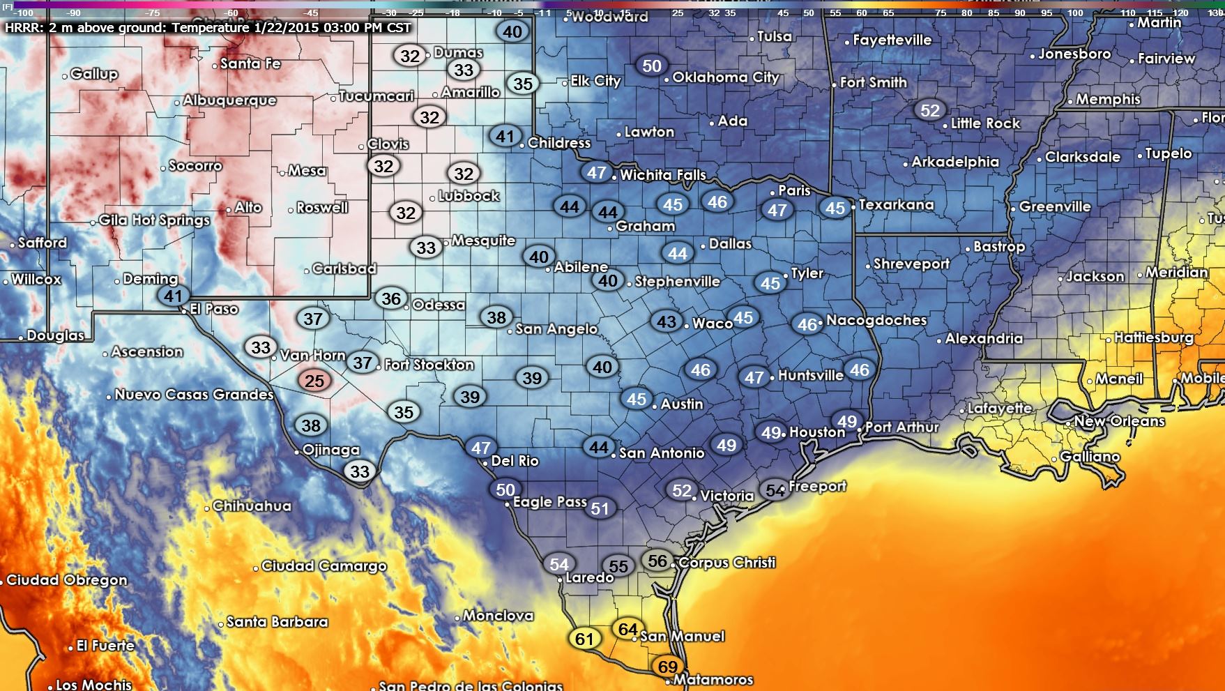
Before I dive into our busy forecast let’s just take a quick look at what our temperatures should be around 3 PM this afternoon. I do need to point out that in areas that have snow cover I really think temperatures will struggle to rise today. Locations like the Texas Panhandle and Western/Central Oklahoma will likely not come close to the projected temperatures on this graphic because snow cover will keep temperatures from rising too much.
We’re starting off this morning with two individual precipitation areas. One is impacting the South Plains and southern half of the Texas Panhandle with light to moderate snow. The second area if a large area of moderate rain which extends from the Red River from US-81 all the way east to Texarkana. This rain continues south from the Red River to Interstate 10 in South Texas! Talk about a large batch of rain and some happy Texans this morning. I know it’s a dreary and wet morning but we really do need the rain. Since most vegetation is dormant because its winter hopefully we can get a decent runoff of water into area lakes.
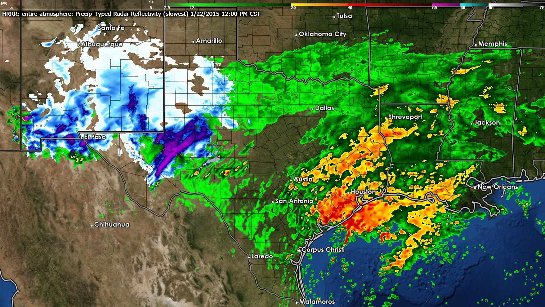
As the storm system producing all this rain begins to exit the region we should see the rain move east of I-35 later this morning and by lunchtime should be exiting the I-35 corridor from the Red River south to San Antonio. East and Southeast Texas will still be getting soaked. While the steady heavier rain will exit North Texas by early afternoon it does look like mist and/or areas of light rain will continue through the afternoon hours as a moist atmosphere remains in place. Out west in the Permian Basin a second piece of upper level energy will be entering the region and it looks like we’ll have snow falling around lunchtime from Midland and Odessa south to Fort Stockton and Interstate 10.
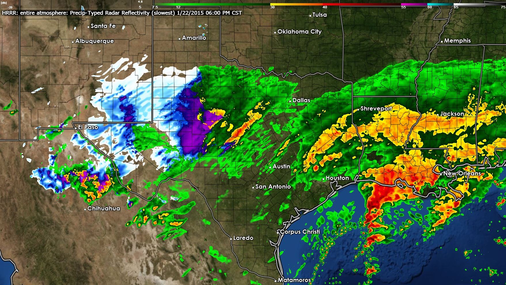
By dinner time the second storm system will have caused another round of widespread precipitation to develop across the Concho Valley extending east into North Texas. Rain will also still be occuring in East Texas from the storm system. All precipitation will be moving northeast today. In locations near or below freezing we’ll likely see snow or a rain/snow mix as indicated by the blue shading on the simulated radar image. This is where some snow accumulation on grassy and elevated surfaces will be possible. We’ll keep an eye on things and post updates to the accumulation forecast as needed.

Expected rain totals today and tonight are looking good along and east of I-35 across East and Southeast Texas where we could see some locations receive an additional 2+ inches of rain today. Southeast Texas was already mainly out of drought conditions and this round of rain will ensure those folks stay out of the drought for the next few weeks if they were not to receive any more rain after today. Combined with the wet snow that fell last night/this morning across the Panhandle and South Plains along with additional winter precipitation and rain expected today across Texas this has been a very beneficial storm system for our state. Hopefully we’ll see some positive response in our lakes.

I’ve compiled a video animation from the High Resolution Rapid Refresh showing the progress of today’s weather. Keep in mind this is a weather model so it may have some errors. The video file is about 25 MB so some slower connections may need a few seconds to let it buffer.


0 Comments