
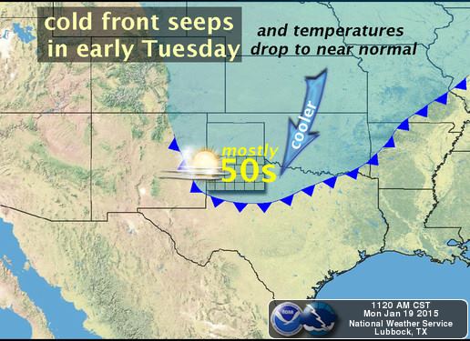
Synopsis: A slow moving cold front will begin moving through the state early tomorrow with only minimal impacts on surface temperatures at first. A secondary push of colder air will drag its feet, like a kid getting sent to timeout, and not arrive until Wednesday across the northern half of the state and eventually filter down through the southern half of the state late Thursday. At the same time, an upper level system will be moving in from the desert southwest providing an opportunity for widespread precipitation chances beginning late Wednesday through Thursday. The latest forecast models are also starting to show increasing chances for accumulating snow across the northern and western panhandle…with a mixed bag of winter precip opportunities across parts of west Texas/Trans Pecos, south rolling plains, and Permian Basin region of west central Texas. No, we’re not quite done with winter just yet!
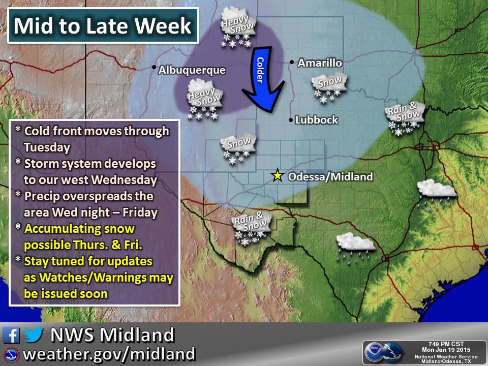
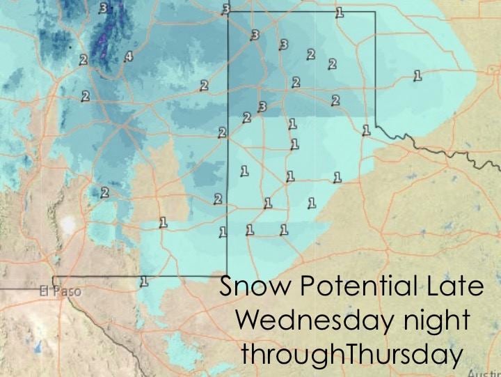
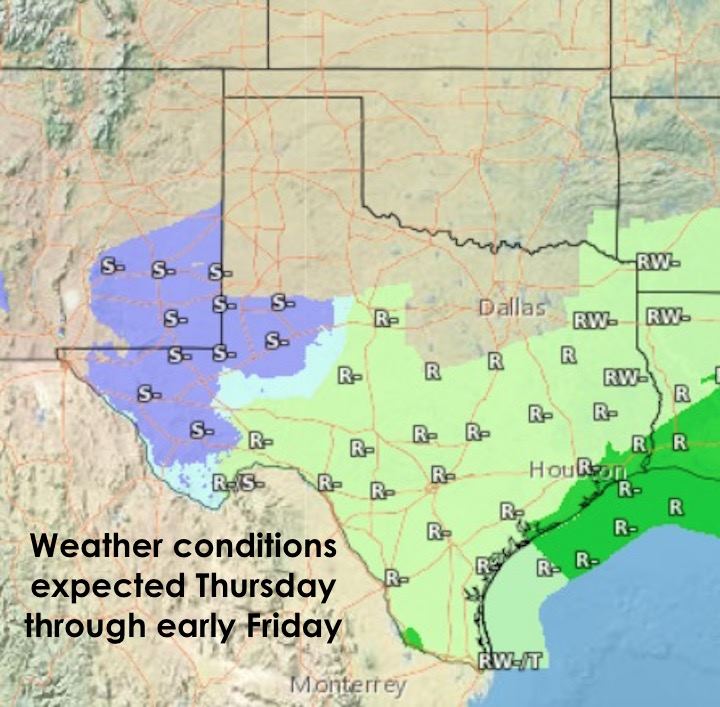
Winter Weather Highlights: This forecast will continue to refine, but for now, best chances for accumulating snow resides across the panhandle, possibly the rolling plains, and across the higher elevations of west Texas. Chances for snow mixed with freezing rain/sleet also exist across far west Texas and south rolling plains Wednesday night. Obviously travel impacts can be expected for locations receiving snow, freezing rain and sleet by early Thursday morning. Parts of western north Texas may also see some light snow by Thursday morning; however, significant travel impacts look less likely across this region with temperatures expected to remain just above freezing and roadway/soil temperatures still warm as well. That said, this system as a whole will need to be watched for any signs of coming in stronger and colder, as the forecast models are currently trending, as this could lead to increasing ice and snow accumulations across these areas.

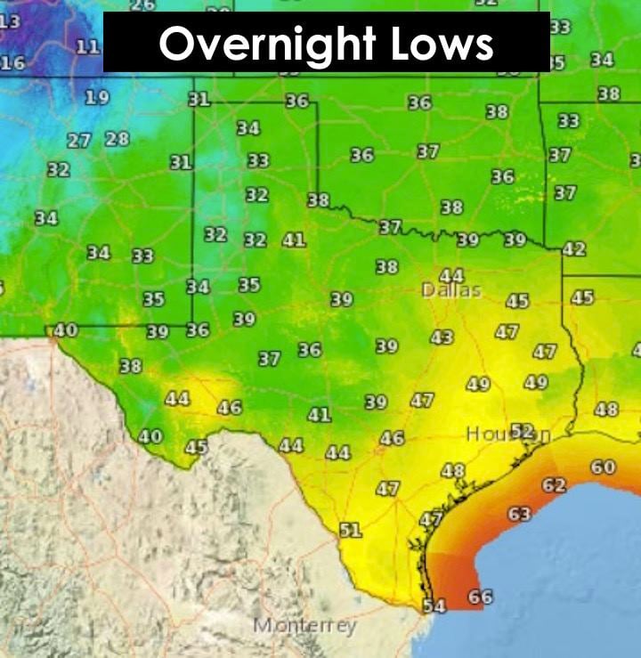
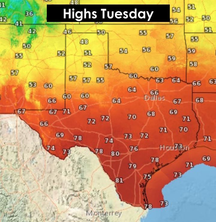
Overnight Tonight/Tomorrow: Tonight, cool and seasonable with widespread fog development likely across coastal areas in the pre-dawn hours tomorrow morning. Some areas could see dense fog development with some early morning travel impacts expected. This will be monitored overnight by local forecast offices with a few dense fog advisories possible before daybreak. Highs tomorrow look to be seasonal across the panhandle after passage of our next front with warmer and above normal for the remainder of the state as the cooler air takes its time to filter in. Most areas should remain sunny to partly sunny until Wednesday when cloudy and dreary conditions for a few days. Enjoy the sun while it lasts!


0 Comments