

Animated image. Give it a few seconds to load and it will begin its animation. Courtesy of the NWS office in Ft. Worth, TX.
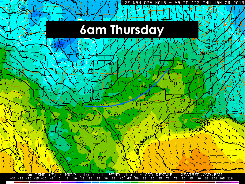
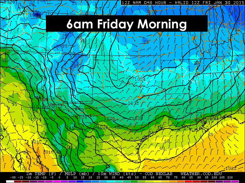
I hope everyone has enjoyed the past several days of sunshine and warm spring-like temps because that will all begin to change tomorrow as our next arctic front arrives. Realistically, tomorrows temps will still be pretty nice for most of central and south Texas as it will take longer for the effects of the front to reach those areas. But for the panhandle and northern Texas, we will begin to feel the effects of the front as it begins to move through early tomorrow. Temperatures will get chilly and stay chilly through the middle of next week for all except deep south Texas where temperatures are expected to stay fairly mild. We’ll have another cold front arrive Sunday, then yet another later next week. The highs and lows each day won’t be radically below normal, but we will see several days where we could be a good 10 degrees or so below seasonal normals. Pretty much typical for Texas…Spring one day, Winter the next!
Here’s a look at the timing of the front….


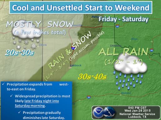
Rain! An upper level disturbance approaches by the weekend and will bring widespread chances for beneficial rain for much of the state. Snow will be likely across the western panhandle Friday into Saturday. The central panhandle region will have a chance for seeing a mix of snow and rain. The eastern panhandle, will likely see mostly rain with maybe some big fat flakes mixed in. Other areas with potential to see some snowfall with be the Guadalupe mountains and the far northwestern Permian Basin. Accumulations between 1 to 2 inches is possible which will likely lead to some icy roads late Friday night into early Saturday. Plan accordingly!
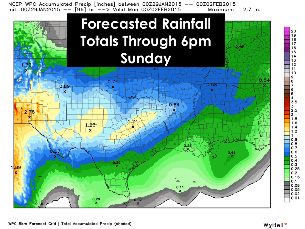
Elsewhere, a cold rain will dominate most of Saturday. Most areas are expected to receive between 1/3 to 1 inch of rain, but some may see between 1 and 2 inches before this system finally clears out on Sunday. It’s a bit disappointing that it has to mess up the weekend, but we certainly still need this rain as it chips away at our longstanding drought.


0 Comments