
It looks like Old Man Winter isn’t going to loosen his stranglehold on us anytime soon! Precipitation chances pick up late this week and into the weekend with the approach of another upper level trough. At the same time, yet another blast of arctic air arrives from the north. The combination of the two at just the right time could mean the chance for a mix of winter precipitation across parts of north and central Texas early Friday into Saturday. 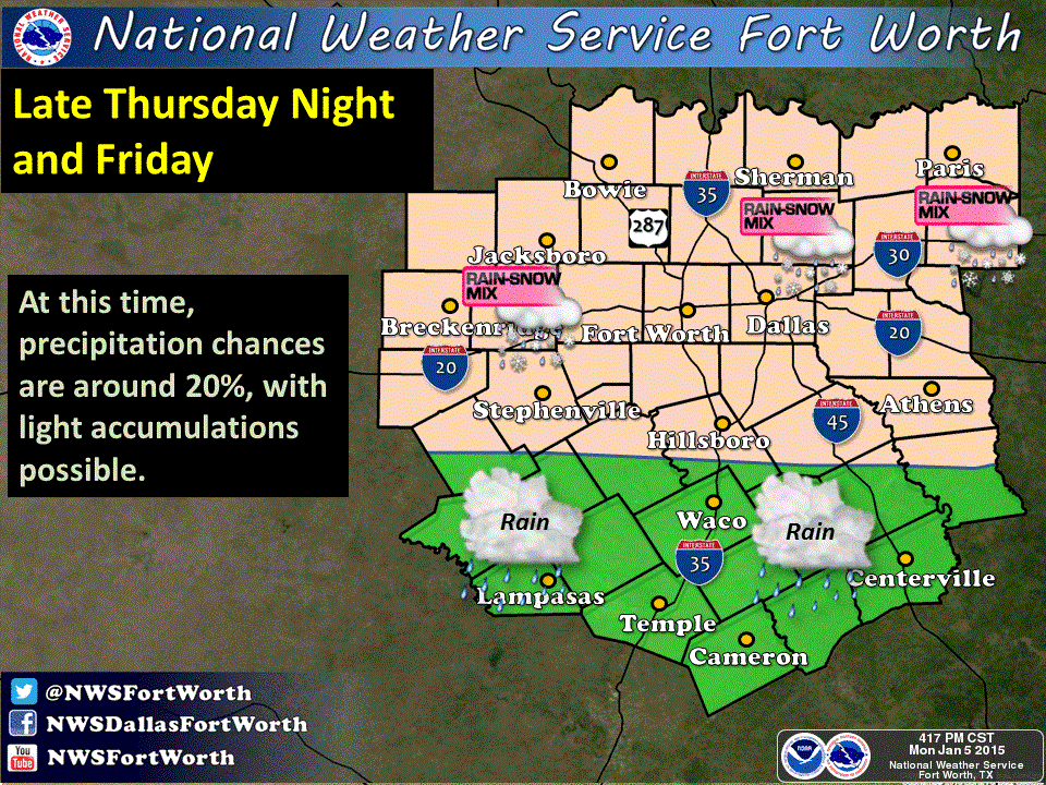
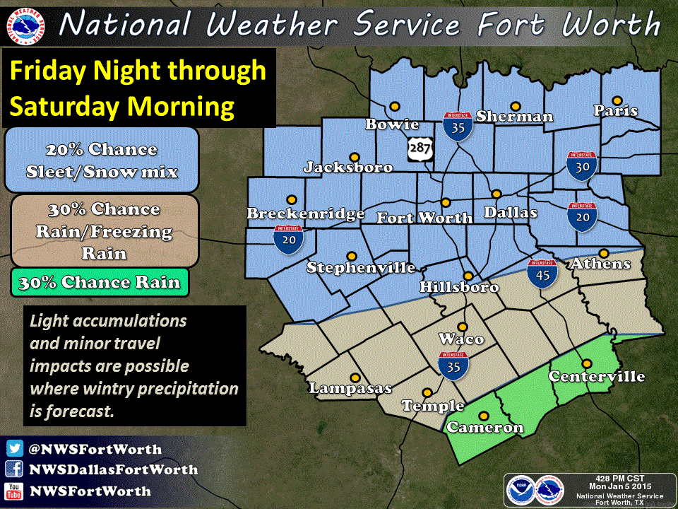
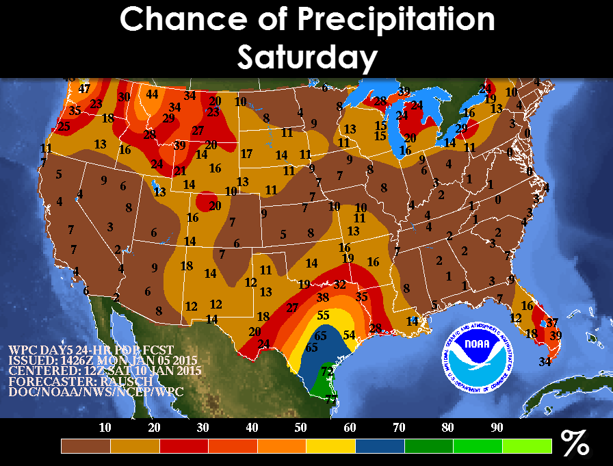
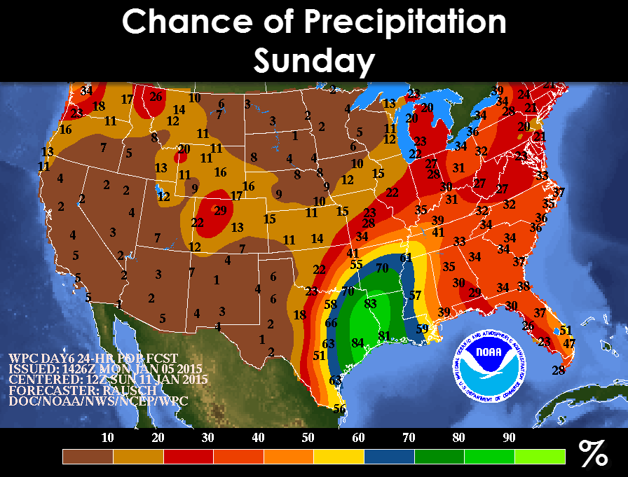
Dallas/Ft. Worth and areas to the north north will have the best chances of seeing at least some light freezing rain and light snow early Friday into early Saturday. Further south towards Waco, Temple and the northern Hill Country region west of I-35 could see a mix of rain and freezing rain late Thursday night into early Saturday morning. This forecast is NOT etched in stone yet as we’re still several day out, but the forecast models are beginning to show a consistency with bringing the cold front in a bit faster and while the precipitation is still falling. That said, just be aware of the possibility and we’ll continue to monitor this and keep you up to date as we get further into the week! For now here are the chances for precipitation on Saturday and Sunday. With a cold airmass in place we will definitely have to watch for some of the precipitation to fall as winter precipitation this weekend.


0 Comments