
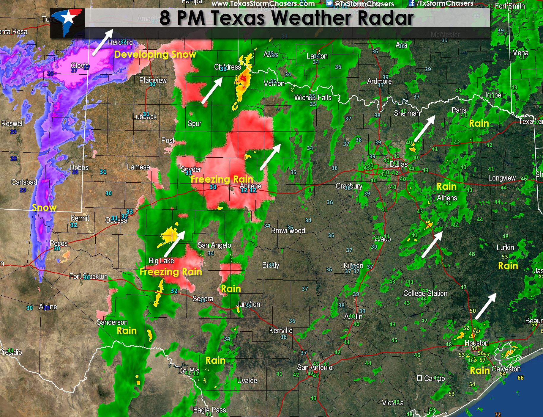
* An area of light to moderate snow is developing across eastern New Mexico as upper level forcing increases and the atmosphere moisten up. This area of snow will gradually move east and expand into the Texas Panhandle and parts of the South Plains later this evening. Accumulating snow is possible and with temperatures below freezing will accumulate on all surfaces including roadways.
* A large area of rain is occuring across Northwest Texas south into the Concho Valley and Hill Country. Temperatures for the most part are above freezing which means no winter mischief. The exception is parts of the Caprock and Concho Valley. Temperatures in Childress, Abilene, and Sweetwater are at freezing which supports freezing rain. This area of precipitation is moving east.
* Thunderstorms have developed across South Texas from Uvalde south to Crystal City and are moving east/northeast. They contain brief heavy rain and frequent cloud to ground lightning. Another batch of rain with embedded thunderstorms are moving across East Southeast Texas.
* Rain will increase tonight along the I-35 corridor as upper level forcing increases and helps precipitation develop. SOme thunderstorms are possible but otherwise its going to be a cold rain.


0 Comments