
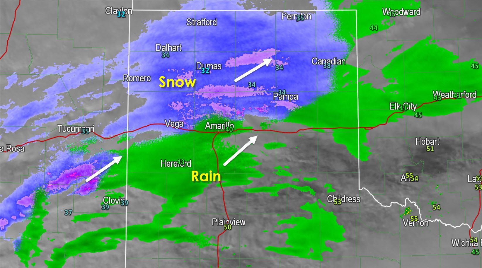
Light to moderate snow is falling across the northern Texas Panhandle. The rain snow line currently extends from near Vega to just north of Amarillo to Pampa and Canadian. As the atmospheric column continues to cool the rain/snow line will push south. I expect a changeover to alls now in Amarillo to occur by 4-5 PM. Bands of light rain are moving east/northeast across the southern Panhandle and northwest South Plains. This precipitation is also helping to cool and moisten the atmosphere. Precipitation will start off as light sprinkles and rain with a changeover to snow in the aforementioned areas this evening. Do note that snow can occur in areas in the 33-35 degree range thanks to the cold air above the surface. That means snow can still accumulate on grassy/elevated surfaces but the surface roads would remain just wet/slushy until temperatures drop below 30-32F.

A large area of light to moderate rain is moving northeast across the Concho Valley into western North Texas. This is all liquid and is expected to remain that way today and tonight as it moves into all of North Texas. Rain should start falling in the immediate D/FW Metroplex around 6 PM and quickly expand east to cover the Red River and Northeast Texas by 9 PM. Around and after midnight additional heavier precipitation with a few thunderstorms will develop across the Hill Country and South-Central Texas.

We’ll a more detailed update on tonight’s forecast for the winter weather aspect and the widespread rain aspect of this storm after 4 PM. Don’t forget we love your weather reports and photos so share them with us on our social media accounts!


0 Comments