
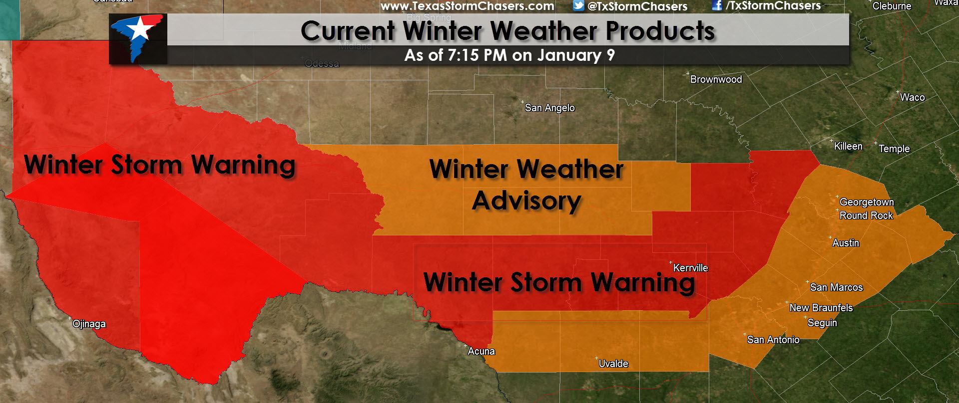
* WINTER STORM WARNING for the Davis Mountains, Marfa Plateau, Big Bend Area, Stockton Plateau, Lower Trans-Pecos through Saturday Morning including Marfa, Alpine, and Fort Stockton. Ice accumulations up to 0.25″ are expected in the lower elevations with snow accumulations of 3 to 5 inches possible in the higher elevations. A Winter Storm Warning means significant accumulations of ice and snow will cause widespread travel disruptions.
* WINTER STORM WARNING for the Hill Country through Saturday Evening including Del Rio, Rocksprings, Kerrville, Fredericksburg, Llano, Marble Falls, and Burnet. Ice accumulations up to 0.25″ are possible which could accumulate on roads and bridges in addition to elevated surfaces. A Winter Storm Warning means significant accumulations of ice will cause widespread travel disruptions.
* WINTER WEATHER/TRAVELERS ADVISORY for portions of West-Central and South-Central Texas through Saturday Morning. Giddings, Bastrop, Tayler, Georgetown, Austin, New Braunfels, San Antonio, Uvalde, Junction, Sonora, Del Rio, Eldorado, and Ozona are all included. Light freezing rain or drizzle will be possible tonight in locations that fall below 32 degrees. A light coating of ice will be possible mainly on elevated surfaces which may result in icy spots on bridges and overpasses. A Winter Weather Advisory means accumulations of ice may create travel disruptions.
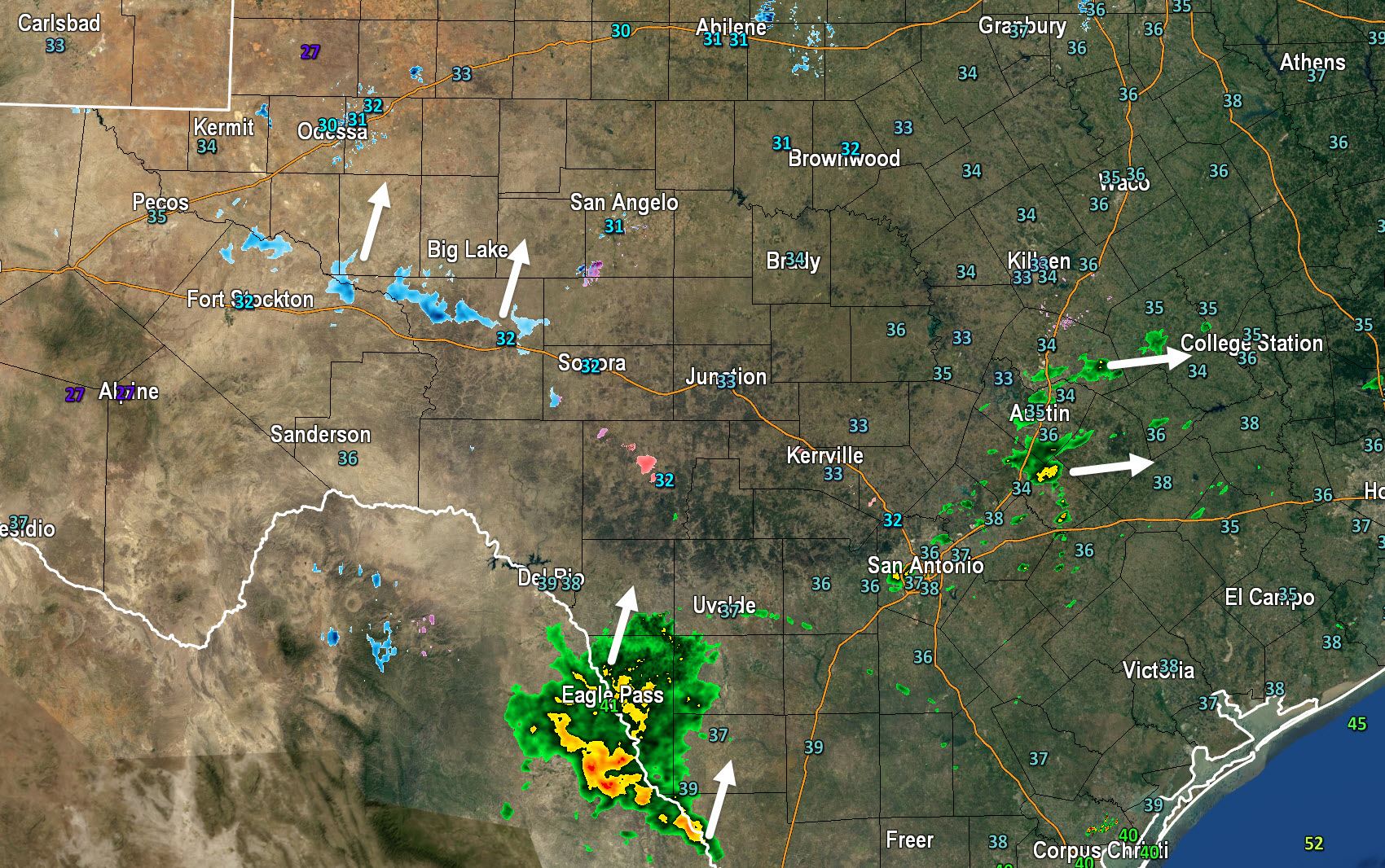
Here’s the radar as of 7:25 PM CST. Isolated showers mixed with a few sleet pellets are moving across the Austin Metro and will move east into the Brazos Valley through 9 PM. Precipitation has developed in Mexico and will continue to move north from Eagle Pass into South Texas through 9 PM. Temperatures in both these areas are above freezing. Meanwhile a few sleet/freezing rain showers have developed from near Fort Stockton east to Sonora. These are also moving north and are a sign that lift is increasing across the region. We anticipate additional precipitation to develop this evening. Areas that are below 32F that receive precipitation are at risk for ice accumulation tonight so keep that in mind. Freezing Drizzle is possible across the southern half of the Concho Valley into the Hill Country tonight as well.


0 Comments