
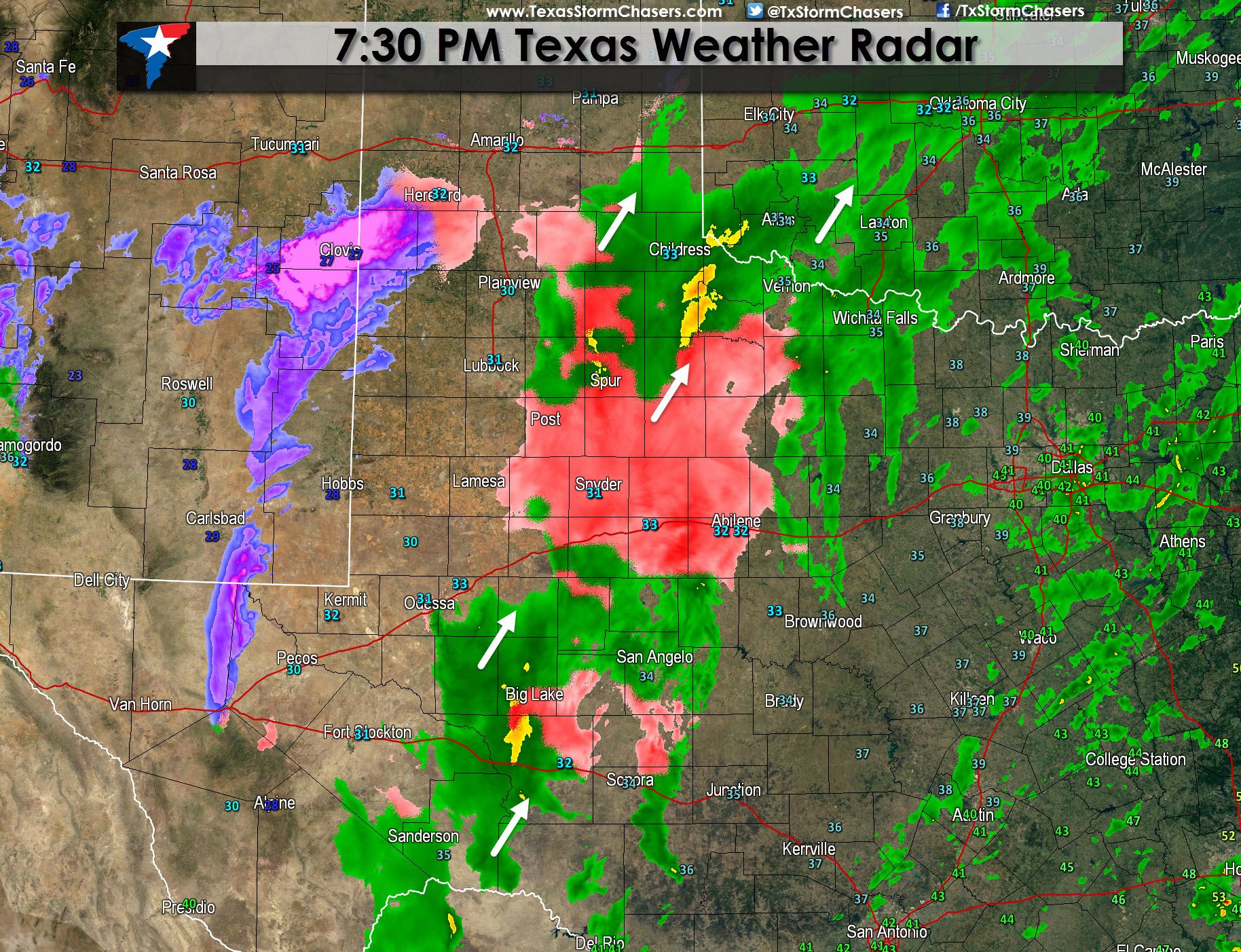
* WINTER STORM WARNING in effect through Saturday Morning across the Permian Basin, Concho Valley, South Plains, and parts of the Texas Panhandle. Roads remain slick and hazardous where winter precipitation has accumulated today and additional accumulations are expected this evening into tonight.
* A large area of rain extends from the Concho Valley into West-Central and Northwest Texas. Cells in this area are moving north/northeast but the overall precipitation shield is gradually progressing east.
* A band of snow is developing across eastern New Mexico and the southwest Texas Panhandle. This area is moving northeast and will expand over the next few hours. The result will be widespread snow across the Texas Panhandle by 11 PM. It will take some time for the atmospheric column to moisten up and for snow to reach the ground. That means initally while radar shows snow it may not actually reach the ground. As this process occurs surface temperatures will drop in the Texas Panhandle into the upper 20s which will only go to support snow accumulations tonight.
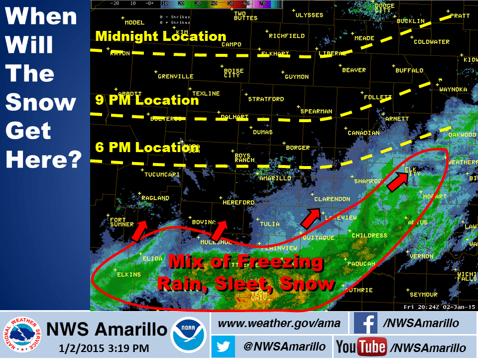
Here’s what the HRRR is showing for midnight. Rain will be widespread across North, East, and Southeast Texas but with temperatures well above freezing this will be purely rain. There could even be a few rumbles of thunder. Snow will be in progress across the Texas Panhandle and the South Plains with freezing rain possible in the Rolling Plains. Travel is strongly discouraged in areas that saw winter precipitation accumulate today and those that will see it tonight.

You can track travel conditions across Texas at drivetexas.org


0 Comments