

* Moderate snow is now falling across the Southwest Texas Panhandle and western South Plains. Snow accumulations up to 5 inches have been measured in Parmer County in the Southwest Panhandle. While the overall snow is moving north it is developing eastward. Accumulations of 1 to 5 inches will be possible tonight across the Panhandle, South plains, and Permian Basin.
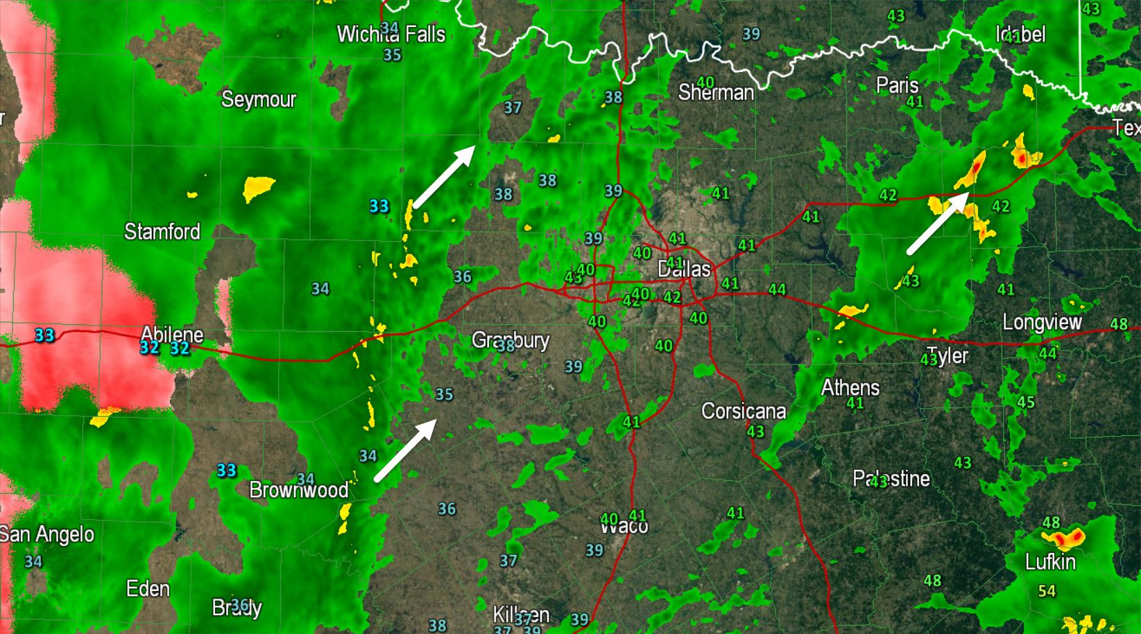
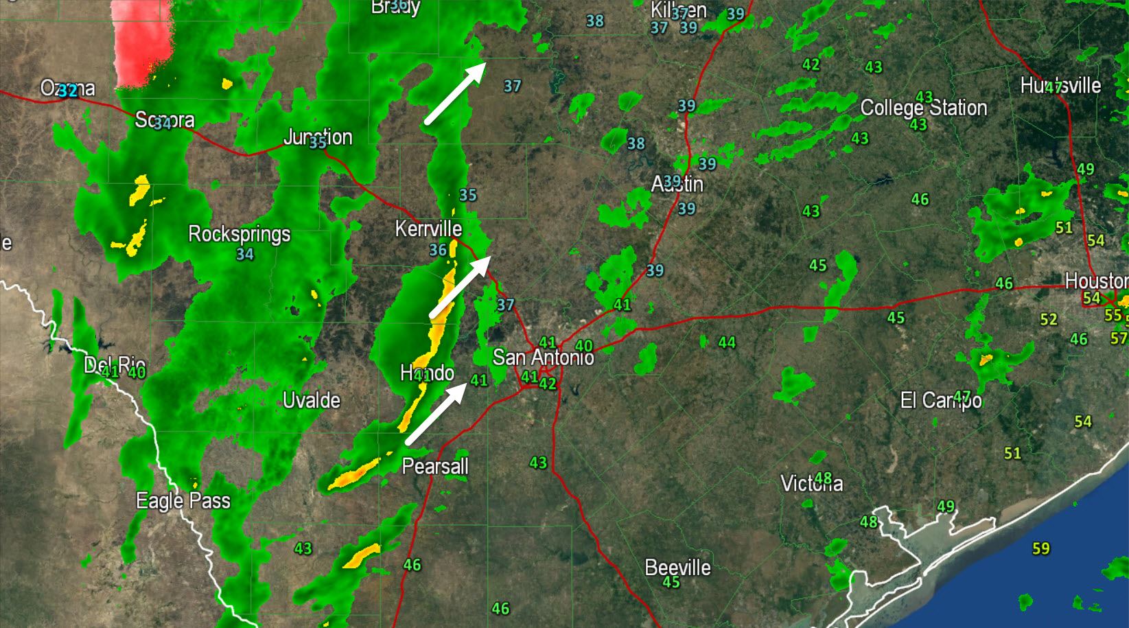
* An area of rain with embedded thunderstorms is developing across western NOrth Texas, the Hill Country, and South Texas this evening. The overall area is moving east but individual cells are moving northeast. We’ve noticed an uptick in lightning activity because upper level lift is increasing. Even though temperatures at the surface are in the upper 30s to lower 40s there is a pocket of warmer, more unstable air a few thousand feet above the ground supporting the lightning. No severe weather is anticipated but some of the storms will produce frequent cloud to ground lightning and perhaps small hail thanks to the cold air in place.
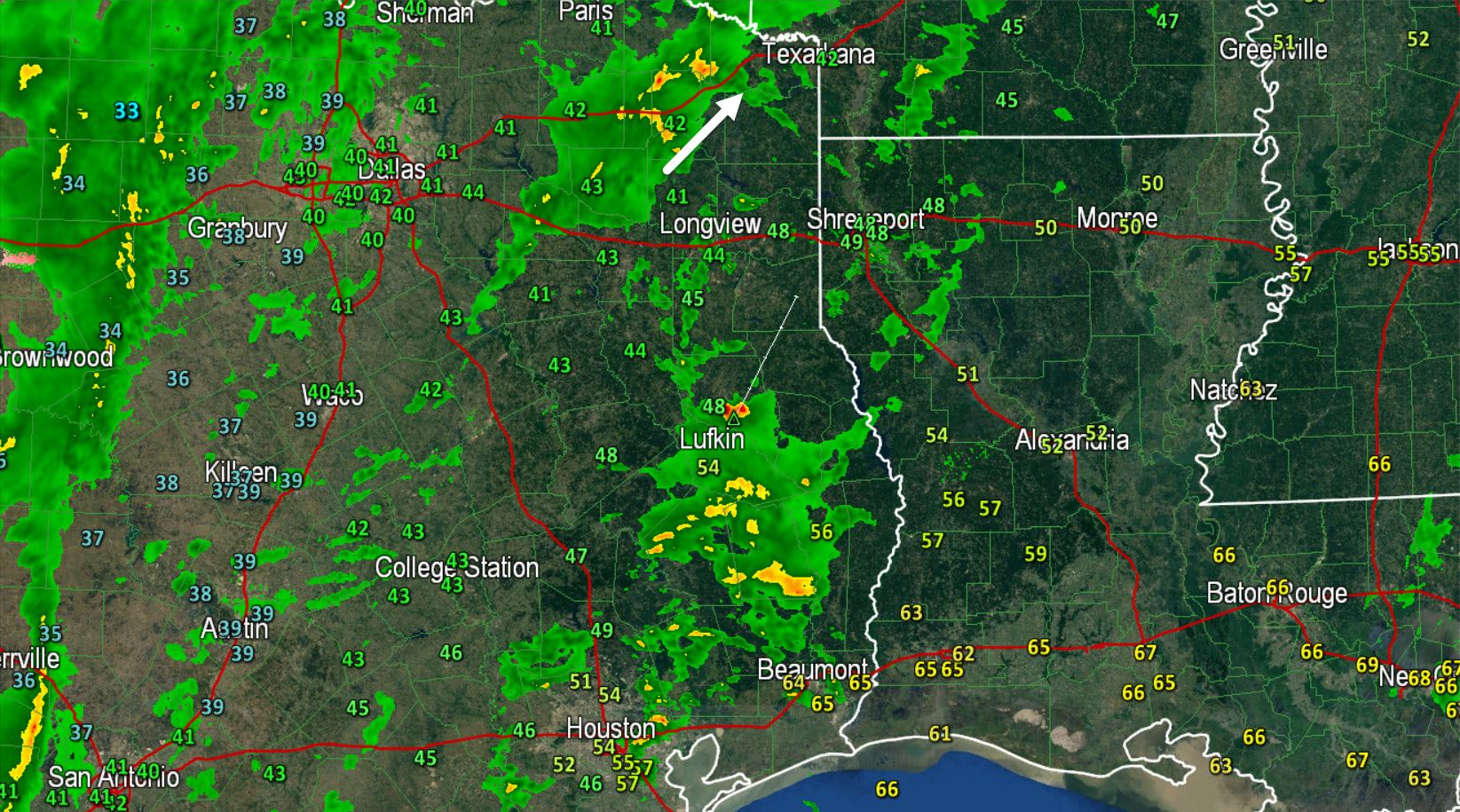
* Isolated thunderstorms are also occuring across Northeast and East Texas. They’re moving northeast and will produce heavy rain and frequent cloud to ground lightning.
* Remember you can track the latest weather across the state using our free interactive weather radar at texasstormchasers.com/radar


0 Comments