
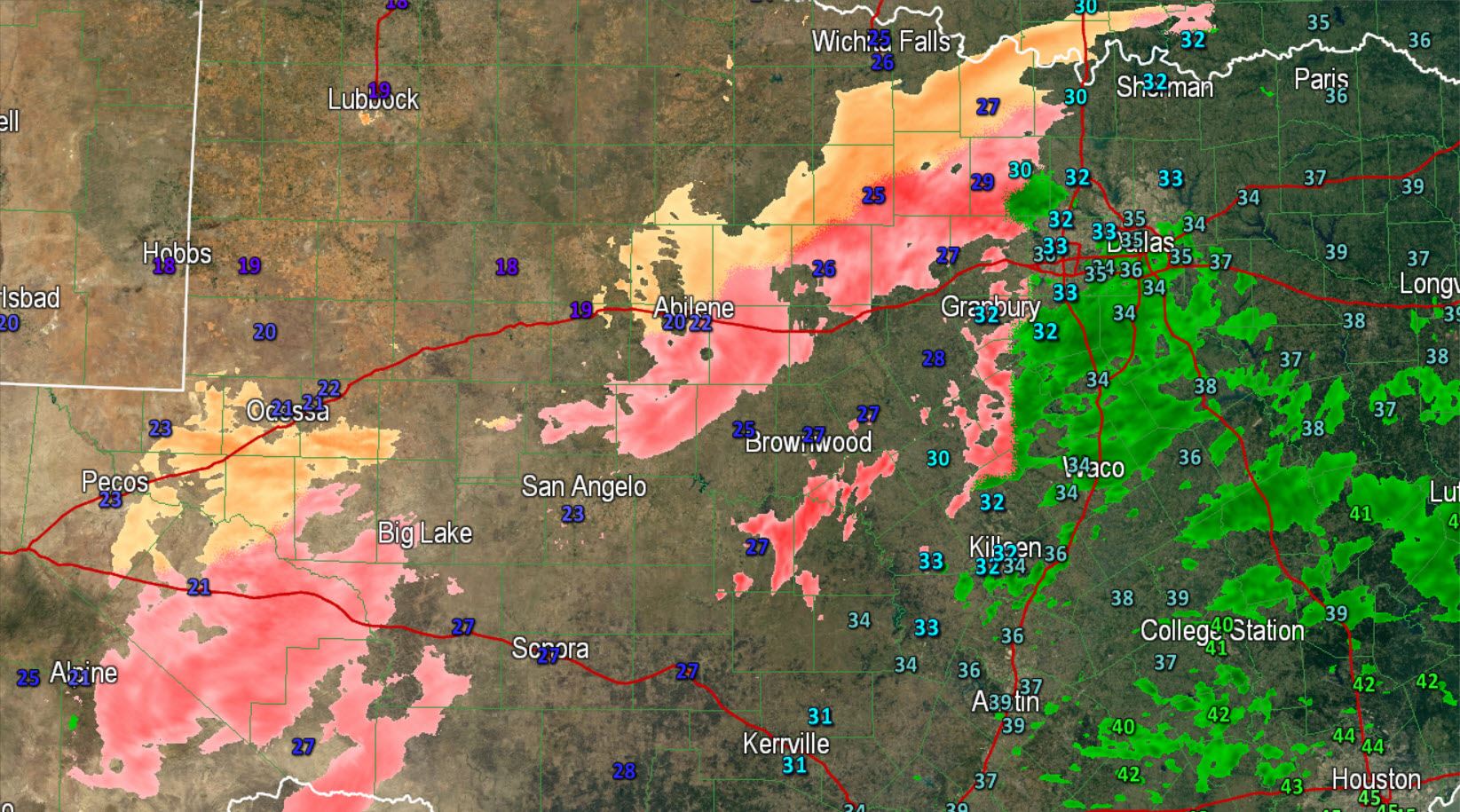
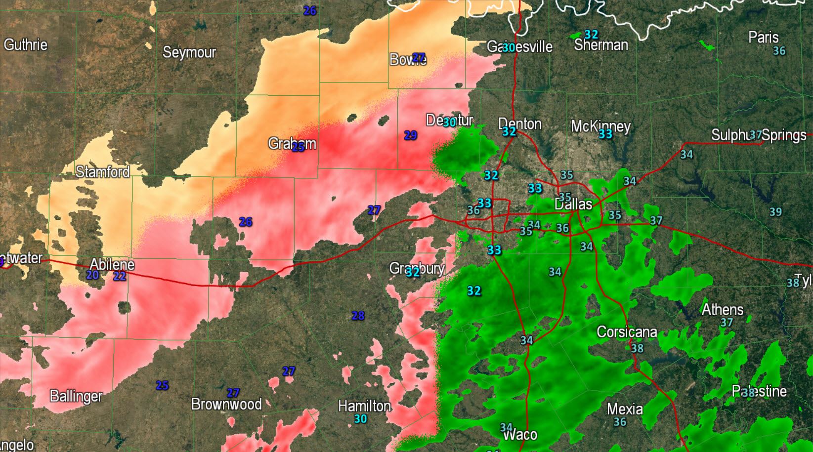
Widespread freezing rain perhaps mixed with a few sleet pellets is falling across parts of the Permian Basin, Concho Valley, into western North Texas. Activity is moving northeast and will continue to develop over the next few hours this morning. Where temperatures are below freezing there will be ice accumulations. We now have reports of icy bridges in Weatherford (just west of Fort Worth) and in Wise County. The freezing line is across western Tarrant and Denton Counties with most of D/FW sitting above freezing. Light rain in D/FW will not freeze unless temperatures fall below freezing. Based on the current forecast it looks like we may see temperatures drop 1 or 2 degrees through 5 AM before staying steady. That means the freezing line could move into more of D/FW which is shown quite well by the high resolution model HRRR.
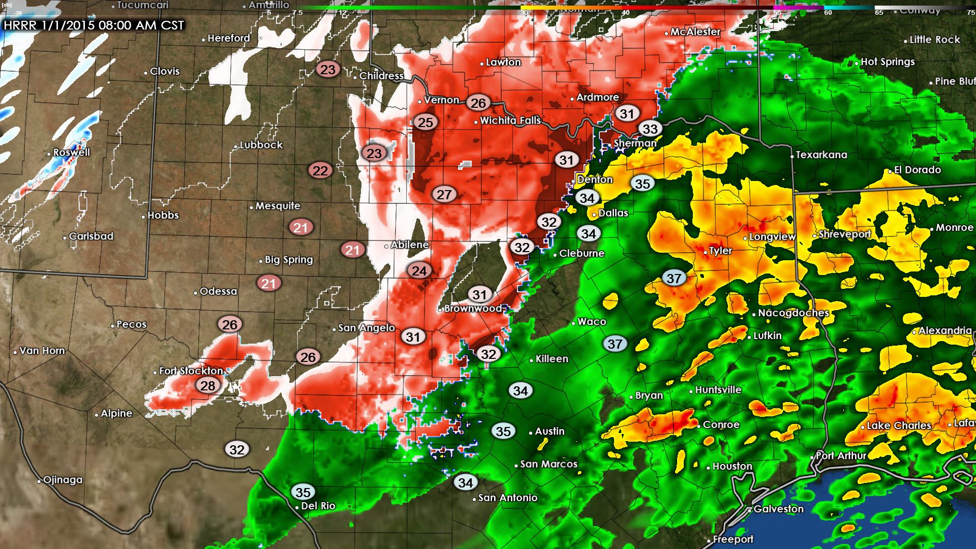
Here’s the latest look for later this morning from the High Resolution Rapid Refresh (HRRR) weather model. At 5 AM we’re expecting the coverage of precipitation to have increased compared to now. As always the freezing line will mark where rain changes over to freezing rain or sleet. Where temperatures are below freezing and precipitation is falling we anticipate there to be ice accumulation. Significant ice accumulations are anticipated this morning across the Concho Valley into western North Texas where extremely hazardous travel conditions will continue through much of today. By mid to late morning temperatures will begin climbing and the freeze line will start moving northwest as warm air advection helps warm things up.


0 Comments