

Radar at 9:10am CST
As predicted, the freezing line this morning has pretty much bisected the metroplex with temps at or below freezing from about Sherman, Denton, Ft. Worth and down towards Cleburne. Areas north and west of the metroplex are reporting freezing on bridges and on some roadways…and the further west you go, the worse the driving conditions are. For the immediate DFW metroplex, so far, just all liquid precip with the typical hazards present whenever water hits our city’s pavement.
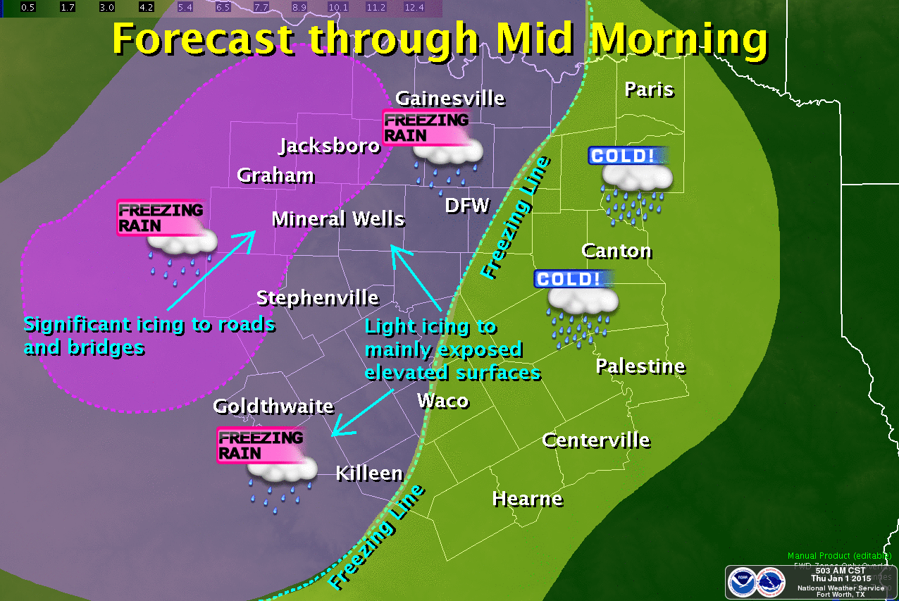
The remainder of the morning should play out like the graphic above with most of the sleet and freezing rain hazards north and west towards Gainesville, Bowie, Decatur, Jacksboro, Mineral Wells and Graham. We could see some icing on elevated surfaces in northern and western Denton county and western Tarrant County, but everyone along and east of the freezing line should see only all-liquid precip. During the day today, this freezing line will begin to shift west and some of the counties within the current Winter Weather Advisories and Warnings will see temps rise above freezing. At that point, local forecasters will reevaluate the current warnings and advisories and may make the necessary adjustments. We’ll get those updates out as soon as possible this afternoon! We’ll also have the forecast for this evening and overnight out as well, so check back!


0 Comments