
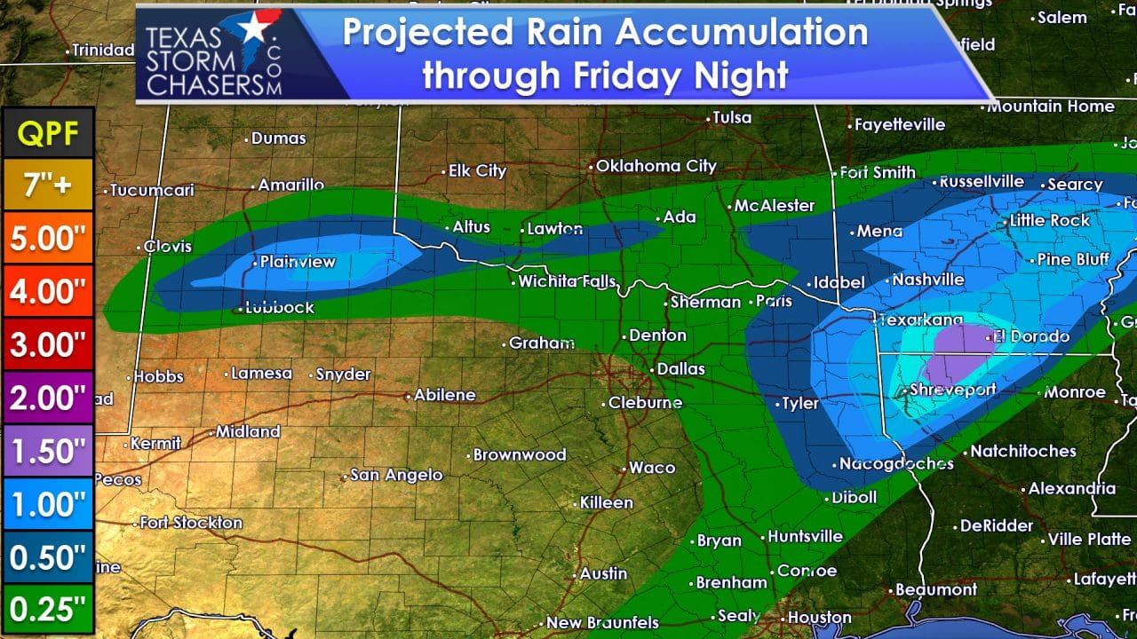
The primary forecast focus through Friday will be rain chances and cooler temperatures across the northern half of Texas. Severe weather and flooding are not anticipated to be threats. A few spots may pick up an inch of rain, but most amounts will be lighter. After Friday we quickly warm up statewide with temperatures 5 to 15 degrees above average for mid-October. Above-average temperatures will continue through the weekend and into next week. Our next cool front should arrive sometime half way through next week.
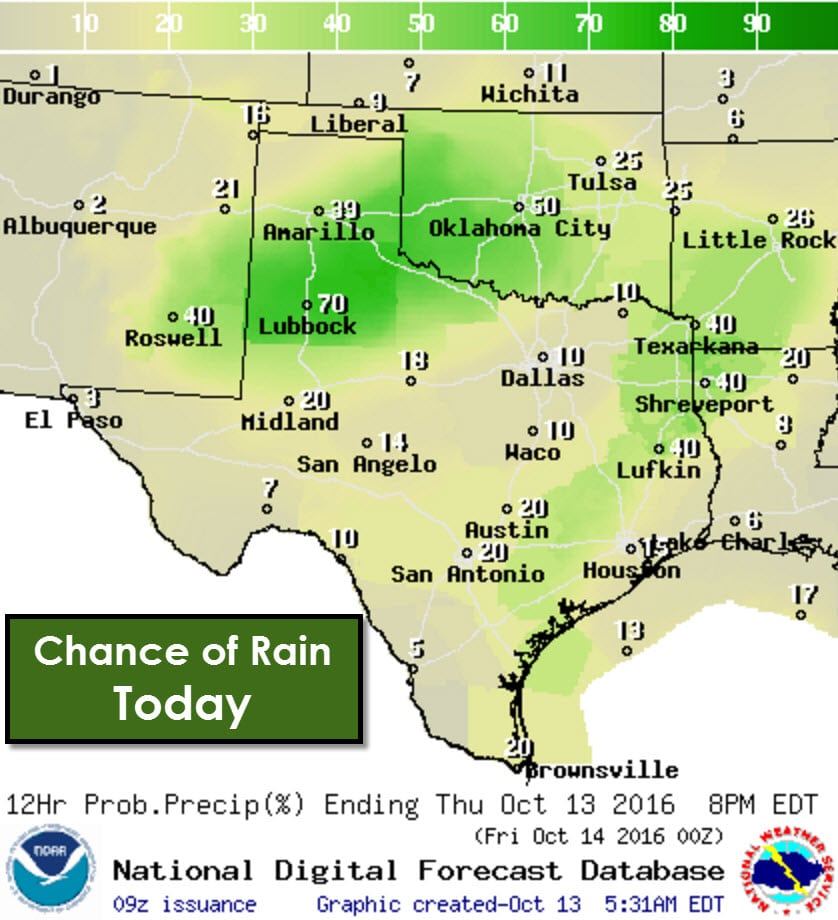
Scattered showers are forecast to develop today across the southeastern half of the Texas Panhandle, West Texas, Northeast Texas, and in portions of Northeast Texas, East Texas, the Brazos Valley, and the Middle Texas Coast. Isolated showers and thunderstorms will be possible in the Permian Basin, Big Country, Concho Valley, Texoma, Southeast Texas, South-Central Texas, and the Rio Grande Valley. Severe weather is not expected and most activity will stay on the light/moderate end of the spectrum.
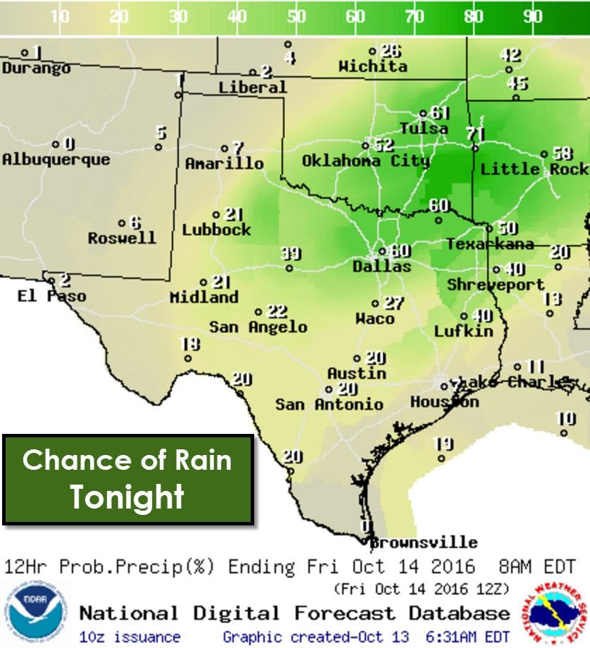
Rain chances increase tonight with scattered to numerous showers in proximity of the Red River from Northwest Texas east through Texoma into Northeast Texas south to Interstate 20 from the Big Country through East Texas. Scattered showers will also be possible in the Permian Basin, Concho Valley, Hill Country, Central Texas, East Texas, and South-Central Texas. A few storms may also develop tonight but severe weather is not expected. A few showers may produce brief heavy rain with more widespread light/moderate rain.
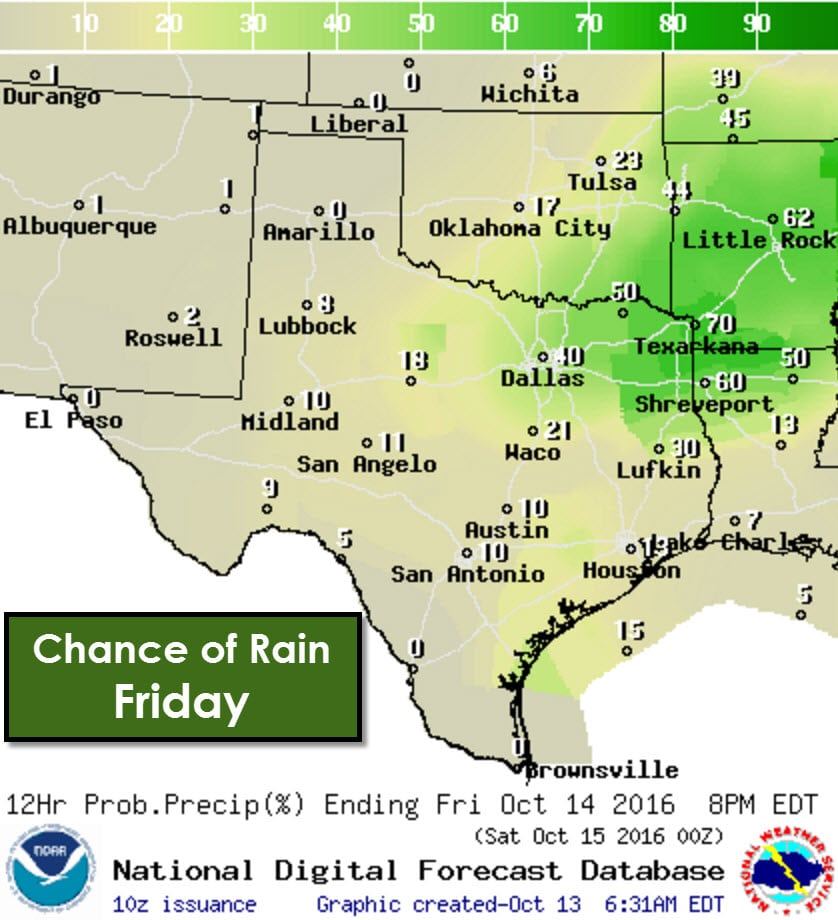
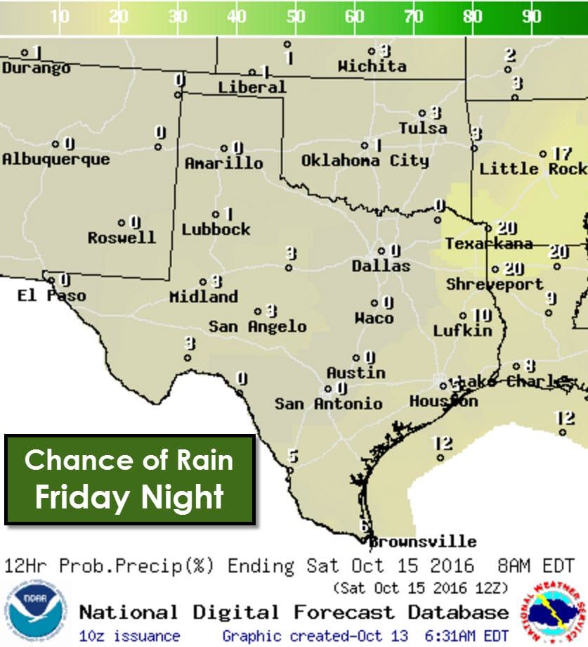
Scattered showers and storms will push east on Friday into Northeast Texas and East Texas. Rain chances will diminish by the late afternoon hours on Friday and Texas should be mostly dry by the evening hours Friday. Severe weather is not expected and most activity will be moving out in time for evening outdoor activities. Fog will be possible by Saturday morning.
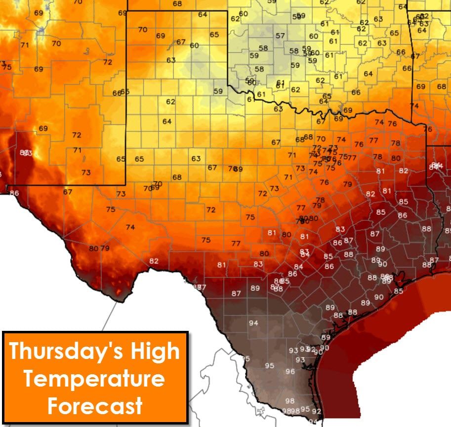
A stationary front extends from the Concho Valley into Central Texas and Northeast Texas. Conditions south of the front will remain hot with temperatures topping out in the upper 80s to middle 90s. We do note that McAllen will try and push up towards the century mark this afternoon. North of the front conditions will be much more fall-like with high temperatures ranging from the upper 50s where rain is likely today into the middle 70s. Enjoy the cooler weather because that will be long gone by Saturday.
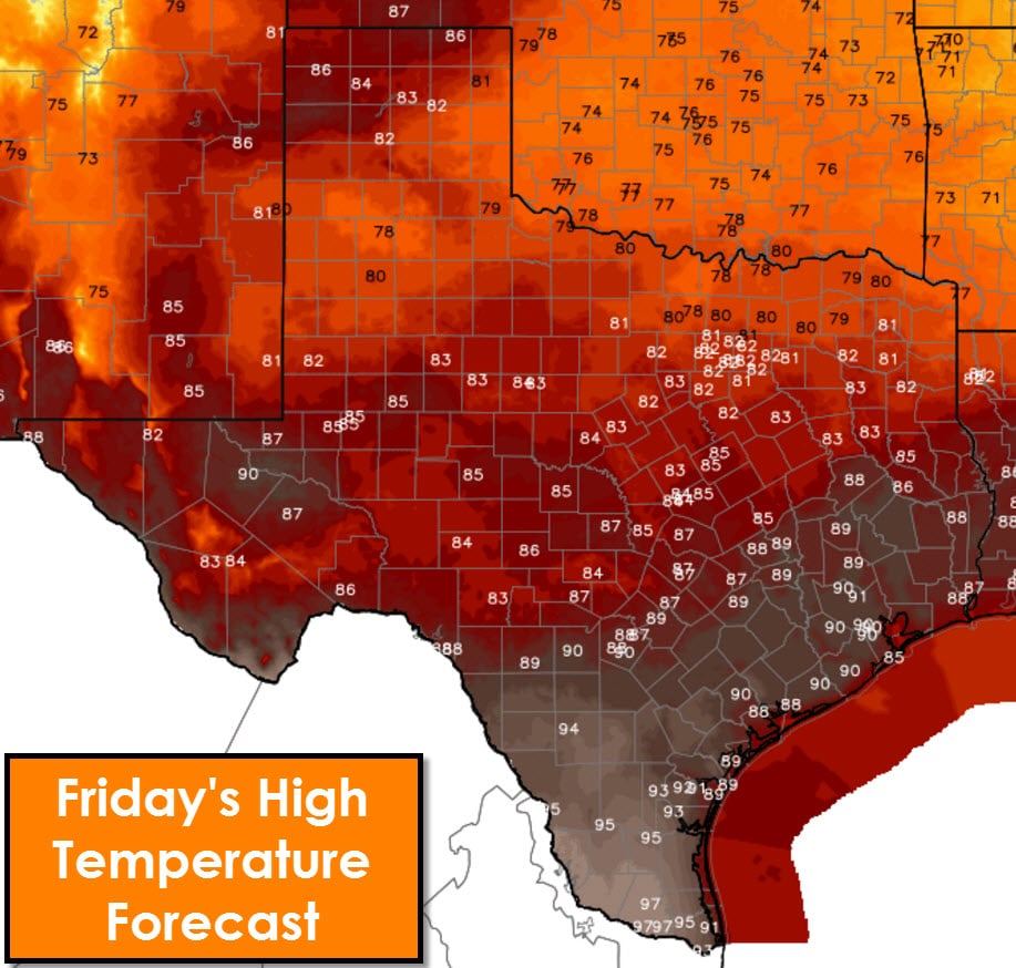
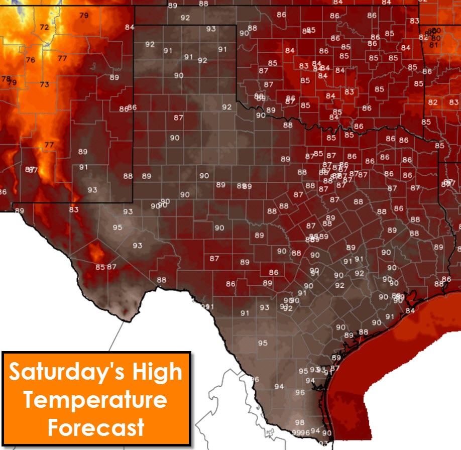
Temperatures on Friday and Saturday will increase as the stationary front today moves north as a warm front tonight and on Friday. Temperatures on Friday will be held down some where clouds/rain occurs, but will otherwise be in the 80s and 90s. By Saturday temperatures across Texas will climb above-average with upper 80s to upper 90s across all of the state. Moisture values will also remain elevated so it won’t be a dry heat. Above-average temperatures will continue through the first half of next week. There are indications we may have a stronger cold front begin to arrive in the Wednesday-Friday timeframe in association with an upper level storm system.


0 Comments