

Two days ago, most weather model output showed a quick-hitting storm system exiting Texas by Thanksgiving. Since then, those same models have transformed our late week into a multi-faceted, multi-day weather headache. I’m afraid most folks will not be enjoying Thanksgiving outdoors this year. We’ll go over the forecast, which includes heavy rain, a few strong storms, and the possibility of a full-blown winter storm. Is it a Monday? It sure feels like a Monday.
Texas Rain & Storms
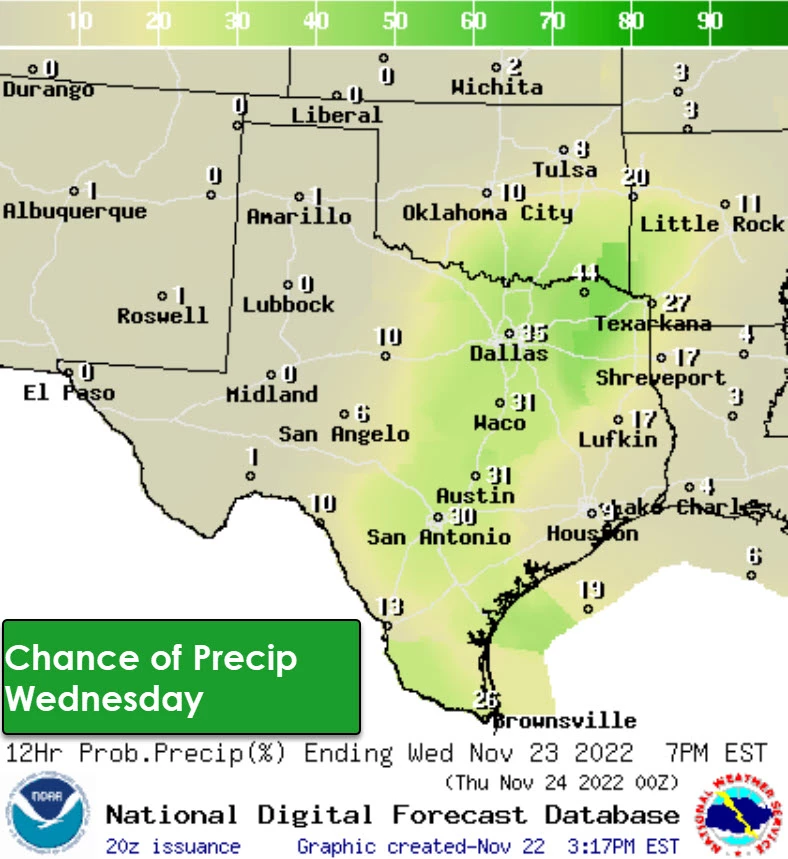
We’ll be starting Wednesday morning with areas of fog and mist. Some of the fog may be dense and could lead to aviation impacts. The mist will disperse by late morning. Precipitation chances will increase Wednesday night across the eastern half of Texas. Those rain chances will continue through Thanksgiving Day. We’ll likely see some storms during that timeframe. A few stronger storms may produce small hail and gusty winds in Southeast Texas.
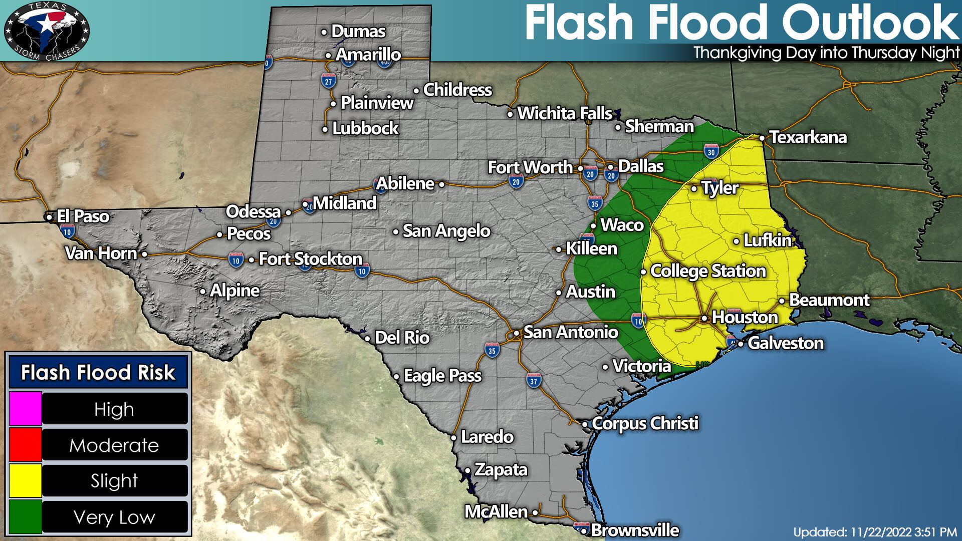
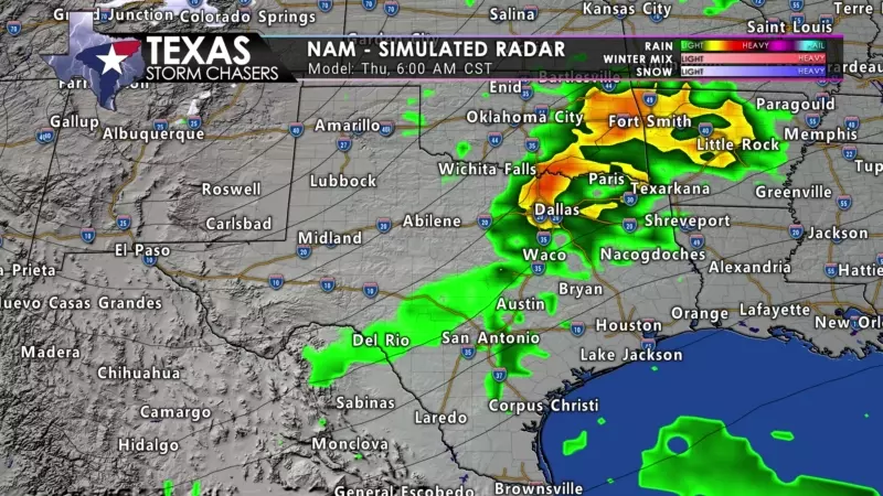
Rain chances will continue Thursday Night through Saturday morning across the eastern half of Texas. Several inches of rain is currently forecast across East Texas. Given the heavier rains possible, some flash flooding may occur – leading to some roadways being covered in high water. Simultaneously, we’ll see precipitation chances increase across the Texas Panhandle, West Texas, and southwest into the Trans-Pecos. Dropping temperatures behind a cold front and cooling temperatures aloft will result in a change-over to snow in some regions.
Winter Weather Mischief…
The chance for accumulating snow has dramatically increased for the Thursday Night, Friday, and Saturday morning timeframe across the Texas Panhandle, West Texas, and the Trans-Pecos. We’re still too far out to accurately pin down specific snow totals. However, we believe a corridor of heavier snow, perhaps leading to significant snow accumulations, will be set up somewhere in the Panhandle and West Texas. Travel disruptions due to difficult travel are anticipated. Strong northwest winds may lead to blowing snow and much-reduced visibility.
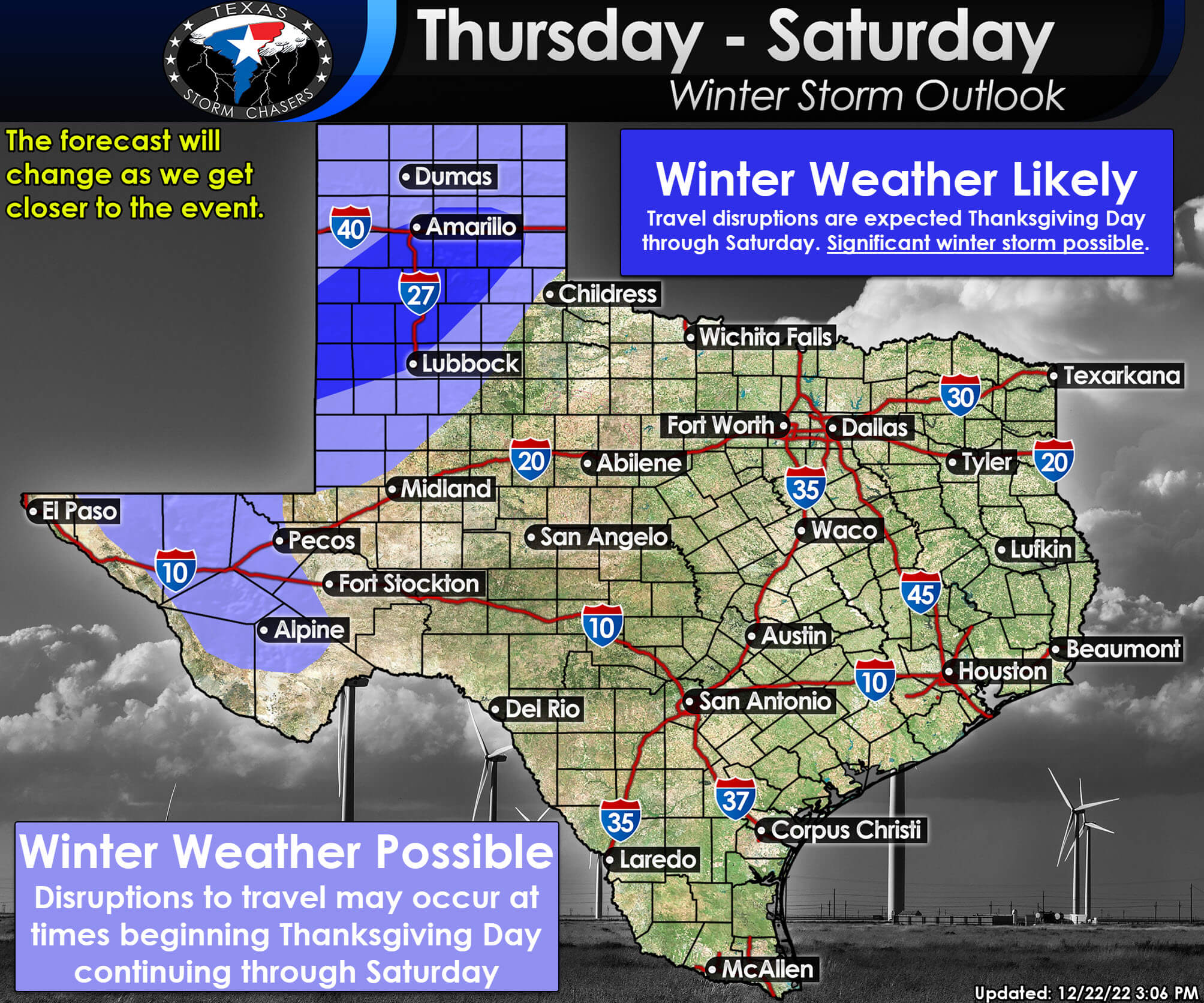
Uncertainties in the forecast include the track of an upper-level low pressure. That track will significantly determine the corridor where the heaviest snows fall and where the rain/snow line sets up. Someone in the Texas Panhandle and West Texas will likely get a bucketful of snow – with a sharp gradient between a whole lot of snow and bare ground and cow turds. As we head into Wednesday and Thursday, we’ll get those details nailed down.


0 Comments