
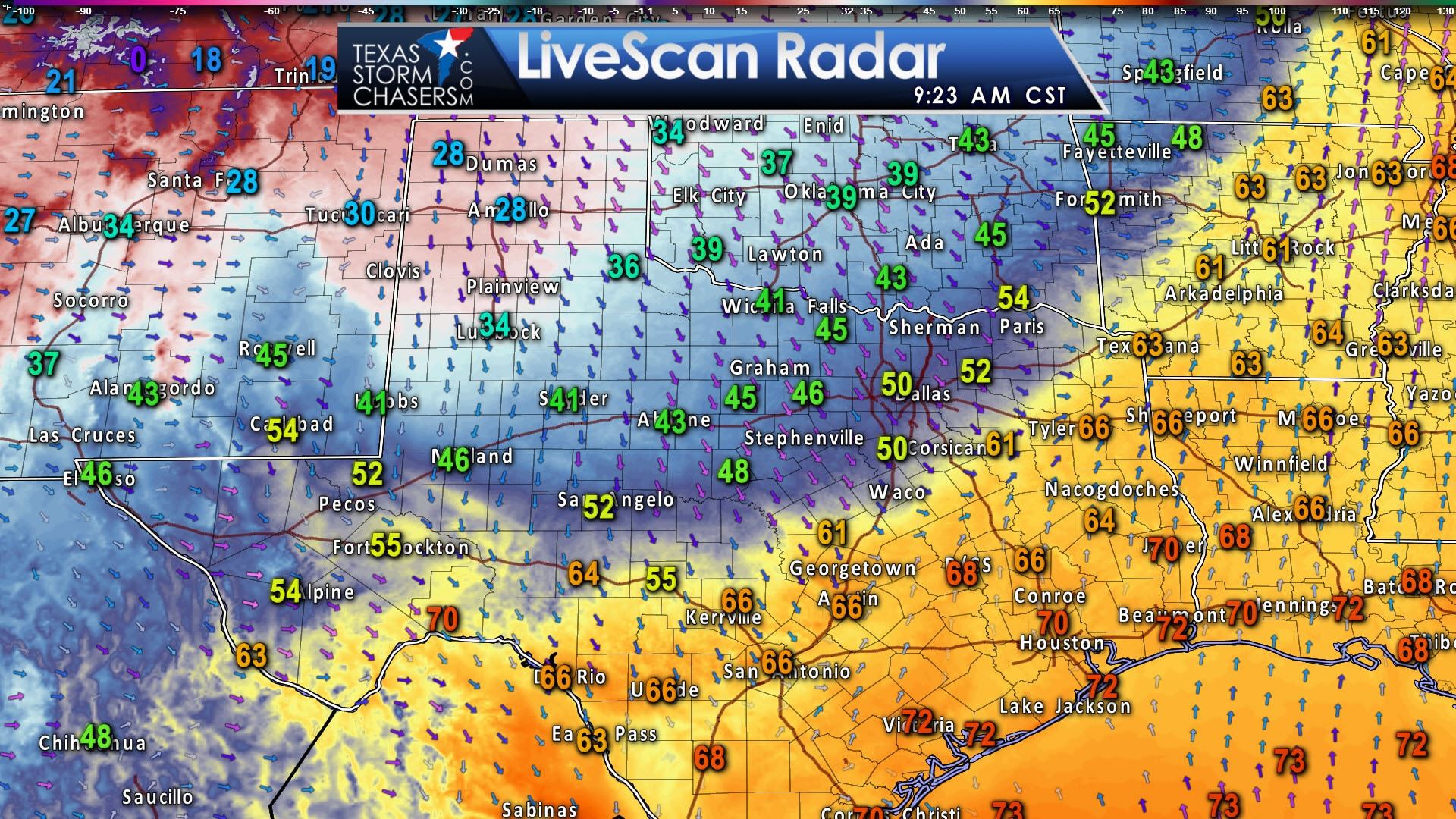
As of 9 AM a cold front extends into Southwest Texas – Central Texas – into far Northeast Texas. North of this front temperatures have fallen into the 20s across the Texas Panhandle with blustery northwest winds. Wind chills are down into the teens and single digits. Further south and east temperatures are in the 40s in the Big Country, Northwest Texas, and North Texas. This front will continue to push south through the day, helping to bring cooler temperatures and northerly winds. Those who are south of the front this morning will experience their high temperatures before the frontal passage. Temperatures will fall back into the 50s and 60s once the front arrives at your location.
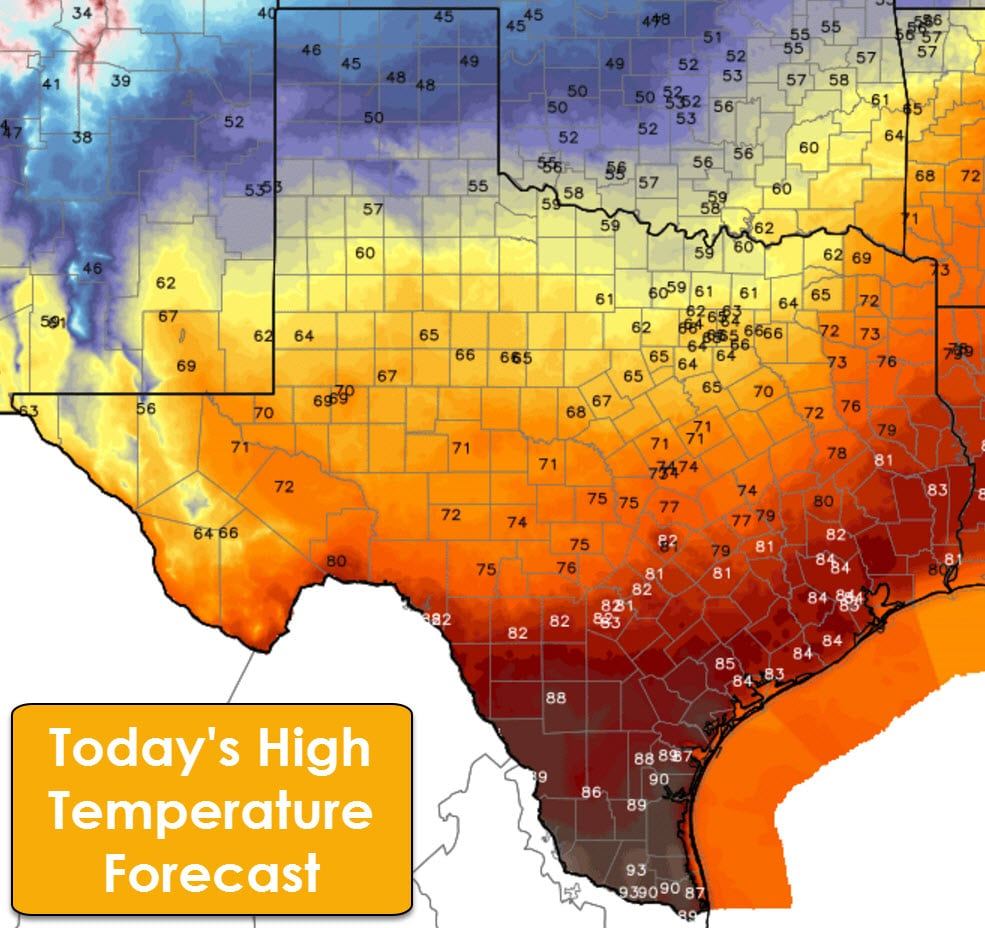
Temperatures in the Texas Panhandle will struggle to climb out of the 40s this afternoon as northerly winds continue to pump in the cooler air. As stated above, the high temperature for the day at your location will occur right before the cold front’s arrival. Depending on your location, that could be in the next hour, or it could be late tonight. Either way it’ll be another hot day along the coast, into South Texas, and the Rio Grande Valley.
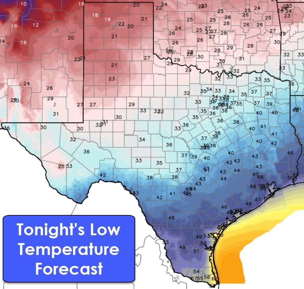
Tonight is when we’re going to see a bit of winter return to more of Texas. Low temperatures will drop into the 30s north of a line extending from the Trans-Pecos Basin into the Hill Country, Central Texas, into Northeast Texas. Teens and twenties are anticipated in the Panhandle and West Texas tonight. 40s are expected into South Texas, the Middle Texas Coast, into Southeast Texas. Deep South Texas and the Rio Grande Valley will bottom out in the upper 50s to right around 60 by sunrise on Saturday.
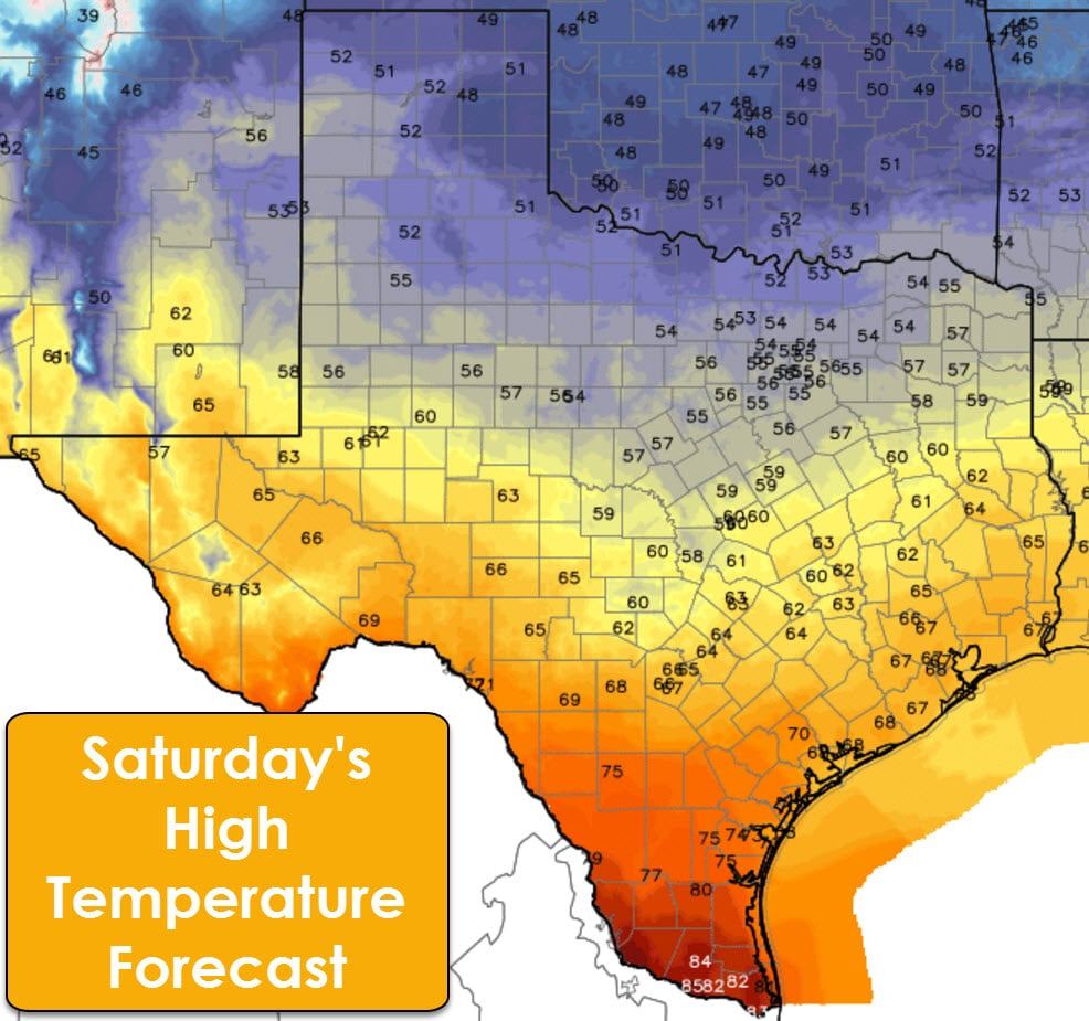
Saturday will be the coolest day we’ve seen in at least ten days as high temperatures remain in the 50s north of a line from Andrews to Waco to Longview. The eastern Texas Panhandle and immediate Red River east into Texoma will struggle to get into the 50s tomorrow afternoon with cold air well-entrenched. Highs will be in the 60s as far south as San Antonio to Houston. While those are still warm for the winter months, it certainly beats the 80s and 90s we had yesterday.
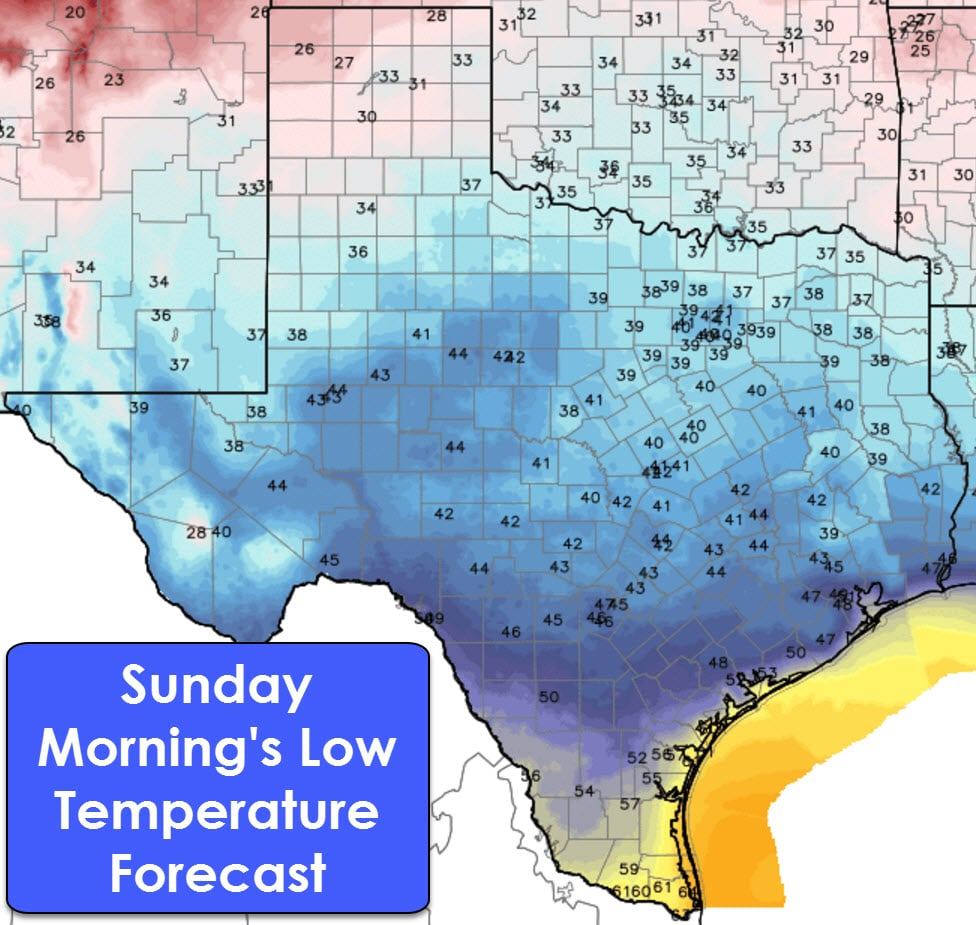
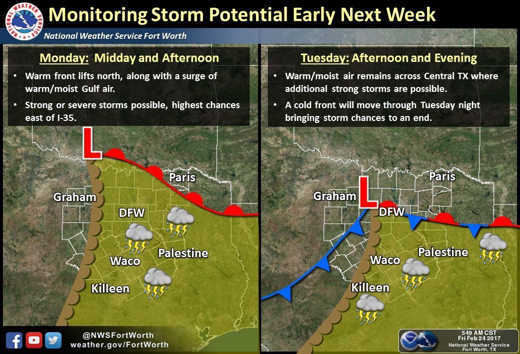
Sunday morning will be rather chilly across Texas with lows dropping into the 20s, 30s, and 40s as far south as South-Central and Southeast Texas. As usual South Texas and the Rio Grande Valley will remain warmer with 50s. Enjoy the brief return to cooler temperatures while you can. We’ll warm back up starting Sunday afternoon and we’ll be back well above average by Monday… just in time for the dryline to make its spring-time introduction. Depending on several factors which we can’t yet determine with confidence, we may be dealing with thunderstorm chances on Monday and Tuesday across the eastern half of Texas. Some of these storms, depending on how things come together, could be our spring-time dryline severe storms. We’ll keep an eye on it as we head into the weekend, but March 1st does mark the official start of our spring severe weather season in Texas. As Sunday night showed, we can and do have severe weather any month of the year.


0 Comments