
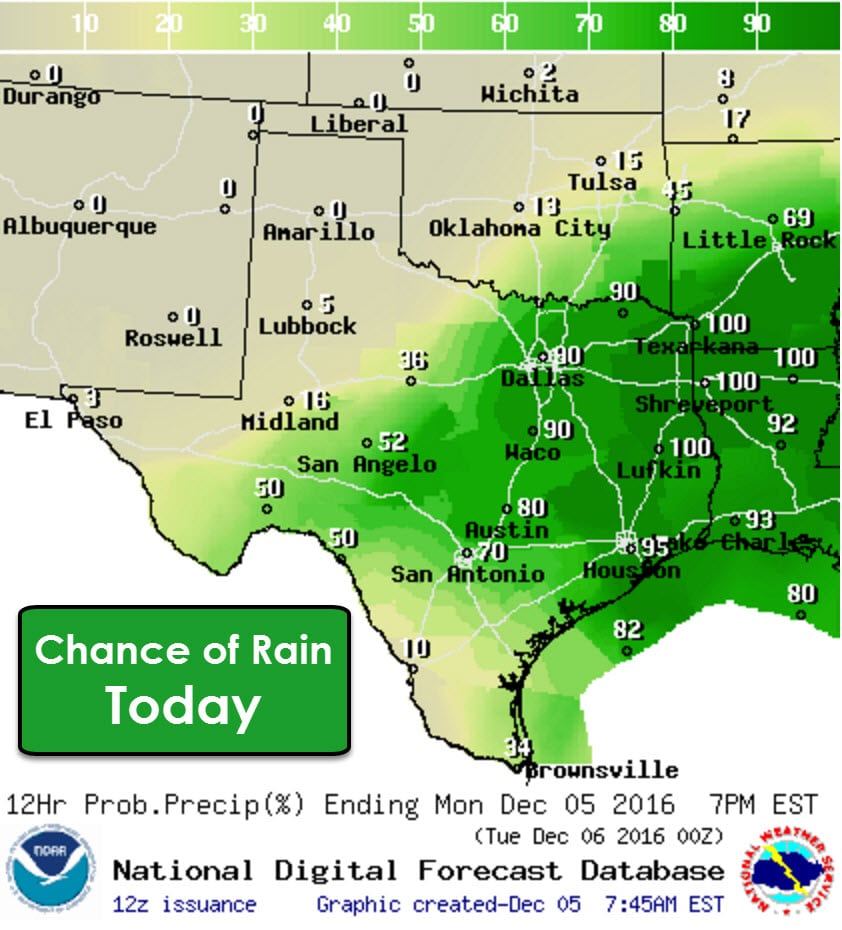
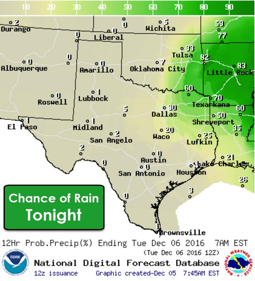
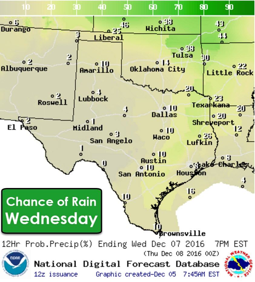
After several days of gloomy, wet weather we only have one more day of it before rain clears out. Rain chances will end from west to east with time today. By this evening and tonight rain chances will mainly be confined to Northeast Texas as an upper level low moves east/northeast. Most locations will only see light additional rain totals, but some heavier amounts are possible in far Southeast Texas. Due to the very heavy rains they received over the weekend any additional rain could cause pockets of renewed flooding. I don’t expect widespread flooding issues to develop today, but it won’t take much rain in parts of Southeast Texas to cause problems. The flash flooding threat ends later today, but high lake/river levels will continue through the end of the week.
After rain chances today our focus shifts to our upcoming arctic cold front. This front will bring the coldest air that most of the state has seen since the winter of 2014-2015. The front will start pushing south into Texas on Wednesday. Winds behind the front will be strong out of the north with a considerable wind chill developing. Low temperatures by Thursday morning will be in the teens in the Texas Panhandle with 20s extending south into the Hill Country, North Texas, and Northeast Texas. Winds are going to be howling out of the north and wind chill values will be in the single digits and teens.
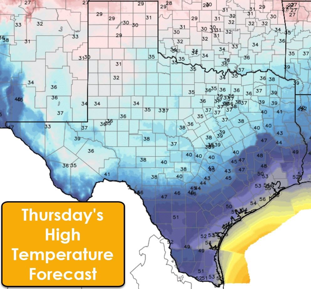
High temperatures on Thursday will not get above the 30s north of Central Texas to North Texas to Northeast Texas. High temperatures will struggle to even get above freezing in the Texas Panhandle, West Texas, into Caprock Canyon. It’ll be comparatively warmer, but still cool from the Rio Grande Valley into Southeast Texas with temperatures peaking in the 40s to lower 50s.
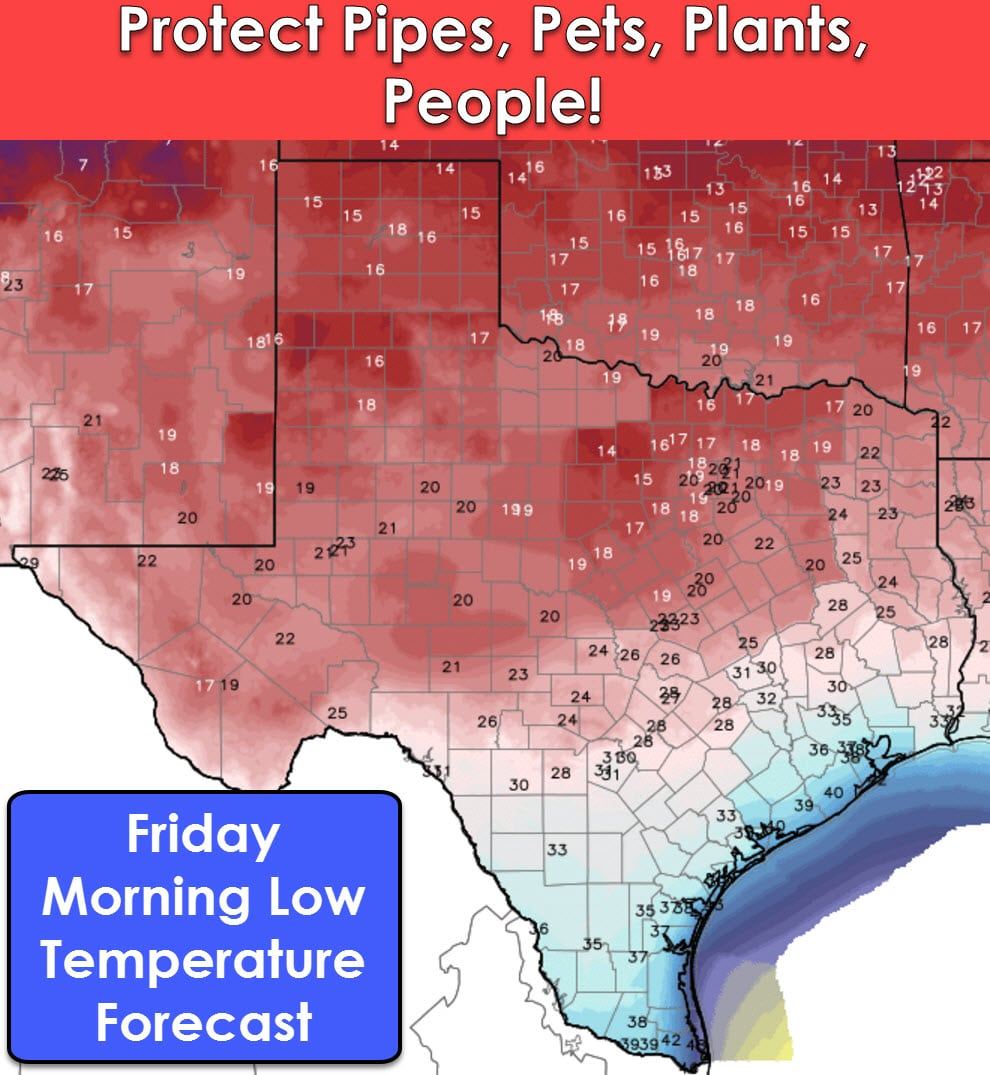
Friday Morning will feature frigid temperatures across the northern two-thirds of Texas. Low temperatures will fall into the teens in the Texas Panhandle, West Texas, Northwest Texas, North Texas, Northeast Texas, the Big Country, Concho Valley, and the Permian Basin. 20s can be expected into South-Central Texas and East Texas. Southeast Texas, South Texas, and the RIo Grande Valley will all drop into the 30s. If the upcoming airmass features even colder weather than what we’re expecting these temperatures may have to be reduced further. Regardless with temperatures falling into the 10s/lower 20s it is essential that you ensure your outdoor pipes are protected, pets are brought indoors, plants are covered, and keep an eye on folks more susceptible to the cold.
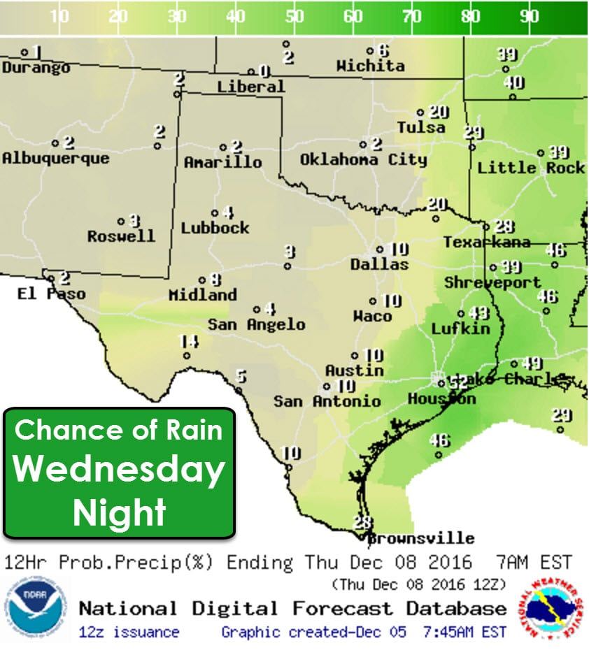
Temperatures will start to moderate on Friday and Saturday, but you’ll still want to keep a jacket around. At this point it appears that a few spots in East and Southeast Texas could receive showers or a few storms with the cold front’s arrival on Wednesday and Wednesday Night. Up to an inch of rain is possible, but most folks will receive far less than that – if it even rains at all in their location.


0 Comments