
Forecast highlights continue to be the increasing warmth this week as high pressure continues to sit overhead. While we won’t be seeing record highs up into the 90s, we will be seeing widespread highs in the 80s this week which is a good 8-10 degrees above average for late October. Forecast models are also starting to back off on the possibility of bringing a weak cold front into the northern half of the state in the middle of the week, so we’re also looking at a decrease in rain chances and no relief from the abnormally high temps. Humidity levels will also be on the increase which will continue to make it feel more like September than late October. For today, we’ll see widespread highs reaching the low to mid 80s across much of the state. The warmest places today will be across the panhandle with highs of 85 in Amarillo and 87 in Lubbock. We’ll also see highs around 86 for Brownsville and Laredo. The DFW area will be slightly cooler at 81, and we’ll see highs around 82 for both Austin and Houston. High clouds from a weak upper level disturbance will hang around today, but unfortunately we won’t be seeing much chance for rain…just a few showers expected across far southwest Texas near Del Rio.
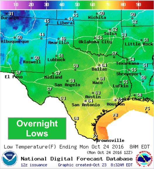
Lows overnight will be warmer than we’ve seen the past couple of days as humidity levels continue to increase. The coolest spots overnight will be across the panhandle with lows dipping into the mid to upper 40s. Elsewhere, upper 50s to 60s will be expected. Again, this pattern of warm days and warm nights with little chances for rain is expected to continue through the week ahead, so don’t put those garden hoses and sprinklers away for the season just yet!


0 Comments