
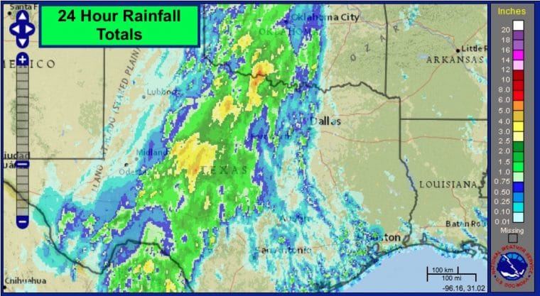
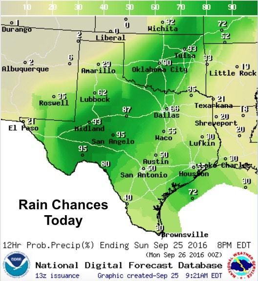
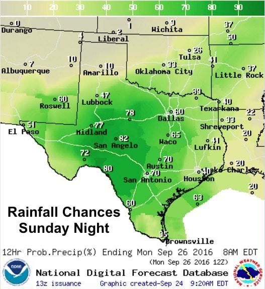
A strong cold front will sweep across the state tonight into Monday with additional chances for heavy rainfall out ahead of it. Most of the rainfall yesterday and overnight was located west of the I-35 corridor across western north Texas and west central Texas. We expect much the same today across these regions with very little eastward movement of the system before the front arrives. Just like yesterday, we’ll see storms train repeatedly over the same areas as they move quickly off to the northeast which means another day and night of localized flooding issues. A Flash Flood Watch remains in effect through Monday evening for much of west central and southwest Texas and this includes Midland/Odessa, San Angelo, Big Lake, Ft. Stockton and down into the Big Bend Region. We will also see the threat of popup afternoon showers and storms along the coast today between Houston and Corpus Christi. These will be slow-movers with the chance for dumping a quick 1 to 3 inches wherever they develop along the coast and the inland coastal plains. The overall threat of severe weather is low, but a few of the storms developing today could briefly reach severe limits with gusty outflow winds and lightning as the main threats. Waterspouts may also affect marine areas just off the coast, so be on the lookout for that as well.
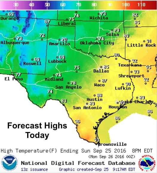
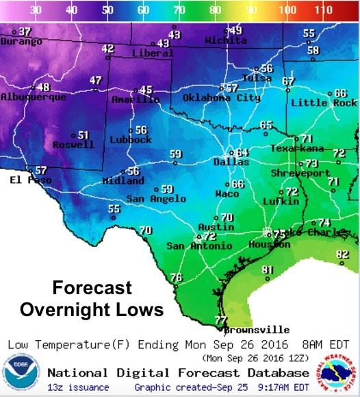
As of this writing, the cold front is stretched across the panhandle from around Amarillo down to around Pecos in far west Texas. Behind the front, winds have picked up and are gusting between 25 and 30mph at times. Temps have also cooled significantly behind the front with readings in the mid 50s currently across the northern panhandle. Highs today across the panhandle, far west Texas will range from the low to upper 70s today. Further to the south and east out ahead of the front, one more day of warm and muggy conditions with highs in the mid 80s across northern Texas, mid to upper 80s across central Texas and upper 80s to mid 90s for coastal and deep south Texas. Once the front sweeps through overnight and through the coastal zones by late Monday, we’ll see conditions dry out with very pleasant fall-like conditions expected for much of the work week ahead!


0 Comments