
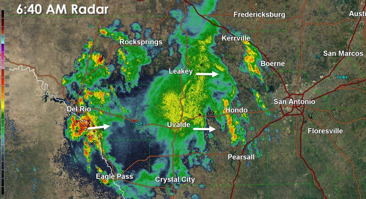
It is a wet start to the day across parts of the Edwards Plateau into Southeast Texas. A large cluster of showers with embedded thunderstorms is trying to make slow progress to the east. It is not out of the realm of possibility that Boerne and San Antonio get a bit of rain this morning. The most widespread activity should remain west of Interstate 35/Interstate 10. Short-term weather model guidance indicates this area of precipitation will likely start to weaken after 9 to 10 AM. Some folks could pick up an inch or two of rain before activity starts to dwindle later this morning.
Another feature of interest this morning is a cold front bisecting the Texas Panhandle. Observations just after 6 AM indicate the front is near a Hereford-Amarillo-Pampa-Wheeler line. Temperatures and moisture levels are a tad lower north of the front, but the noticeably drier air is lagging back in the northwestern Texas Panhandle. This front will continue to slowly sag south this morning with the expectation of becoming stationary by early afternoon. There remains some uncertainty on exactly where the front will stall out later today. Our best estimation currently is that the front will try and make it into the southern Panhandle or northern South Plains before stalling out.

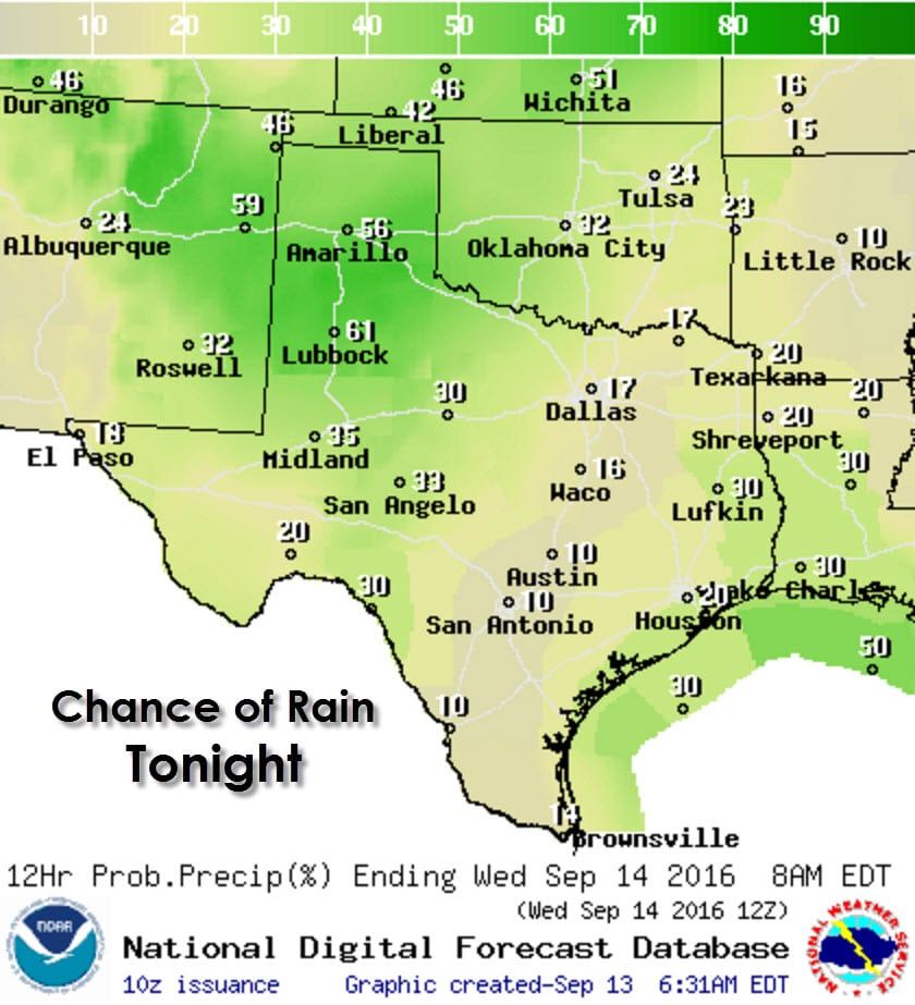
Scattered showers and thunderstorms are possible this afternoon across the southern Texas Panhandle, West Texas, eastern Permian Basin, Concho Valley, east into Southeast Texas. As usual the chance for showers/storms in Southeast Texas will be highest during the mid-afternoon hours as a seabreeze moves onshore. Any particular shower/storm won’t last more than an hour before raining itself out. Coverage will decrease by early evening. By the late afternoon hours a few stronger thunderstorms may pop up in proximity of the stalled front in the southern Texas Panhandle south into West Texas. These storms would move slowly to east around 15 MPH. We may have to wait until later tonight for an uptick in thunderstorm coverage.
Scattered to numerous thunderstorms are expected to develop tonight in the Texas Panhandle, West Texas, and Northwest Texas in proximity to a stalled front and weak upper level disturbance. Some of the activity may be heavy with frequent cloud to ground lightning, localized gusty winds, and very heavy rains. A few flash flooding issues may arise if we see storms move over the same areas or stall out overnight in West Texas. Widespread flash flooding and severe weather is not anticipated tonight. Isolated to widely scattered activity may also develop in the Big Country, Concho Valley, Southwest Texas, and in the Permian Basin and Borderland.
The rest of the week will feature unsettled weather as a stalled front, abundant moisture, and weak upper level disturbances all influence our weather. Scattered showers and storms will be possible pretty much anywhere beginning Wednesday and continuing through the weekend. Undoubtedly we’ll have areas with better rain chances and others that generally miss out each day. Just understand and don’t be surprised if you see a few showers or storms in your area at times this week. It certainly won’t be a washout in most locations.
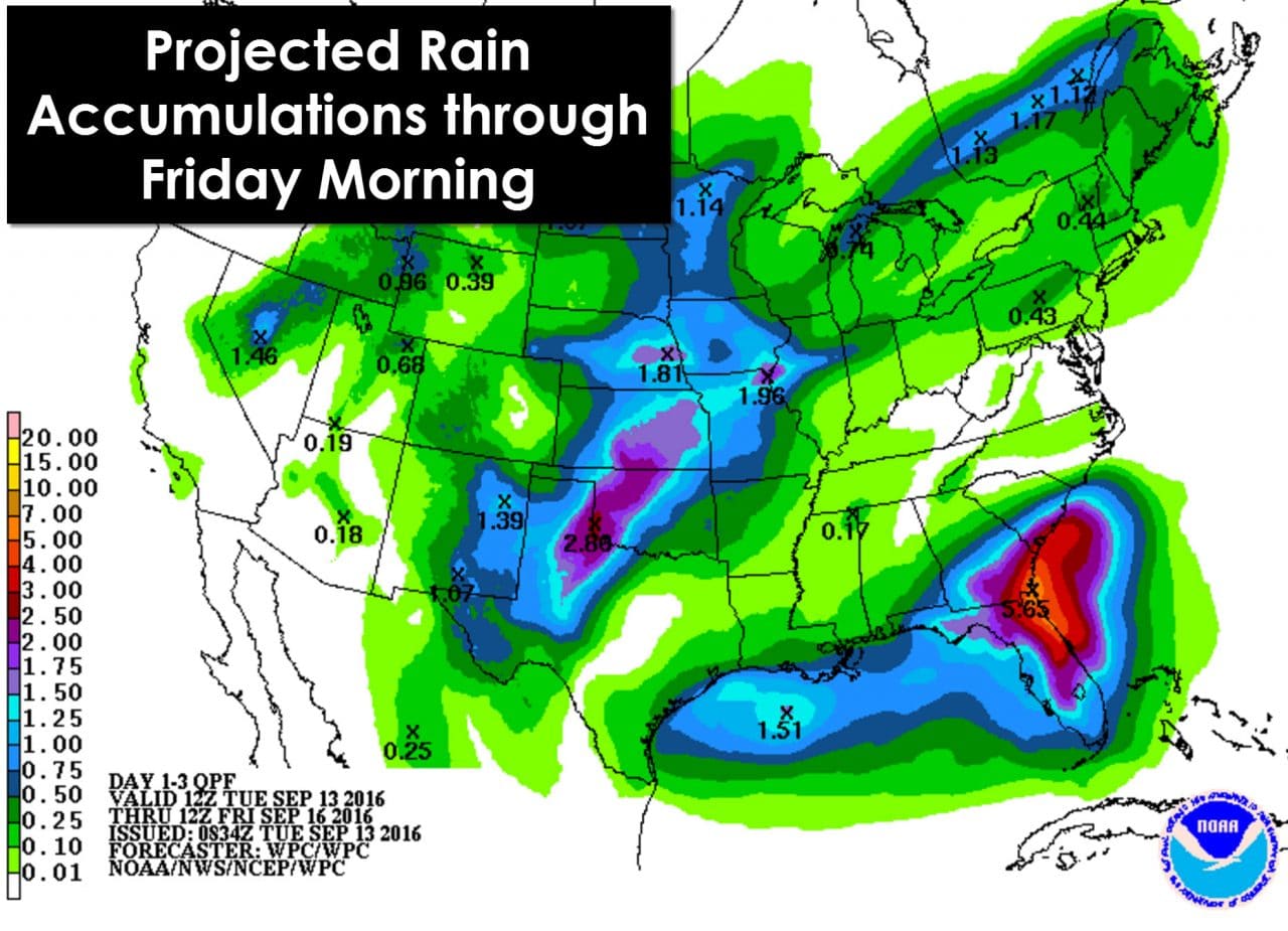
Through Friday morning the heaviest rainfall totals are expected to be in the eastern Texas Panhandle, Northwest Texas, and West Texas where one to three inches of rain may fall. Isolated rain totals up to five inches are not out of the question – and those would likely cause some minor flooding issues. We do note that the Weather Prediction Center generally keeps most of Central Texas dry through Friday morning. I wouldn’t be surprised if a few folks were impacted by a shower, but overall this does highlight where the best rain chances will be through Friday morning. The coastal sections of our state also will have a chance of rain accumulations of a quarter to three quarters of an inch over the next few days.
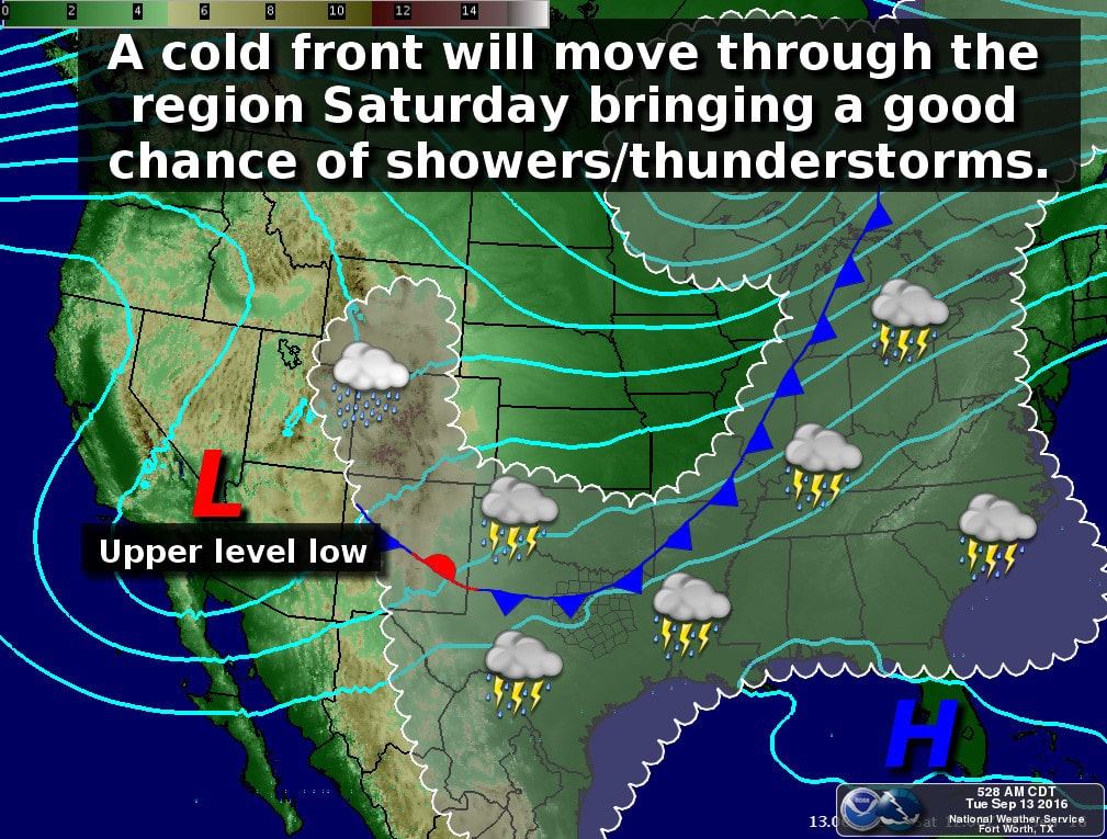
As we head into Friday and the weekend our stationary front will still be in the picture, although likely situated further south closer to Interstate 20. An upper level low will take shape in the southwestern United States and slowly progress towards us this weekend. Abundant moisture and lift from the upper low will allow for scattered to numerous showers and thunderstorms on Saturday. Some locations could see a few minor flooding issues, especially where we see heavier rains fall through Friday. This weekend is the time-frame when rain chances will probably be highest for much of Texas.


0 Comments