
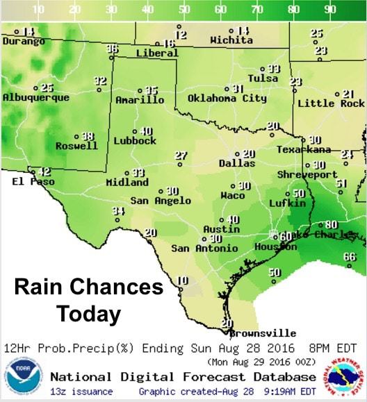
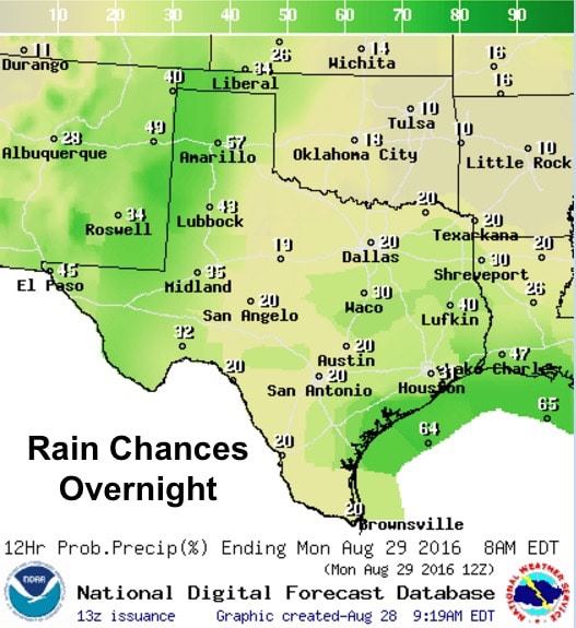
An upper level low spinning over the gulf will continue to bring chances of rain today for parts of southeast and coastal Texas. Most of the rainfall yesterday from this low fell east of Galveston around Port Arthur and the intracoastal waterway east of Bolivar. With the low beginning to drift west/southwest today, we should begin to see its rainbands shift west along with it and provide a bit more coverage of scattered showers and storms across both southeast and eastern Texas this afternoon and overnight. Confidence in how much rain will fall area-wide this afternoon is a bit uncertain, but the Weather Prediction Center does have this area covered under a Slight Risk of excessive rainfall for the next 12 to 24 hours with pockets of 3-6 inches possible under some of the more robust cells that develop.
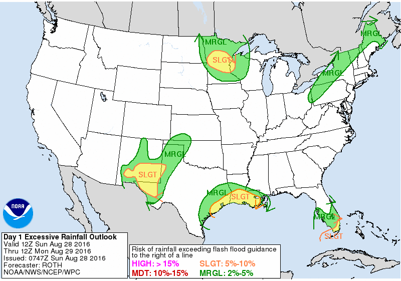
Western Texas and the panhandle region will also see another round of showers and thunderstorms develop this afternoon and continue into the overnight hours. Excessive rainfall is also possible for the Trans Pecos/far West Texas region especially during the overnight hours as heavy rain is expected to continue across the region. Pockets of 3 or more inches is possible which will likely result in Flood Advisories or Watches being issued later today. Widespread severe weather is not expected, but a few of the storms could carry the threat of some small hail, gusty winds and frequent lightning.
Highs today, once again below average for this time of the year. But, even with the below-average temps yesterday, heat index readings across north central and central Texas still got a bit toasty in the mid to upper 90s which made it a bit miserable to be outside much by early afternoon. My husband certainly confirmed that when he came in from mowing. We expect much the same today across parts of north central down into central, southwest and deep south Texas today, so be sure to stay hydrated if you’re planning to be outdoors this afternoon.
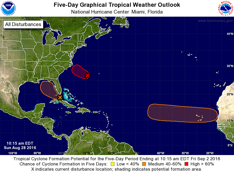
Tropics Update: The Atlantic hurricane basin remains quite active!
The weak disturbance over the northern coast of central Cuba is still hanging on and slowly continue to drift off to the northwest. By Monday, it will likely enter the southeastern Gulf off the coast of Florida and may begin to strengthen at that time. Model forecasts continue to indicate that this system will likely ride up the western coast of Florida and not impact the Texas gulf coast region. We will continue to keep an eye on it and let you know if any of that changes.
Another disturbance off the east coast has strengthened overnight into Tropical Depression #8 and should continue to strengthen a bit as it heads towards the coast of South Carolina. This will most certainly not affect Texas weather, but will impact coastal Carolinas with the potential for some heavy rain and wind later this week before it is eventually swept out to sea.
Another area of interest we’ll have to start watching is a tropical wave expected to move west off the African coast sometime on Tuesday. Conditions will be very favorable for development later this week as it treks west across the eastern tropical Atlantic.


0 Comments