
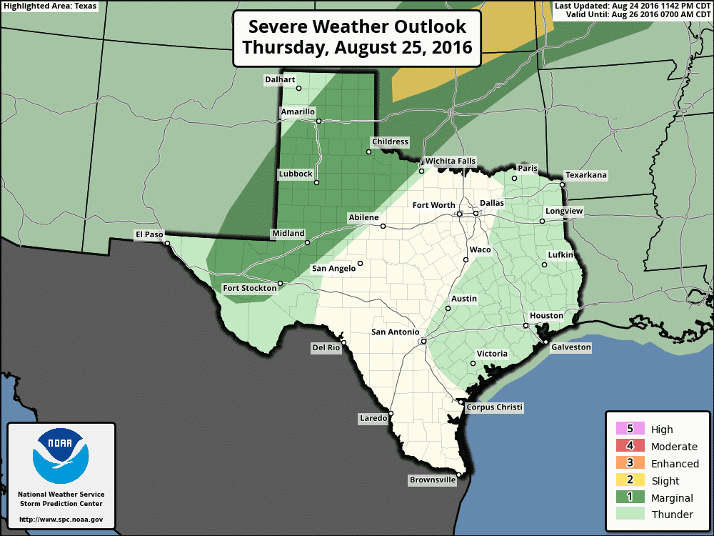
The Storm Prediction Center has issued a category 1 severe weather risk. SPC uses a five-level risk system – 1 being the lowest and 5 being the highest. Risk levels are determined on the overall aerial coverage of severe weather expected along with the threat of higher-end severe weather. For now we have the lowest of five levels in place. This marginal risk of severe weather includes the Permian Basin, South Plains, Rolling Plains, Northwest Texas, the Caprock, and the eastern two-thirds of the Texas Panhandle. We do note that a category 2 severe weather risk isn’t that far off in Oklahoma, and I wouldn’t be surprised to see portions of the Panhandle upgraded to a category 2 risk in later outlooks today. The primary severe weather threats with the strongest storms will be damaging wind gusts over 70 MPH and hail up to the size of quarters. Wind shear values in the Panhandle may support a few stronger hail cores so we’ll have to keep an eye out for larger hail potential.
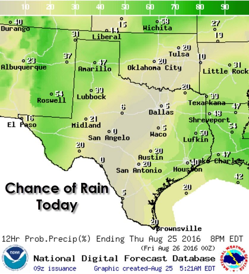
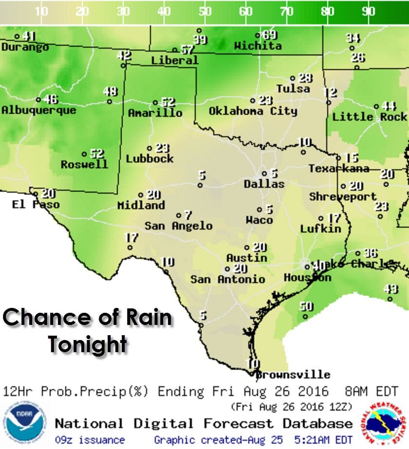
The best chance for scattered thunderstorms today will be in two regions – west and east. The Concho Valley, Big Country, North Texas, and South Texas will be surrounded by rain chances, but should remain dry. Scattered thunderstorms with locally heavy rain are expected today across the Texas Panhandle, South Plains, Rolling plains, Permian Basin, Pecos Basin, Northeast Texas, East Texas, and Southeast Texas. The severe weather potential, as previously mentioned, will be in the western parts of our state today. Rain chances will continue tonight in western parts of Texas and in Southeast Texas. The severe weather threat should diminish late this evening, but a few strong storms may continue in the Texas Panhandle.
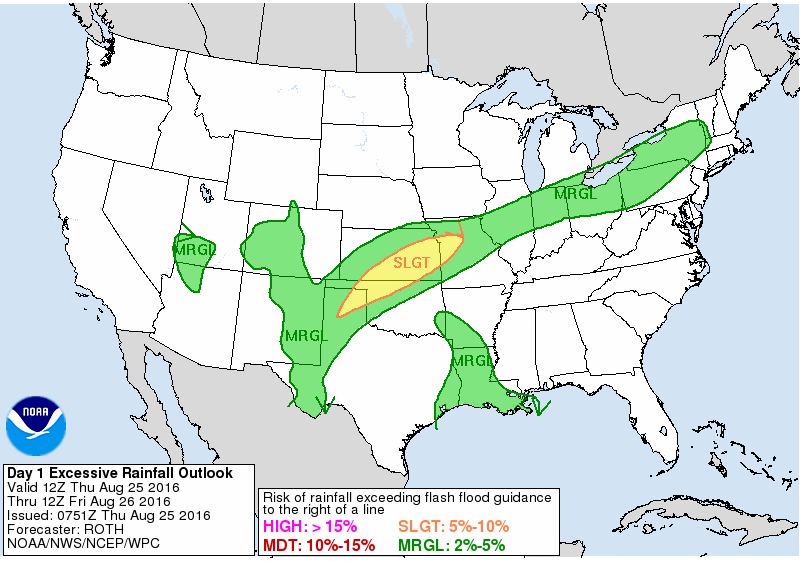
Risk of flash flooding today and tonight
With plenty of moisture in place and the potential for several storms we do have the potential for localized flooding in the Texas Panhandle, West Texas, and the Permian Basin today and tonight. Widespread flash flooding isn’t expected, but some locations could pick up a few inches of rain. Folks out in the Panhandle know it doesn’t take much rain to turn rural roads to mud and for low-water crossings to become impassable.
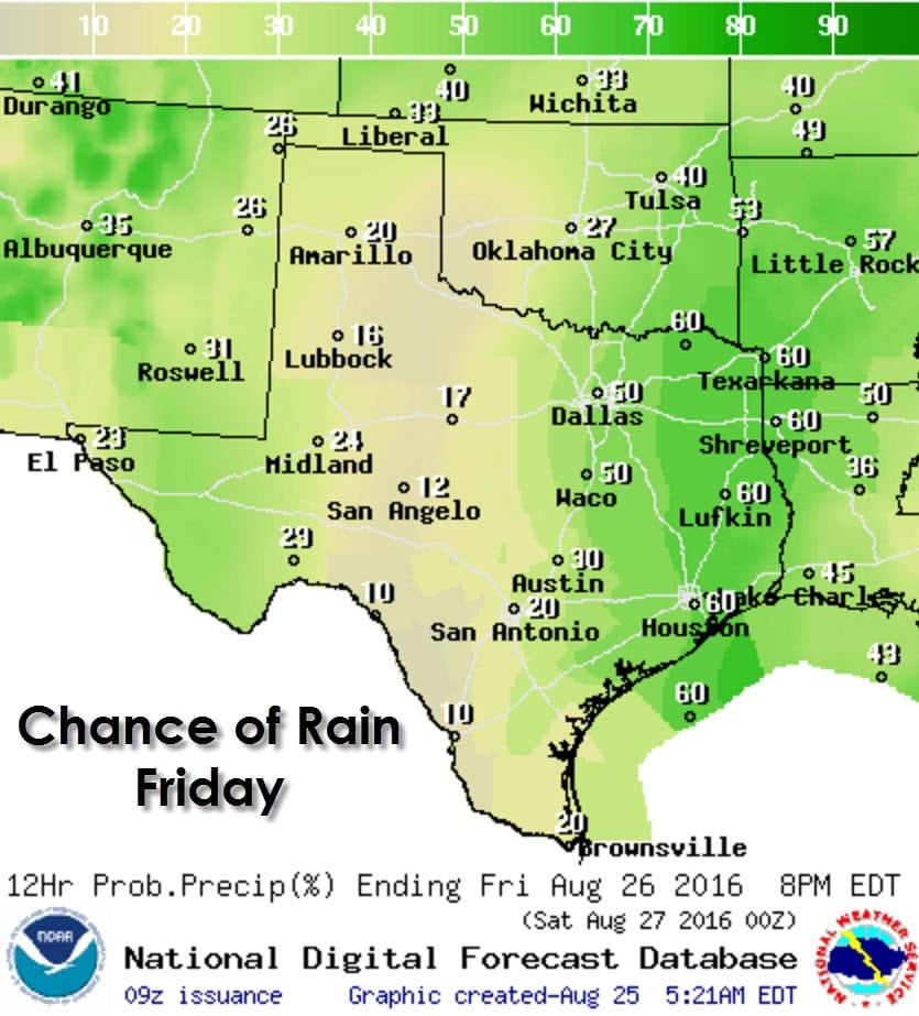
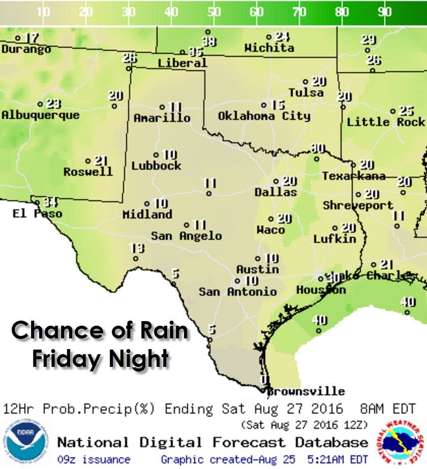
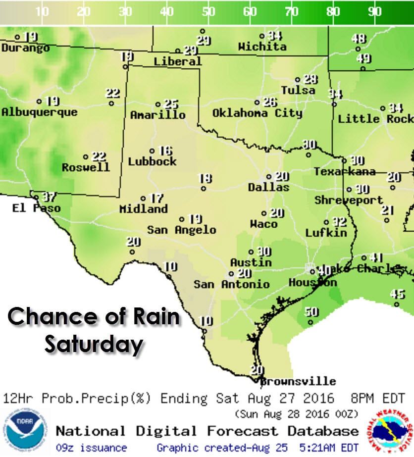
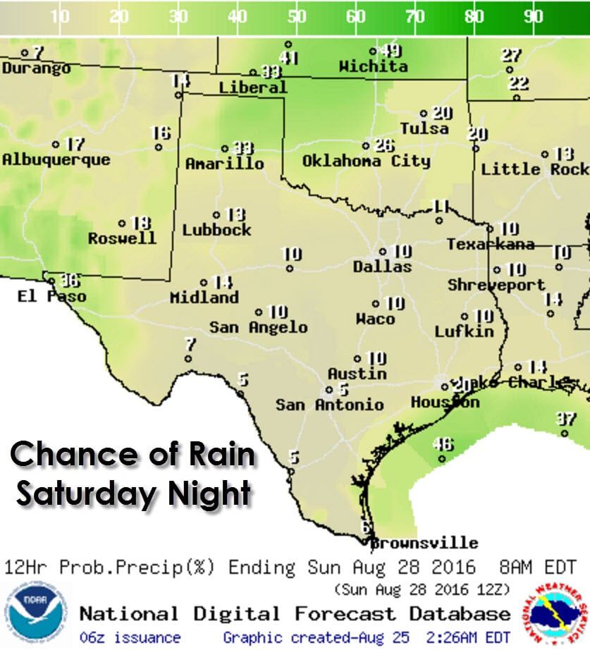
Rain chances increase on Friday along the Interstate 35 corridor from the Red River (Texoma) south into Central Texas. Numerous showers/storms can be expected tomorrow in Northeast Texas, East Texas, and Southeast Texas. Rain chances will also be in place across the Permain Basin. Isolated to widely scattered activity will continue into the weekend with locally heavy rain.
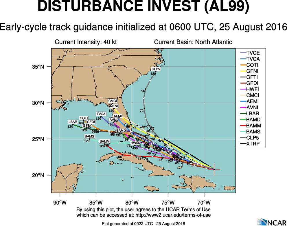
We continue to monitor a strong tropical wave located several hundred miles southeast of the Bahamas. Most weather models keep Invest 99L a relatively disorganized tropical disturbance through tomorrow. By Sunday this system should be near Southeast Florida. From there the system, if it even develops, could try and make a run into the eastern Gulf of Mexico. I will say that at this point I believe the direct threat to the Texas Coast is low, but not zero. If the system makes it into the eastern Gulf it could ramp up in a hurry. The National Hurricane Center gives this system a high chance of developing into a tropical storm by this weekend. Should this become a tropical cyclone it will be named Hermine. Regardless of the track of this system it will probably bring more moisture into Southeast Texas by the end of next week. I encourage our followers on the Gulf Coast to keep an eye on this system as we continue into the weekend and next week.


0 Comments