
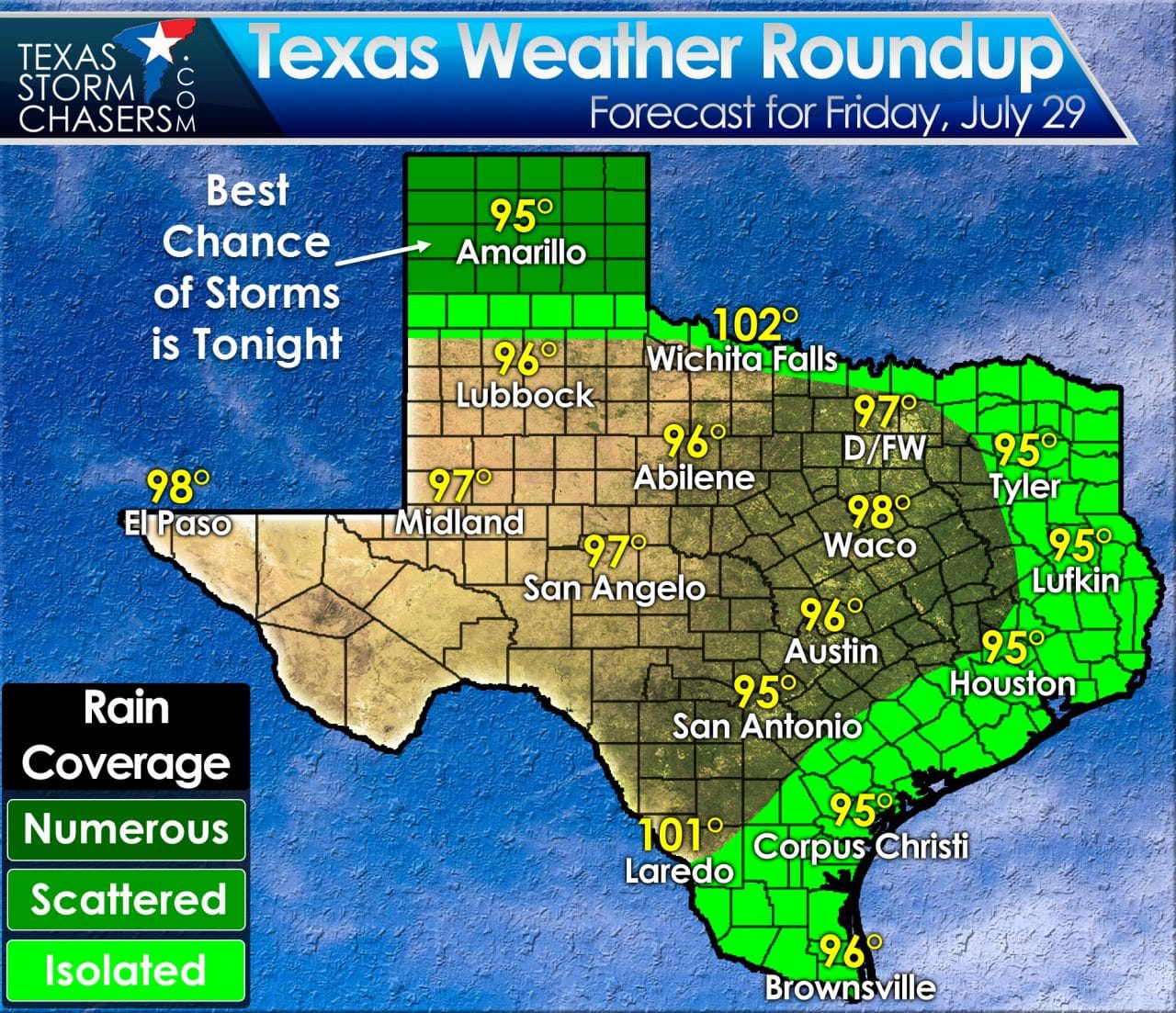
The only convective activity this morning is across the northern Texas Panhandle. Most of that activity is on the weaker side with a couple of lightning strikes. A few showers are falling around San Antonio east to Houston. Nothing too significant to discuss this morning weather-wise with typical warmth and humidity for a late July morning. Rain chances this afternoon will be lower than the previous days as we start to head back into a typical summer weather pattern. Isolated popup storms can be expected across South Texas, the Middle-Texas Coast, Southeast Texas, East Texas, and possibly the Red River Valley. Temperatures will peak in the middle to upper 90s with a few warmer cities topping out above 100 degrees. Some of the storms this afternoon will be strong with localized damaging wind gusts, heavy rain, and dangerous cloud to ground lightning. There is a conditional risk for a complex of thunderstorms to impact the Texas Panhandle tonight. The chance of being impacted by these overnight storms will depend on upstream development in Kansas plus any sort of outflow boundaries in play this afternoon. A few storms could become severe with hail and damaging winds this evening in the Texas Panhandle. We’ll keep an eye on this possibility and post updates as needed later on today. Make it a great Friday!


0 Comments