
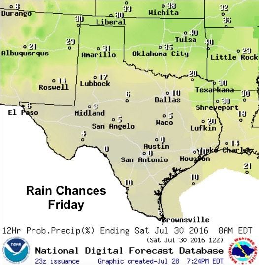
While we’ve enjoyed the cooler temps and rather numerous showers and storms for the past several days this week, our typical summertime ridge of high pressure will begin to build back in over the weekend. As this happens, we’ll see rain chances on the downtick and temperatures on the uptick over the weekend and into next week. We will still have a few chances for rain and storms tomorrow, mainly across the southeast Texas coastal region, and up across parts of the panhandle and possibly the Red River valley region…but outside of that, chances for rain and storms will be slim.
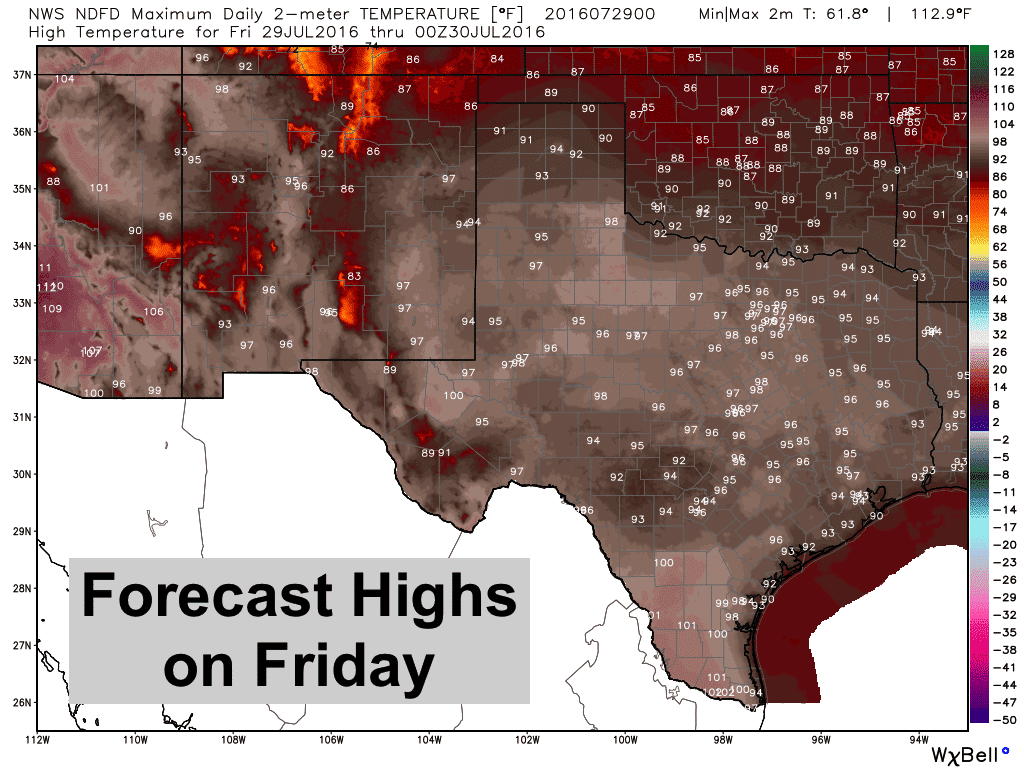
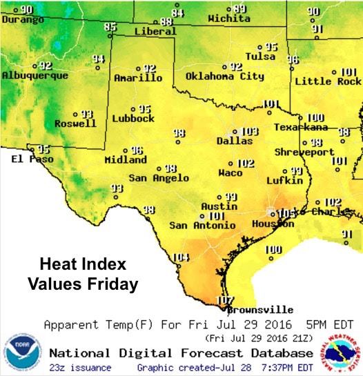
Highs tomorrow will begin to creep upwards, and continue to creep upwards closer to the 100 degree range over the weekend. With abundant moisture still in place across the eastern and southern regions of the state, the heat index values will begin to rise back to uncomfortable levels with the only relief being the chance for pop up storms that develop during the afternoon hours. For right now, it looks like most areas will stay just under Heat Advisory criteria for the weekend, but that could change as we get into the next work week. At any rate, our little vacation from the oppressive heat will come to an end and we’ll be back to a hot and mostly rain-free period as we approach what is typically our hottest time of the year.
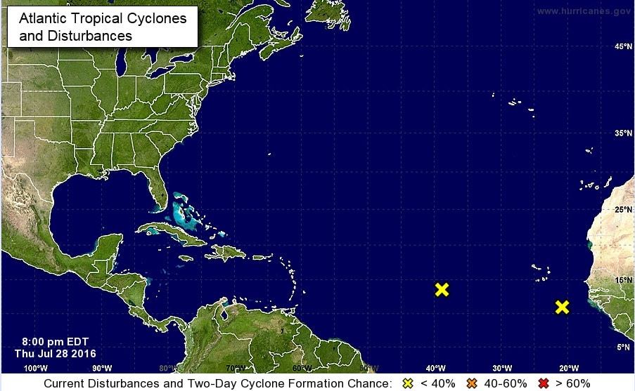
The Tropics – The Atlantic has been relatively quiet so far this season with only 1 hurricane and 3 tropical storms so far. Saharan dust continuously flowing off the coast of Africa has hampered tropical storm development much of this summer. However, in the past two days, we’ve seen two disturbances develop off the west coast of Africa which will be worth monitoring over the next several days. While the one further west is not expected to do much anytime soon, the one to the east and closest to the African coast has a pretty good chance of reaching at least tropical storm status sometime within the next 5 days. August is when we typically start to see the Atlantic storm basin kick into gear, so even if these two disturbances end up dissipating, we’re sure to have more development in their wake over the next two months. As always, if we see anything that could potentially pose a threat to our Gulf Coast region, we’ll keep you updated!


0 Comments