
After a week and a half of talking about heat and isolated showers we finally have something more interesting to discuss. The heat dome has shifted into the Southwest United States. In its wake we’re now moving into a more unsettled weather pattern. This unsettled pattern means less hot temperatures and increased chances for rain. The rain chances are are a good thing. A flash drought is quickly developing and we’re going to be in a world of hurt fire-wise sooner rather than later if we don’t get rains. All the rains this past winter and spring let growth once again become abundant. Several weeks of hot temperatures and dry weather has resulted in a quick drying out of surface grasses. Given a few more weeks of drying we’ll quickly be in a flash drought. Luckily I believe we’re going to avoid that in some regions.
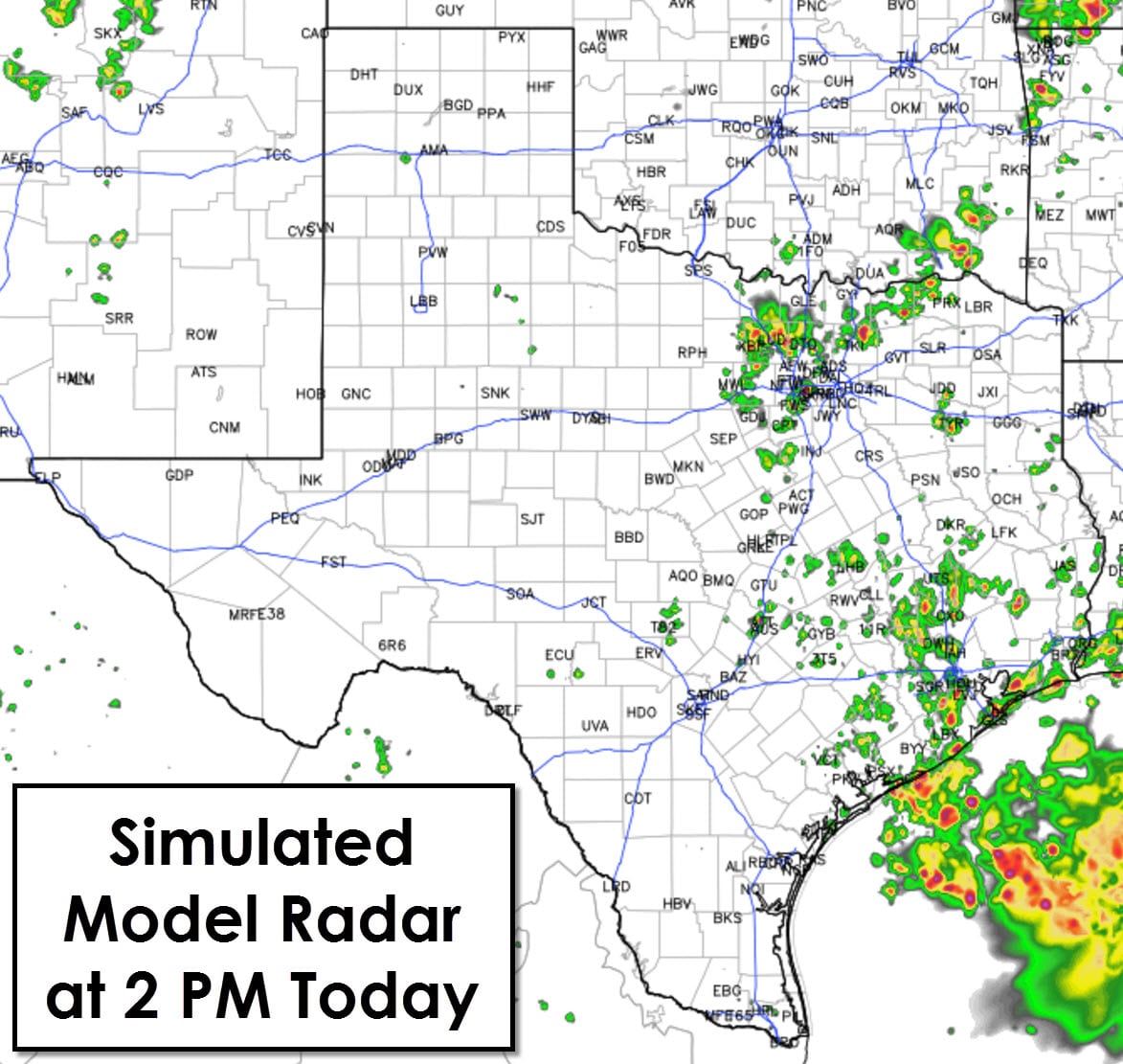
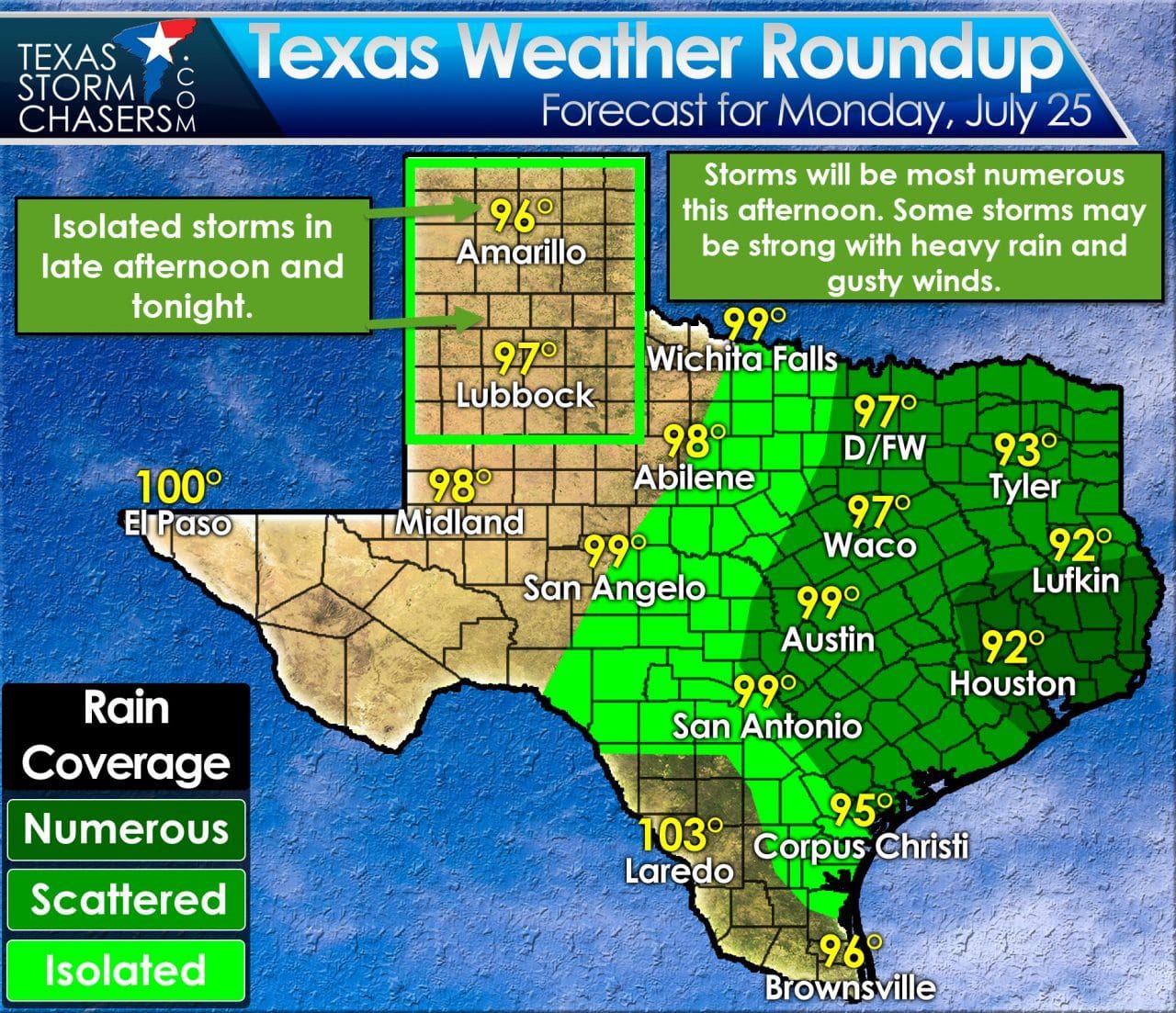
Scatterded to numerous thunderstorms will develop by early afternoon near and east of Interstate 35. The best chances for numerous thunderstorms will be in Southeast Texas this afternoon, but there will be scattered to numerous storms from D/FW into Northeast Texas, East Texas, the Brazos Valley, and Central Texas. Isolated to scattered storms can be expected in Northwest Texas, the Big Country, Concho Valley, and South Texas. Today will probably be the most active day storm-wise that we’ve seen in several weeks. We’re not talking about widespread severe storms by any means. Little wind shear is present and you need wind shear to support longer-lived, organized storms. An unstable airmass with plenty of moisture will undoubtedly support stronger popup storms today. The main threat will be localized microbursts with winds in the 50 to 70 MPH range. Most storms will not be that intense. Very heavy rains are probable under storms today, but they shouldn’t last too long. The threat of flash flooding will be limited and confined to locations that end up under storms for a prolonged period.
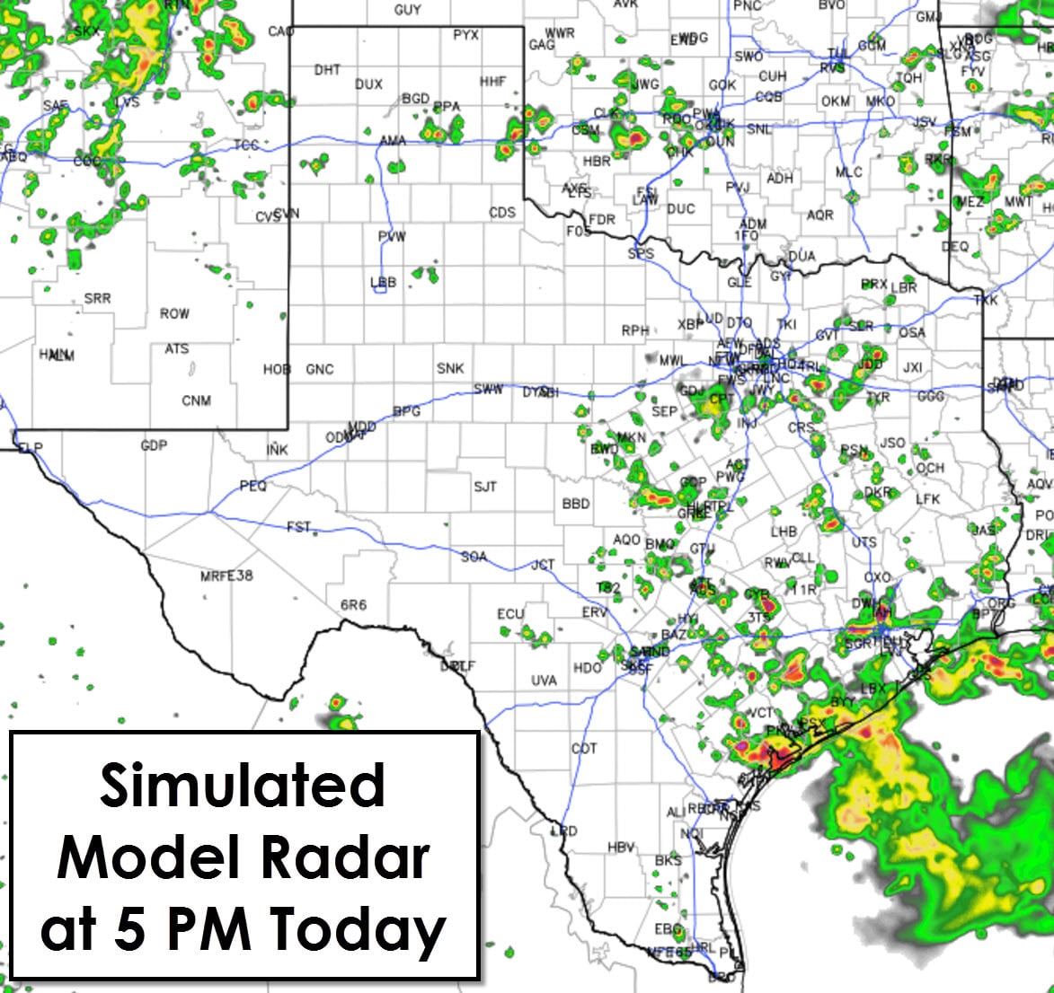
Isolated thunderstorms will also be possible later this afternoon in the Texas Panhandle and West Texas. These storms will be high-based with severe weather unlikely. We may see isolated to widely scattered storms continue into the evening hours.
Temperatures will quickly top out in the lower to upper 90s this afternoon. Even with increasing clouds and storms temperatures will warm up quickly this morning. By this afternoon folks near storms will enjoy outflow and a cool off into the 80s.
Shower and thunderstorm chances will continue most of this week as we remain east of the high pressure, heat dome. It’ll continue to be warm but decently cooler than what we saw last week.


0 Comments