
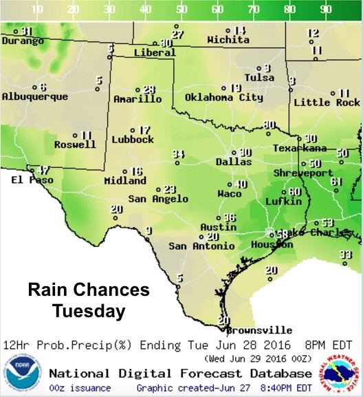
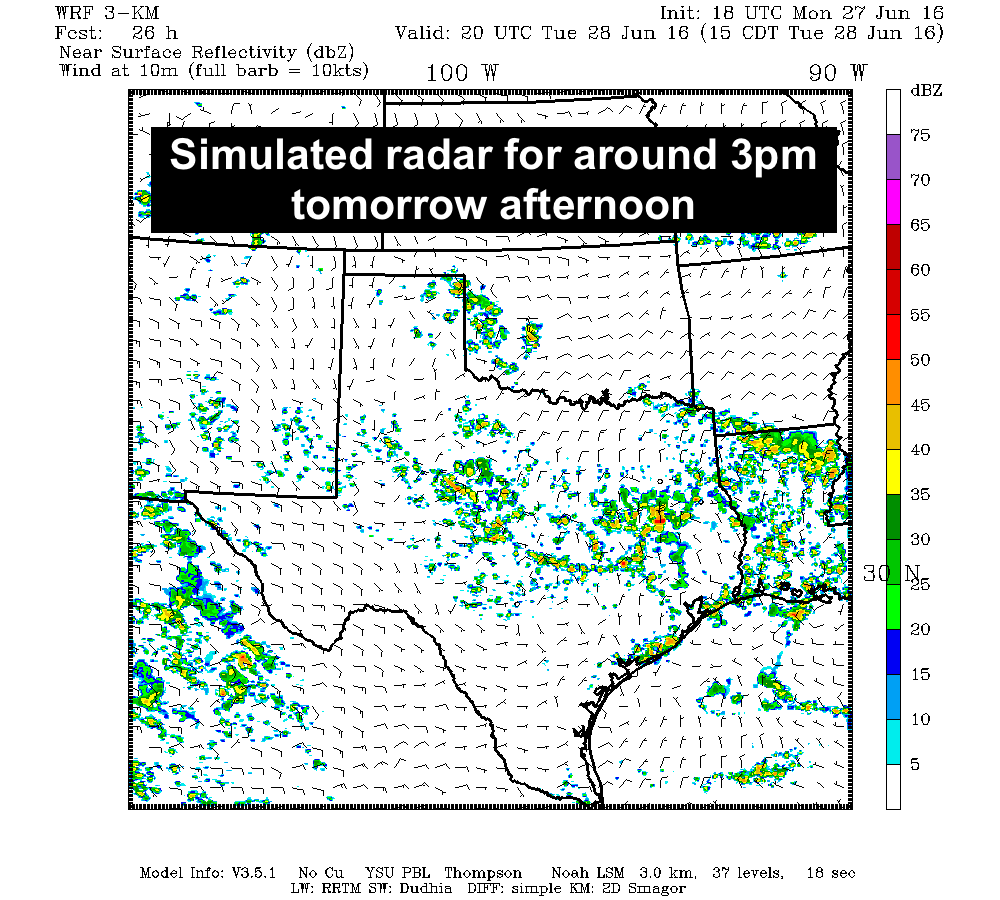
In the wake of today’s pop up showers and storms, a weak cold front will slowly drift south out of Oklahoma and dissipate in the vicinity of the Red River. Residual outflow boundaries from today’s storms mixed with the diffuse frontal boundary will likely become a focus for pop-up showers and storms once again tomorrow afternoon across north Texas. Coverage north of I-20 will be less with only a 20 to 30% chance. Best chances tomorrow will reside south of I-20 into central Texas where a 40% chance is highlighted. Across southeast Texas, the chance for rain will jump into the 50% to 60% range influenced by outflow boundaries from storms this afternoon as well as a weak backdoor cold front moving into the region. Most of the storms that develop tomorrow will remain below severe criteria; however, as we saw earlier this afternoon over Ft. Worth, we will have the chance of seeing a couple of these pop-up cells become severe with small hail, gusty winds and very heavy localized rainfall as the main threats.
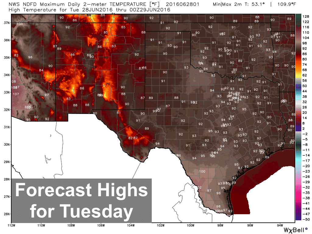
Highs tomorrow, creeping up just a few degrees as high pressure begins to reorganize and build back over the state. This coming 4th of July weekend looks to be hot with the return of temps climbing into the upper 90s to 100s across a large swath of the state. We’re mentioning this now because folks with outdoor plans over the weekend will need to make note of that and kick up the hydration a bit before heading out for the weekend!


0 Comments