
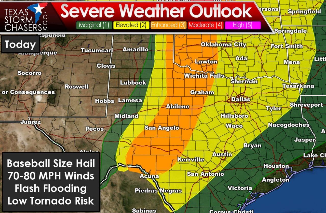
The Storm Prediction Center has expanded the Category 3 severe weather risk zone to include Northwest Texas, the Big Country, and the Concho Valley. These areas are located just east of a surface dryline, where the atmosphere is destabilizing. Ongoing showers and thunderstorms east of the dryline this morning have slowed but not eliminated destabilization. The cap is quite weak today, which means we may just see storms continue to develop into the afternoon and evening hours. An approaching upper level disturbance will result in increasing wind shear supportive of organized thunderstorms. Breaks in the clouds will allow the atmosphere to quickly destabilize this afternoon. Due to the rich tropical airmass in place, the atmosphere is already quite unstable and thus cloud cover won’t play too much of a detrimental role in today’s evolution. The strongest storms this afternoon and evening could produce giant hail larger than the size of a baseball, destructive straight-line winds up to 80 MPH, flash flooding, and isolated tornadoes. The threat for significant, longer-track tornadoes is expected to be further north in Kansas today. It doesn’t matter though, because if the one tornado that occurs in Texas today hits your house, it will be the “big one” to you.
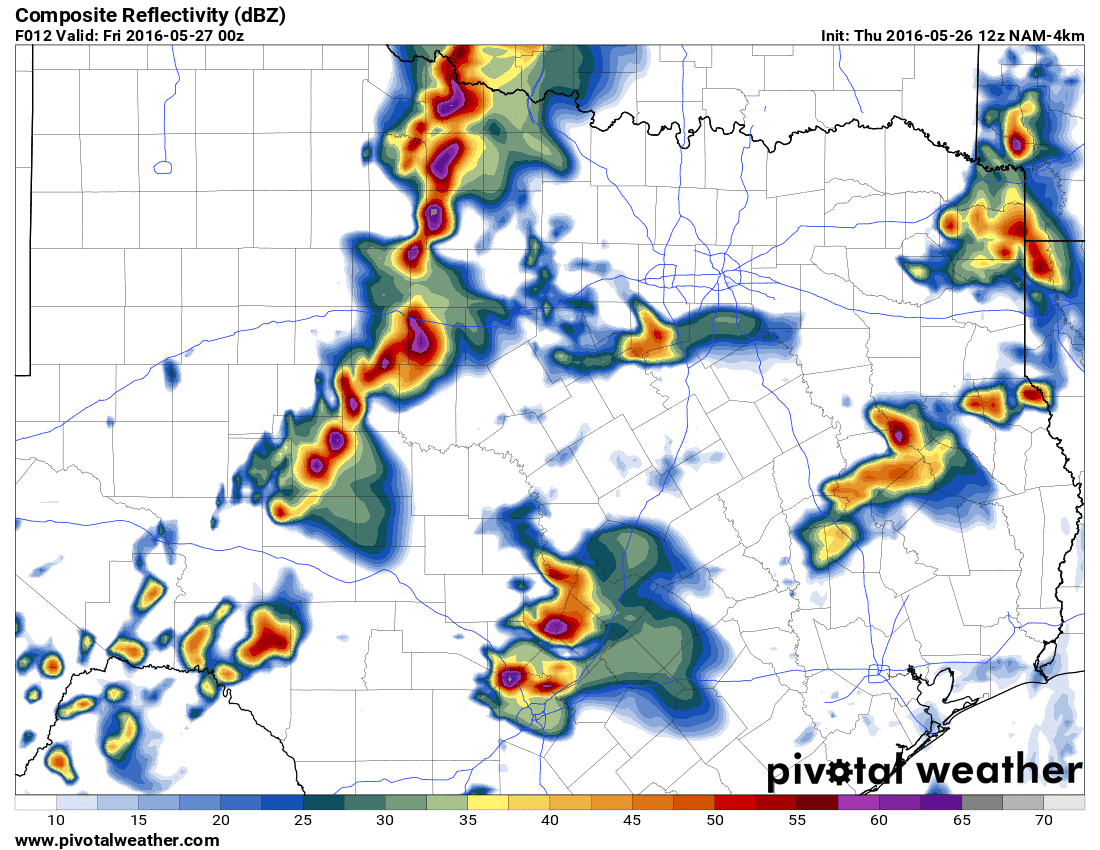
This graphic emanates from one of the morning runs of a high-resolution weather model. It’s showing several severe thunderstorms underway in the risk zones by early this evening. If storms are able to congeal into a squall line, the threat for significant wind gusts would increase while the tornado threat would be somewhat reduced. Regardless, strong instability values and high moisture content will support a very large hail and heavy rain threat.


0 Comments