
While forecast uncertainty is currently on the high side, we are monitoring the chance for a mix of wintry weather along with heavy rainfall beginning late Thursday and into Friday and Saturday. Wintry weather impacts will be mainly felt across the Texas/Oklahoma panhandles down into northwest Texas Friday and Saturday. Widespread light to moderate rainfall is expected elsewhere. Let’s discuss the wintry weather first….
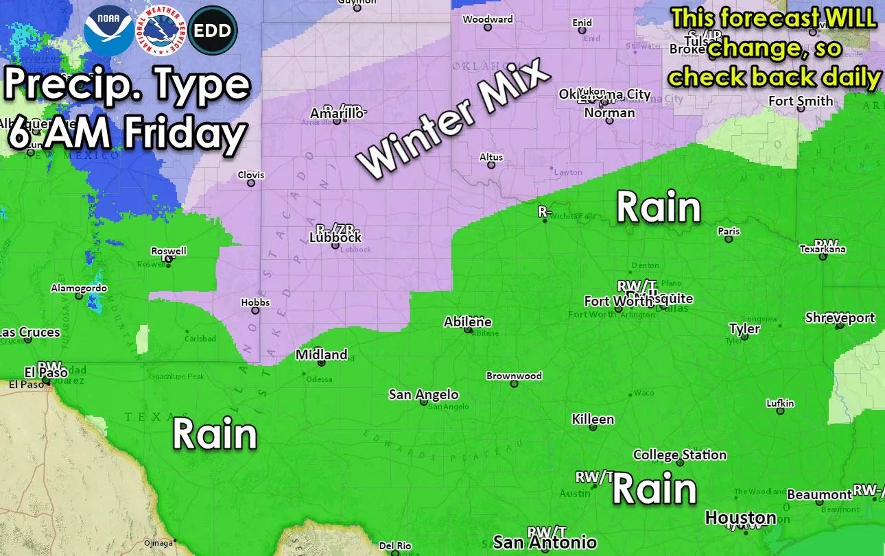
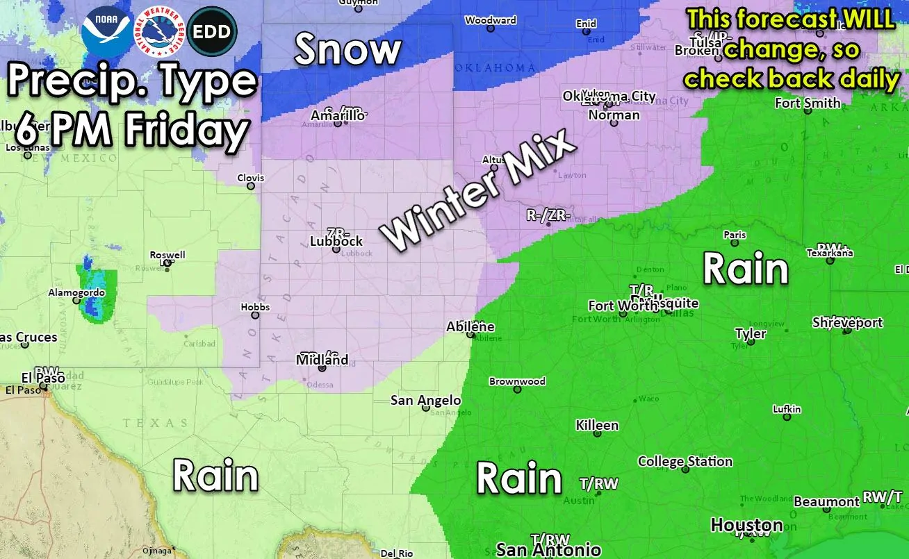
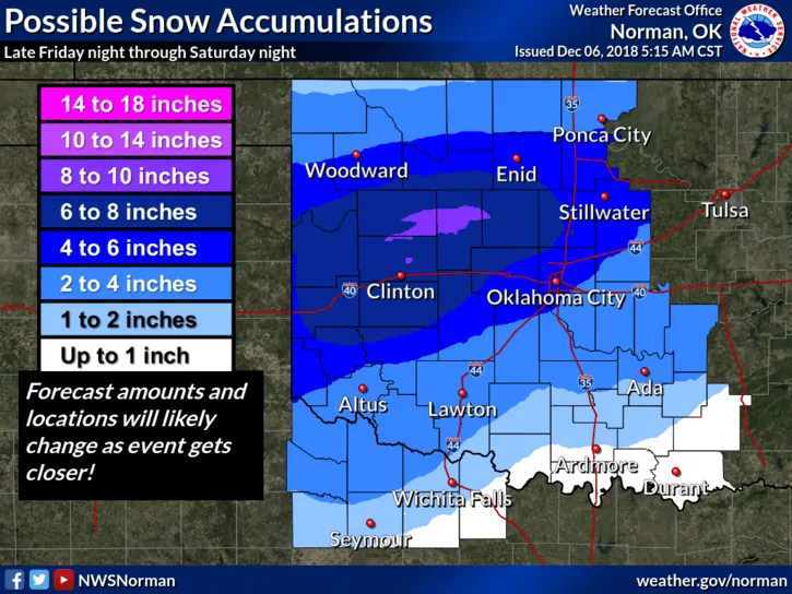
By Thursday afternoon, a strong upper level system will be on approach from the west with precipitation chances increasing from west to east across the state Thursday evening and into Friday. At the same time, our next cold front will arrive and push into the panhandle region by late Thursday into Friday dragging cold, sub-freezing air along with it. Snow chances will arrive as early as early Friday morning across the northern Texas panhandle and Oklahoma panhandle regions, with a wintry mix expected further south. As the freezing line drops south during the day Friday and into Saturday, we’ll begin to see a changeover to all snow perhaps as far south as Amarillo. Snow versus a winter mix of freezing rain and sleet will depend on the position of the front and depth of the cold air behind the front at that time, so it’s likely that we’ll see some adjustments to the current forecast as the work week wears on. Deeper cold air would mean mostly snow…shallower cold air would mean better chances for either sleet or freezing rain. For now, just know that some form of winter weather is likely across much of the panhandle, rolling plains and northwest Texas Friday into Saturday and this will be a pain in the patoot for commuters and other travelers through the region. Please plan to check back with us during the week!
Current Forecast Graphics from the Amarillo and Lubbock Forecast Offices
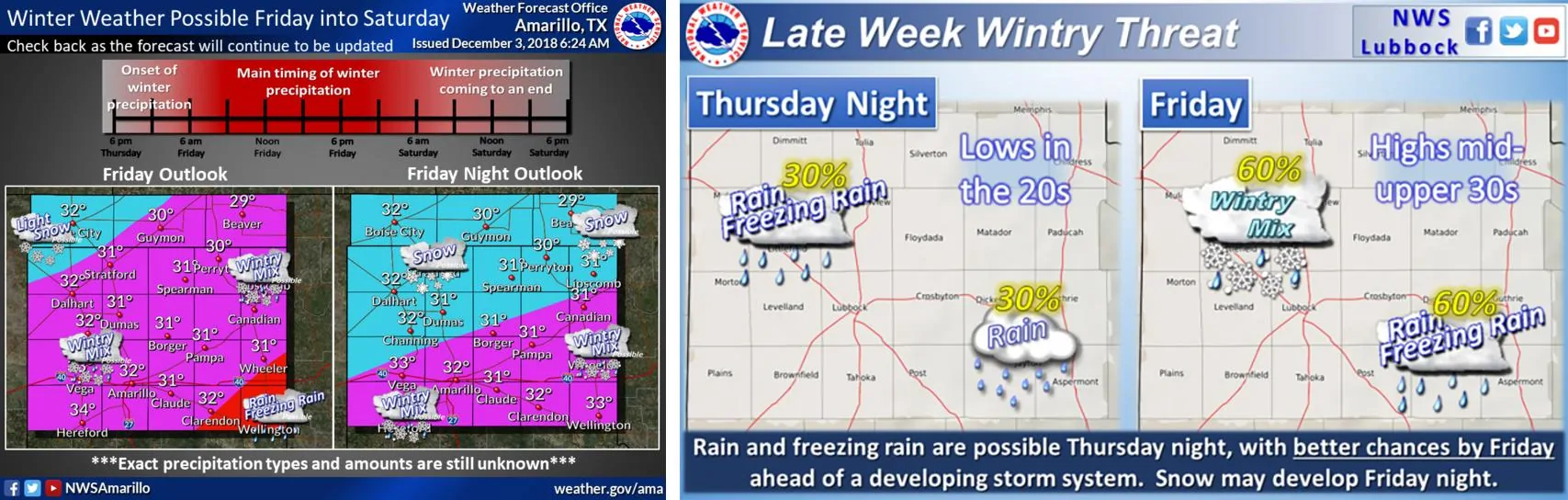
Current Forecast Graphics from the Norman, Oklahoma Forecast Office Covering Northwest Texas/Western North Texas
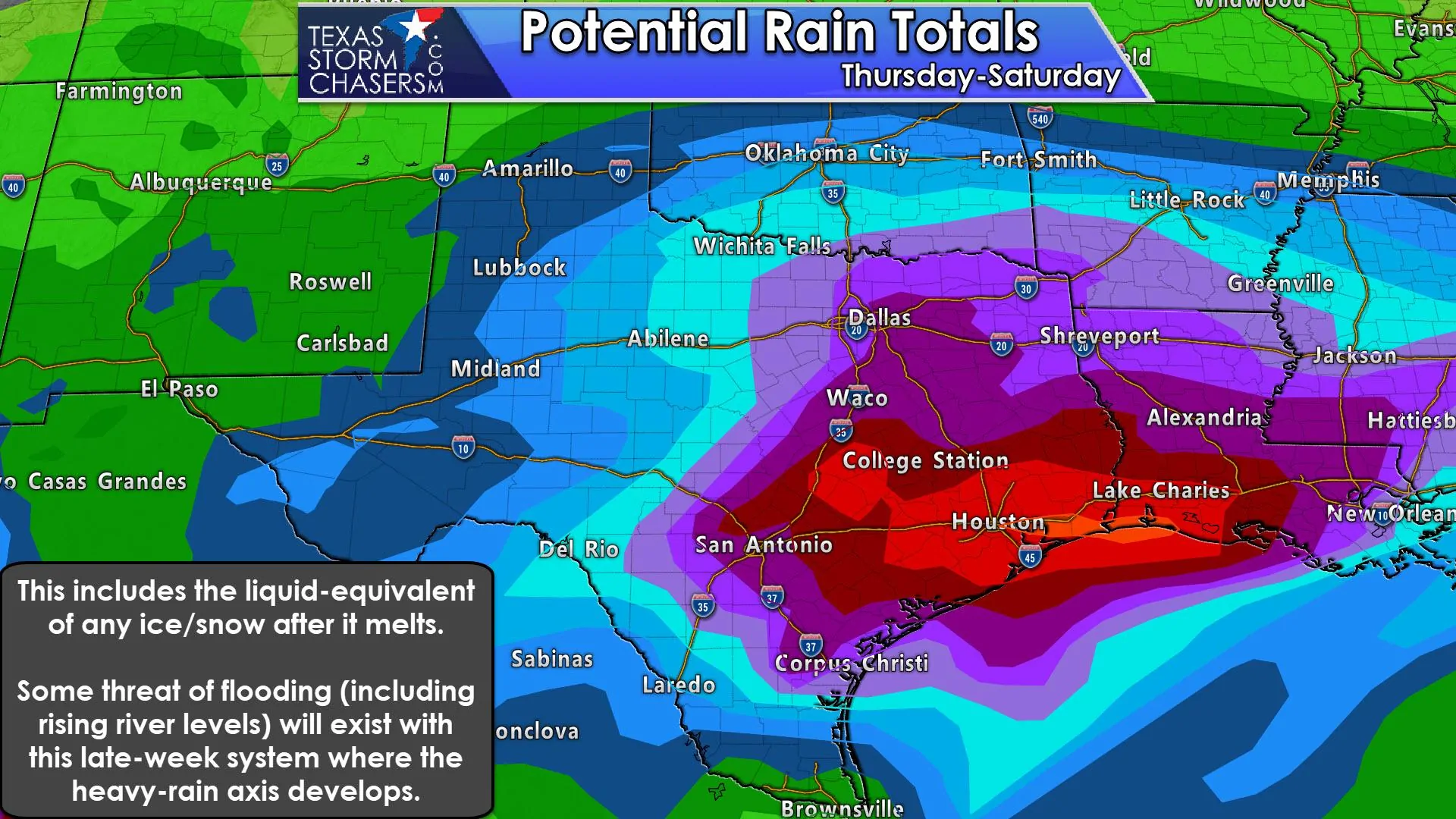
As for the rest of the state, we’ll be looking at rain…steady rain…increasing late Thursday night and continuing through Friday and into Saturday. At this time, severe weather is not expected as instability levels are looking meager at best, but with sufficient wind shear forecast to be in place at that time…especially across parts of south central Texas…we’ll keep an eye on it anyway. Highest rainfall totals at the moment are looking to be across parts of north central, central and southeast Texas which could pick up a quick 2-4 inches by the time the system moves out late Saturday. Isolated higher rainfall totals exceeding 4-5+ inches are also not out of the question, but it’s too early to really pinpoint the exact location where the heaviest rain will occur. The position of the frontal boundary by Friday into Saturday will play a part by further enhancing convection in its vicinity, so we’ll likely see a few updates on rainfall totals between now and then. Again, just a heads up that we’re in for a messy end of the work week, so plan ahead…especially if you will be traveling Friday and Saturday.


0 Comments