
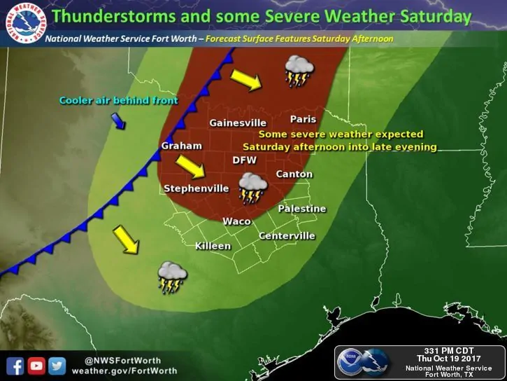
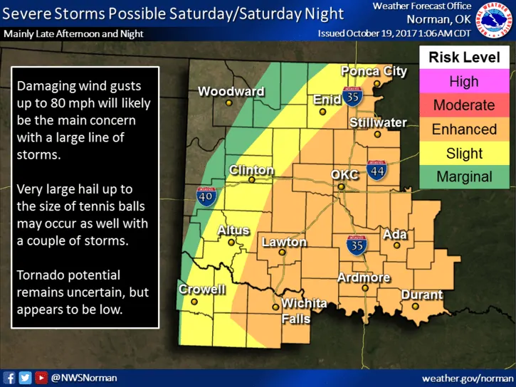
Let this be a heads-up for anyone with outdoor plans this coming Saturday! The Storm Prediction Center has placed an Enhanced Risk (Level 3) for severe weather across far northern Texas/Red River Valley Region. A Slight Risk (level 2) encompasses much of the rest of northern Texas including the Dallas/Ft. Worth metroplex. A strong upper level trough will approach from the west as our next strong cold front arrives from the northwest with strong to severe storms spreading across parts of north Texas Saturday afternoon and into the evening and early overnight hours. The chance for storms will likely begin during the early afternoon hours, well ahead of the front for areas mainly east of the I-35 corridor. Storm coverage is expected to be rather isolated during the early to mid-afternoon on Saturday with a reasonably strong cap in place…in fact, we may not see much in the way of storms at all. However, instability and wind shear will be sufficient for a couple of strong to severe storms with the threat of damaging winds and hail if something can manage to get going and break the cap. Overall, the main threat for severe weather will arrive later in the evening as the cold front and best forcing from the upper level disturbance arrives west of the DFW metroplex. By late afternoon (say…4pm onward…) we should begin to see a squall line of storms develop across western north Texas and the Red River Valley region which will move quickly east/southeast towards the DFW metroplex. Timing for DFW metroplex impacts appears to be late evening, most likely after 10pm. Main threats with the squall line will be damaging winds up to 80mph and large hail. The threat for tornadoes is low, but cannot be completely ruled out, especially if a few storms can develop out ahead of the front in the warm and humid airmass across the region. Be sure to check back tomorrow and early Saturday morning for additional updates on Saturday’s storm potential!


0 Comments