
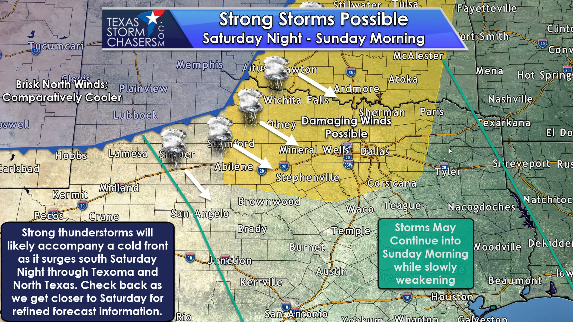
We’ve been in a rather timely pattern over the last few weeks. Most of the work week is quiet with a strong cold front pushing through Texas during the weekend. That has been the case the last two weeks and it will continue this weekend as well. A relatively potent upper-level storm system will move over the Southern Plains on Saturday and Sunday. Accompanying the upper-level system will be our weekly cold front. Like last weekend this front will move at a fairly brisk pace from north to south on Saturday, Saturday Night, into Sunday. Ahead of the front southerly winds will bring higher dewpoint/sticky values for the end of this work week. These higher moisture values – combined with an unstable airmass – will allow a line of thunderstorms to erupt along the cold front as it pushes south into Texoma and North Texas Saturday Night. Storm coverage looks to be relatively high – a nearly solid squall line. Some storms in the squall line will probably be strong to severe with a risk of damaging straight-line winds and hail up to the size of quarters. This is not a big hail or tornado setup, but a brief tornado can’t be ruled out entirely.
Being four days out means timing aspects are certain to change along with the ‘risk zone’ for a few severe storms. Most of Saturday will be dry across Texas as a strong cap should prevent thunderstorm development. The line of storms will probably fire up in the late afternoon or early evening hours as the cold front enters Northwest Texas and West-Central Texas. Those storms will become linear quickly – meaning a transition to a squall line versus discrete thunderstorms. That squall line will book it south and east during the evening hours – eventually impacting much of Texoma, North Texas, and the Big Country. This timeframe/location will be where the relative highest chance for 50 to 70 MPH straight-line winds looks to set up. As the squall line and cold front move into Central Texas and the Brazos Valley, they’ll start losing some of their steam thanks to the time of night and undercutting from the cold front. Still – some storms will likely remain strong with gusty winds and lots of lightning through Sunday morning. You’ll know the cold front has arrived when gusty north winds kick in along with a noticeable drop in temperatures. Thunderstorm chances will quickly end an hour or two after the cold front’s arrival at a given location.
For forecast information for your specific location please visit the National Weather Service’s website at www.weather.gov. Just pop your zip code in and you’ll have all the information you’ll want!


0 Comments