
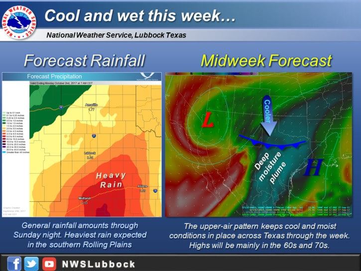
Astronomical fall began last week, although that means absolutely zilch when it comes to meteorological occurrences. Fourtinietly a pattern change will bring a taste of fall to the state this week into the upcoming weekend. A slow-moving upper-level low pressure in the southwestern United States will provide several rounds of precipitation through the middle of the week. That area of low pressure will also allow a cool front to progress south through the state this week. The front’s movement will be slow, so it’ll take until the end of the week for it to make it to the coast. However, temperatures north of the front will generally be ten to twenty degrees lower along with noticeably lower dewpoint values. That cooldown will be the welcome benefit of this week’s pattern change.
The slow-moving nature of the upper-level storm system to our west will result in prolonged, multi-round rain chances across the western half of Texas through Thursday. Widespread severe weather is not anticipated as instability values are low. Plentiful moisture across the state along with moisture from Tropical Storm Pilar in the Pacific will allow for efficient rainfall rates with the heavier storms this week. We are not expecting it to rain every minute of every day across the western half of Texas this week. There will be periods of heavier rainfall and there will be periods of no precipitation. With the heaviest rains expected west of Interstate 35, we are not expecting any hydrology issues in locations impacted by Harvey last month. Isolated to widely scattered showers may impact the Middle Texas Coast at times this week, but rainfall amounts will be considerably lower/less widespread than west of Interstate 35.
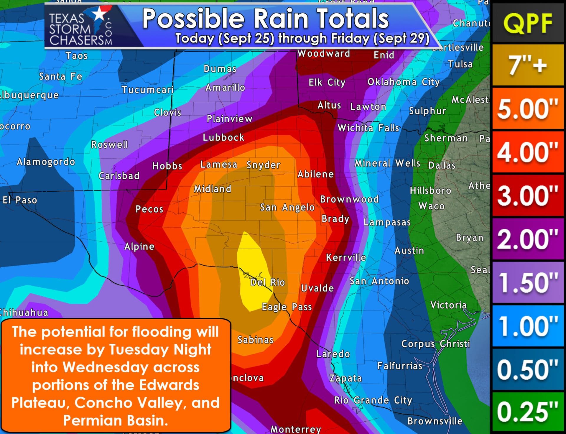
Additional rainfall totals from today through Friday are likely to be in the 3 to 7-inch range across the Edwards Plateau, Concho Valley, western Big Country, eastern sections of the Permian Basin, and extending northward into parts of the South Plains and Northwest Texas. Localized event total rainfall amounts exceeding 8 inches are possible. Not all of that rain is expected to fall in one day as this will be a multi-day event. Localized flooding will be possible and the threat for flooding will likely increase on Tuesday and Wednesday where the heaviest rains fall. The highest impacts to most folks will likely be in the form of flooded low-lying or poorly maintained roadways. Rises on streams can also be expected, so keep an eye on those. These rainfall totals and locations will probably not verify exactly as the graphic depicts, but you know that just by living in Texas. Rainfall totals will fall off quickly with eastward extent with only light rain totals in D/FW, Waco – with rainfall amounts of one-half to one and a half inches possible in San Antonio to Laredo. Most of Southeast Texas should see little in the way of widespread rainfall through Thursday.


0 Comments