
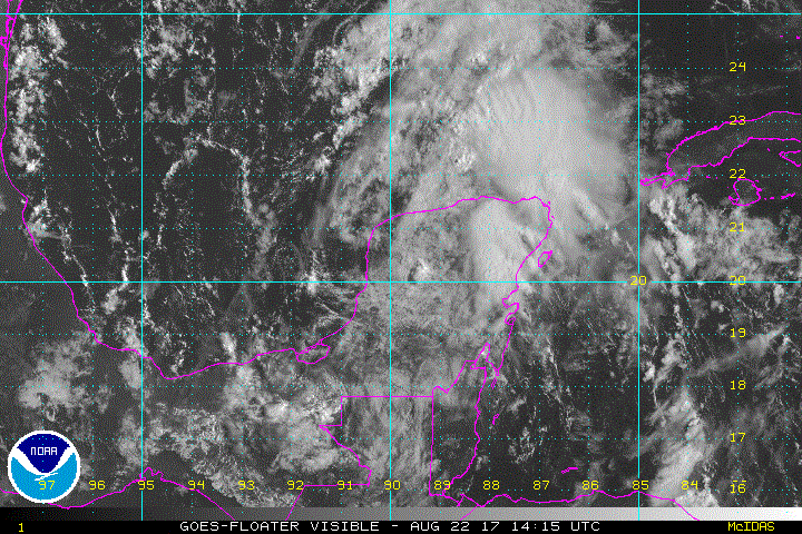
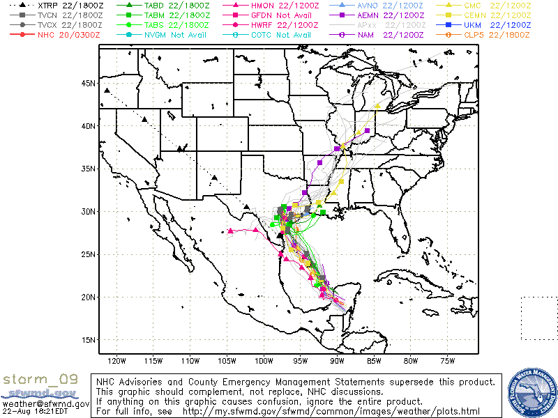
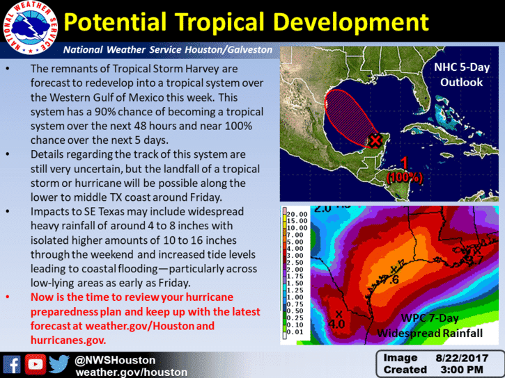
We won’t know much more until later this evening once Harvey has fully detached from the Yucatan Peninsula and emerges into the Bay of Campeche, but it’s looking more and more likely that we will definitely be dealing with either a strong Tropical Storm or a weak Hurricane which will make landfall somewhere along the lower to middle Texas Gulf Coast later this week. Right now, it appears anywhere between Corpus and Freeport would be the likely locations for landfall. Exact details on the forecast track and timing for landfall will remain unclear until we see a bit more development with Harvey, and the Hurricane Hunter aircraft have had a chance to complete a few reconnaissance missions. We’ll be watching the next National Hurricane Center advisories overnight as we could see Harvey reform into a Tropical Depression within the next 12-18 hours.
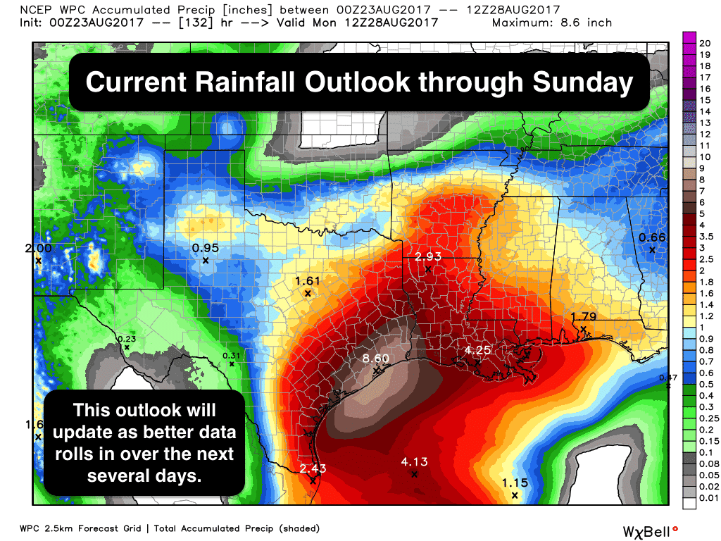
What we want to highlight at this point is the threat for major…possibly bordering on historic…flooding potential once Harvey makes landfall. His remnants are expected to hang around for a few days across south central and southeast Texas which will likely generate widespread heavy rainfall up to as much as 16+ inches through the weekend. Again, it’s still too soon to focus on exact locations for where the heaviest rainfall will occur, but if you live along the coast or inland…particularly anywhere between Corpus and Beaumont….where flooding is common during heavy rain events, you should start making preparations now. Do not wait until the last minute to begin preparing. Make sure you begin stocking up now on items you’ll need to carry you through for a few days in the event your location becomes cut off due to impassable roadways. Have sufficient medications and non-perishable foods on hand, and also be prepared for lengthy power outages…especially for areas expecting the strongest winds where Harvey eventually makes landfall.
The graphics below show the current forecast model outlook for rainfall accumulation through the weekend ahead. As Harvey’s track and potential impacts refine over the next 24-48 hours, we may see a shift in where the heaviest rainfall and potential for significant flooding will occur. Be sure to check back as we’ll continue to update everyone with the latest.


0 Comments