
Wednesday: Our weather across the state will be mostly quiet over the next couple of days. Chances for scattered showers will linger tonight and through Wednesday across east and southeast Texas. The remainder of our state is expected to remain dry. The western half of the state will see lots of sunshine tomorrow, while the eastern half will start off a bit cloudy with clouds scattering by early afternoon. Temperatures tomorrow will be mild and a few degrees above normal, but nothing too extreme. All in all, a pretty decent forecast for Wednesday.
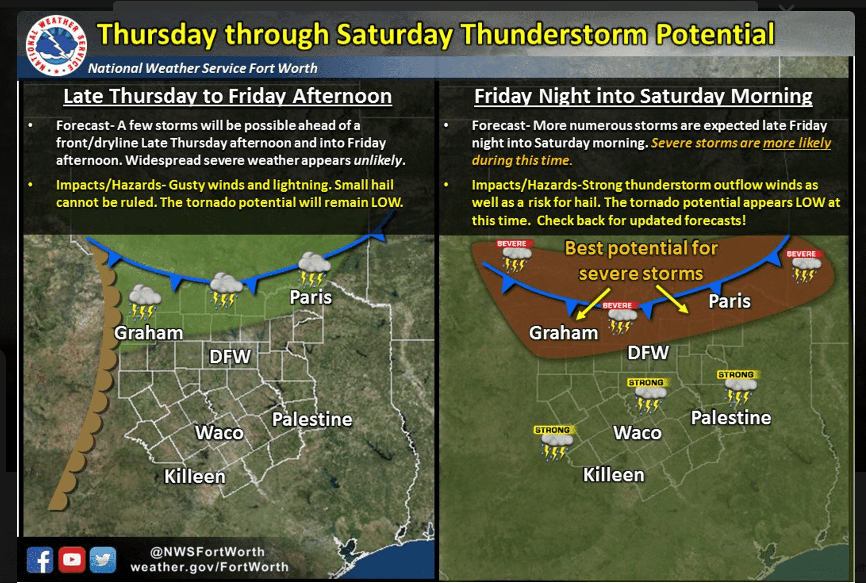
Thursday: A cold front will drop into the panhandle on Thursday before stalling out. We could see a few chances for storm development along the stalled frontal Thursday evening, but those chances are pretty low with a stout capping inversion in place which will severely limit the ability for storms to form.
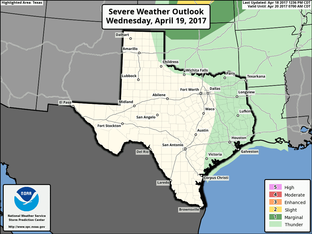
Friday: Late Friday, another much stronger cold front will arrive a better chance of seeing strong to severe storms develop across southern Oklahoma and along the Red River valley as the front begins to move south into our state late Friday evening. Hail and damaging winds look to be the main threats with this next Timing of the front and where storms are expected to form is still a bit unclear, but at this point, it looks like the best chances for seeing any form of severe weather on Friday afternoon/evening will be north of I-20 and up closer to the Red River. We’ll have more details out on that tomorrow after additional forecast model data rolls in overnight. Once the front arrives, we’ll see a couple of days of much cooler and drier air in place for Sunday and into Monday as well.


0 Comments