
Happy #WeatherWednesday friends! I hope y’all found last week’s discussion on positive lightning entertaining. Today we stick to the thunderstorm topic and take a close look at a special thunderstorm called a “supercell”. These storms pose the most risk of hazard to life and property, but are very uncommon in comparison to the quantity of ordinary thunderstorms that take place around the globe all the time.
A supercell is a long-lived discrete or semi-discrete rotating thunderstorm. This will be a very basic discussion of the supercell, but maybe some other time we will revisit the supercell and dig deeper into the qualitative and mathematical aspects.
The birth of supercell is initiated when enough forcing (i.e. daytime heating or frontal vorticity) is present to draw air from the surface upward to its lowest condensation level (LCL). Once the lift is enough to overcome any temperature inversion or other stable effects, the surface air can tap into unstable air and vertically develop a cumulus cloud. With the right conditions, this development can evolve a cumulus cloud into a cumulonimbus cloud.
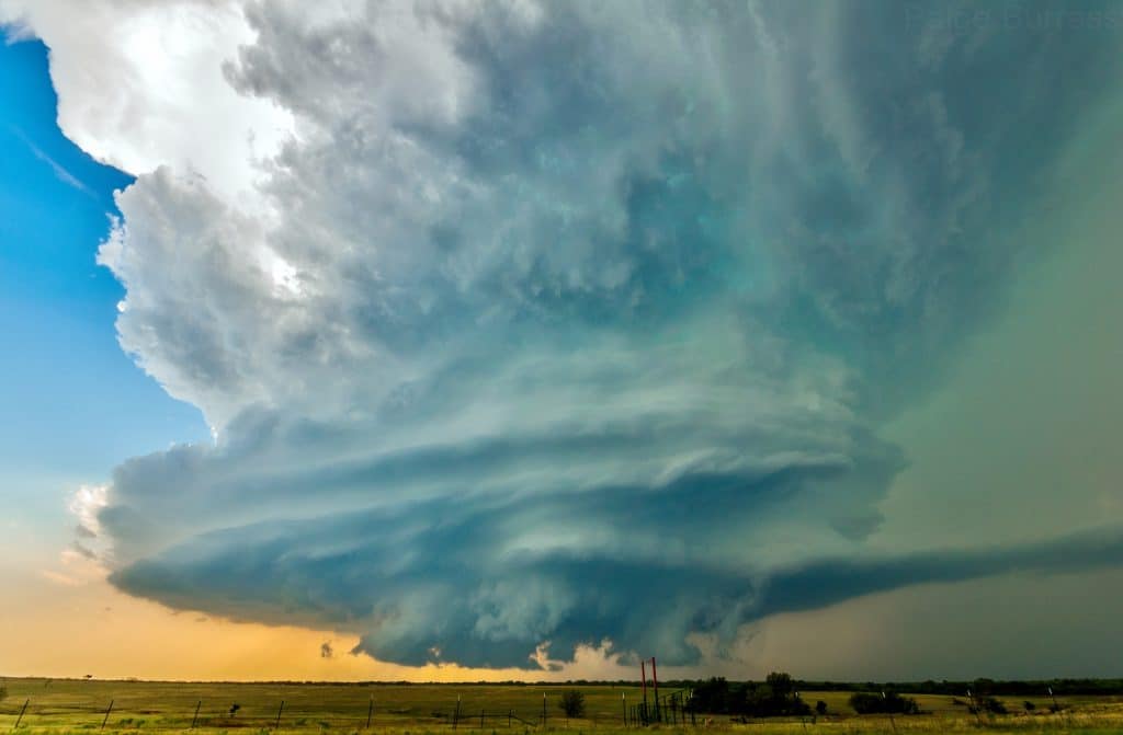
At the mature stage of a supercell, it is at its strongest, most unstable point in its life cycle. What makes a supercell strong and what are the signs that it is strong? When a storm in a high CAPE and high shear environment with enough forcing and moisture utilizes the whole unstable layer (the slab of the atmosphere where air perturbed upward will continue to accelerate higher) and maximum relative helicity, it has a high success rate of maintenance as a supercell. At its peak strength, it is experiencing peak updraft and downdraft speeds. This is a recipe for large hail and damaging winds. Positive lightning and a clear vault between the rain free base and the rain/hail core (downdraft) are also indicators of a mature supercell. A rotating wall cloud or tornado could also develop, but not always!
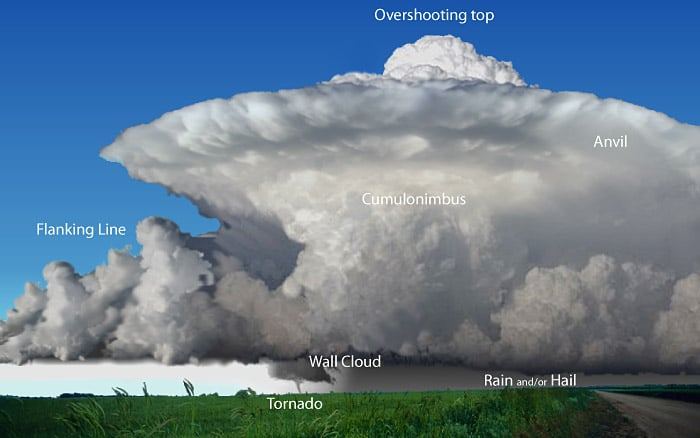
Supercell example from NWS JetStream
The final stage is the occlusion stage where the supercell is most likely to either dissipate or produce a tornado. What is happening is the RFD (rear flank downdraft) is pinching off the updraft from the main source of surface inflow. If it’s too much of a pinch, the updraft will be choked. But under the right conditions and correct balance of RFD and inflow, enough rotation can be induced to develop a tornado. Rarely does this stage last very long, or does a tornado.
It’s hard not to go on and on about supercell maintenance and tornadogenesis, etc.! But basically speaking the supercell can behave a number of ways once it reaches maturity. It can dissipate quickly in the final stage (occlusion), it can remain mature for any amount of time, it can remain occluded for any amount of time, or it can “recycle” where a new rotating updraft goes through the stages and assumes dominance of the cell at maturity when the original updraft occludes and/or dissipates. One thing is for sure, it is always more than possible to experience large hail and damaging winds with organized supercells, as well as pretty cloud structure!


0 Comments