
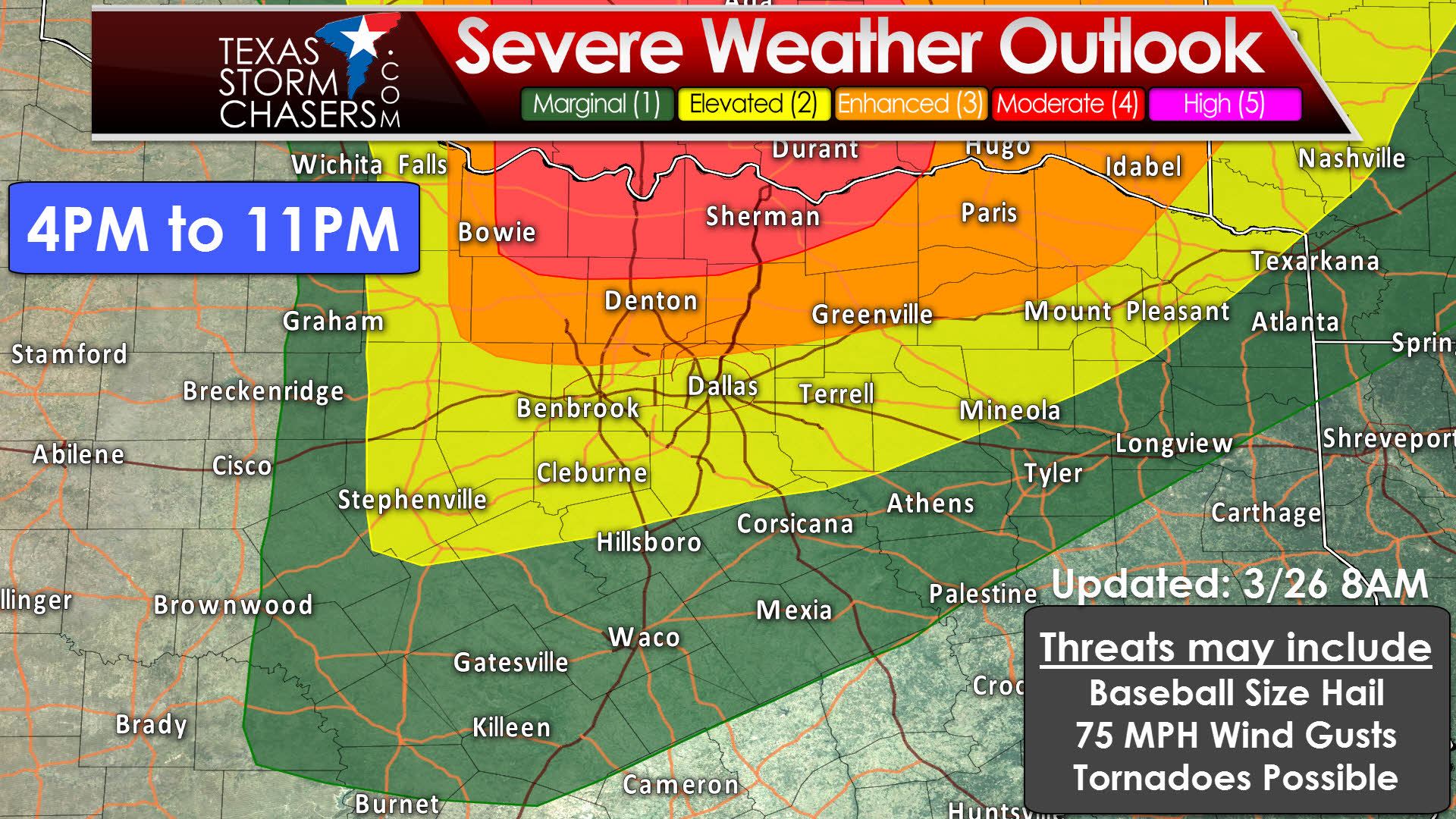
The Storm Prediction Center has upgraded portions of Texoma to a category four risk of severe weather. A category three risk includes the northern half of the D/FW Metroplex extending into Northeast Texas. The category two and category one risks extend further south into Central Texas and East Texas. This is going to be a day where we may not see many storms due to a strong cap, but those storms that do develop could be intense. Very large hail larger than the size of baseballs, damaging wind gusts over 70 MPH, and a tornado threat. Even if we have only one or two storms south of the Red River, those two storms could produce significant severe weather. A majority of folks probably won’t see issues today due to low storm coverage, but its a day to keep an eye to the sky. 4PM to 11PM is the ‘window’ of concern, but that may need to be extended past midnight as some models develop storms around 8-9PM in northern D/FW.

This simulated radar image comes from the 7 AM run of the High Resolution Rapid Refresh. I don’t think the day will play out exactly like what this image shows, but it gives a good idea that the best chance for storms will be along and north of Highway 380. It is entirely possible we see a storm develop a bit further south, but that will depend on factors weather models can’t pick up. Storms will move to the east/northeast.
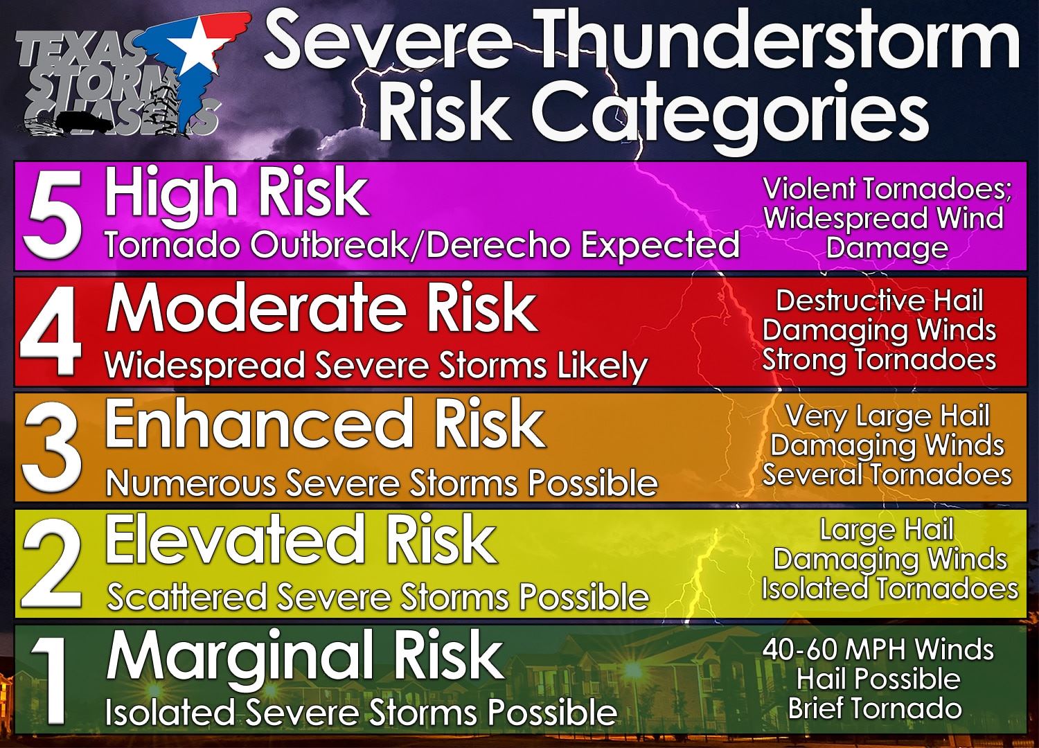
Here’s a quick reference to the five-level system we use for severe weather outlooks. One is the lowest and five is the highest. We’re currently at a four in Texoma…


0 Comments