
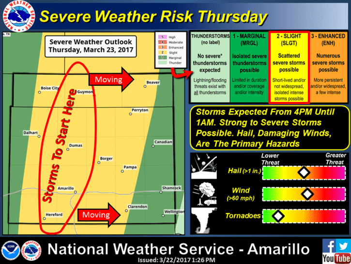
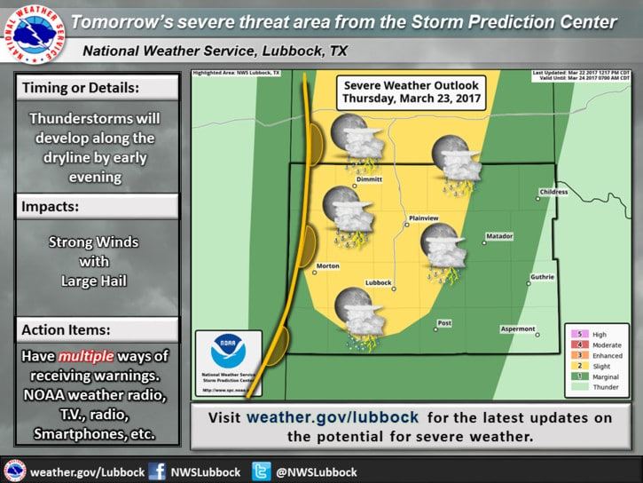
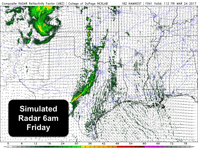
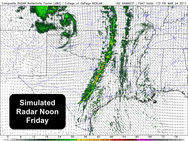
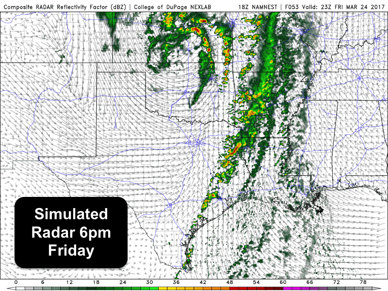
Looks like our spring severe weather season will finally kick into gear tomorrow across the Texas panhandle region. Most of the day on Thursday will be quiet with sufficient atmospheric capping in place to keep storms at bay. However, as we get into the late afternoon/early evening hours, forcing from a strong upper level low to our west, a dryline forecast to set up near the TX/OK border and a pacific cold front will provide enough lift to finally break the atmospheric cap and we’ll see storms develop along the dryline. Development will be isolated to scattered at first with a few supercell thunderstorms possible which will bring a threat of quarter size hail and downburst winds. The tornado threat is low, but non zero, due to a relatively narrow window of opportunity for any of the more severe storms to become more surface-based before the cold front overtakes the dryline. As we get beyond sunset, the cold front will overtake the entire line, and from that point on into the overnight hours, we’ll be looking at a more linear (squall line) of storms. Storms during the overnight hours are expected to remain sub-severe as daytime instability levels will decrease, so we’ll be looking at just the threat of some gusty winds, frequent lightning and brief heavy downpours as the line of storms continues moving east into north Texas. We can’t completely rule out a strong storm or two during the overnight and early morning hours on Friday, but the best potential for strong to severe storms on Friday will be during the afternoon hours mainly east of the I-35 corridor across northeast and east Texas where better heating and instability will be in place.
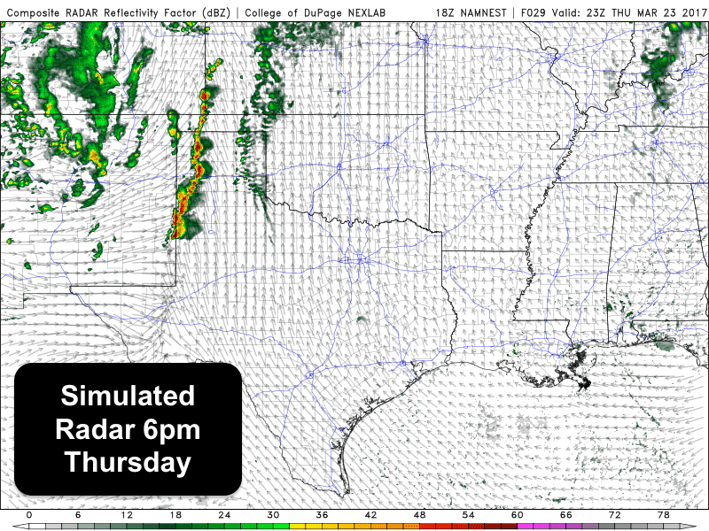
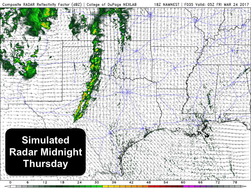
Below, we have a few simulated radar graphics from one of the high-resolution forecast models with a look at how the storms Thursday evening through Friday evening might look like.


0 Comments