
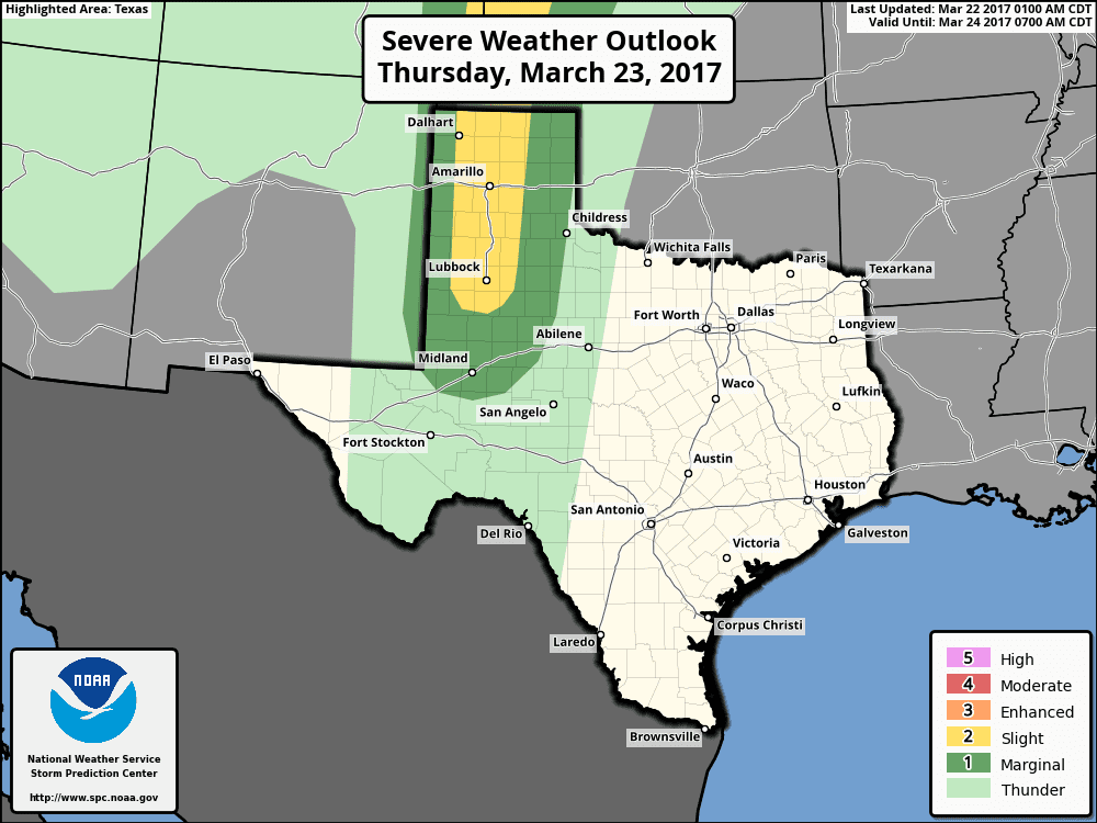
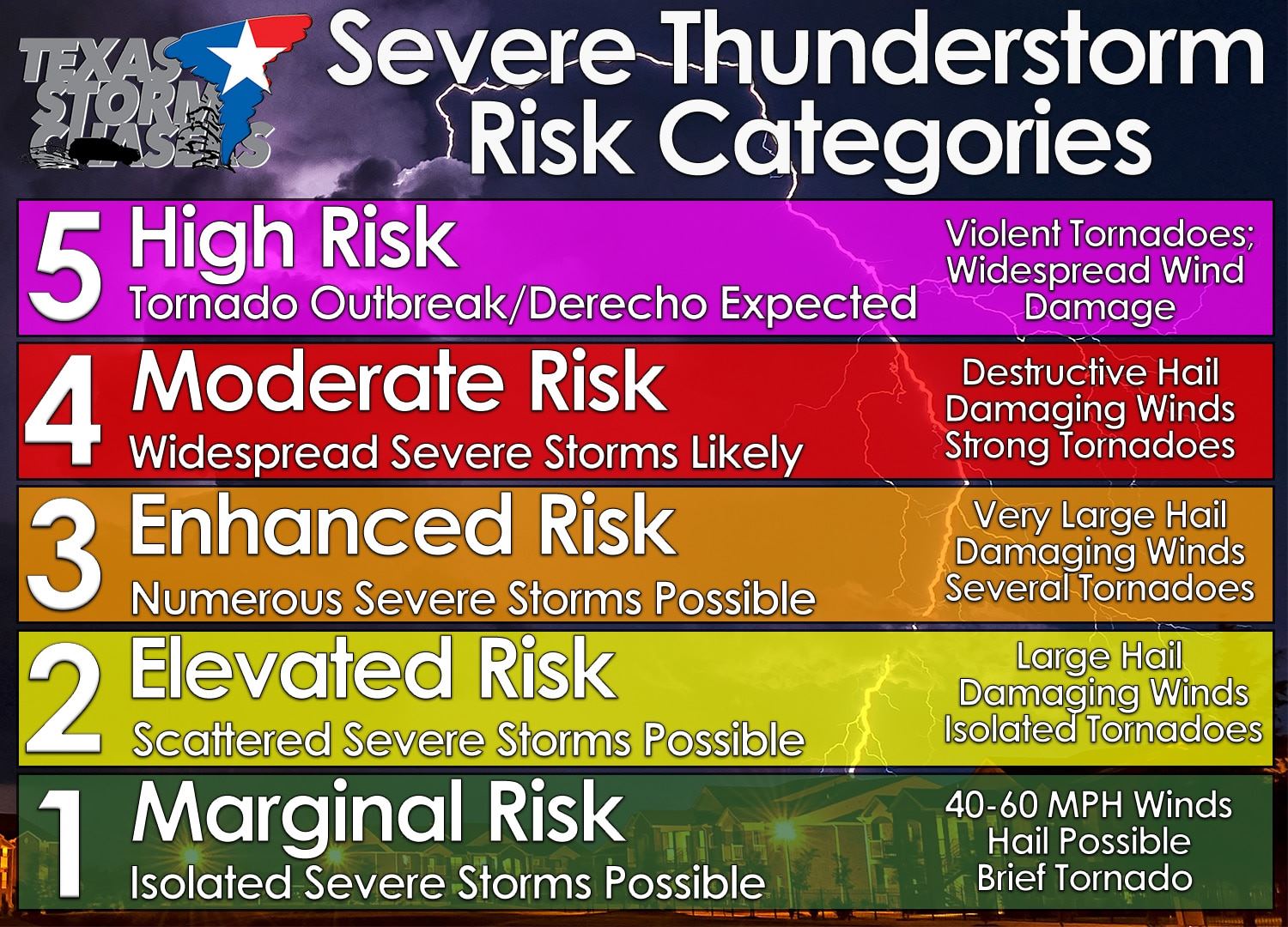
We now have a category two risk of severe weather in the Texas Panhandle and West Texas for late Thursday afternoon and evening. The strongest storms may produce damaging straight-line wind gusts up to 70 MPH and hail up to the size of half-dollars. A very low risk of a brief tornado can’t be ruled out, but isn’t likely as the primary storm mode will be linear.
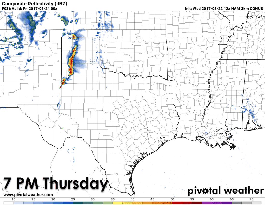
Thunderstorm initiation is expected after 4 PM tomorrow afternoon in western sections of the Texas Panhandle and West Texas. The initial storms – for about the first two hours of their life – may be semi-discrete supercells with a risk of large hail, localized damaging winds, and a low risk of a brief tornado. Relatively meager moisture values and a quick transition to a squall line should keep the tornado threat very limited tomorrow. By dinner-time we expect a semi-broken to solid line of thunderstorms to be moving east across western to central sections of the Texas Panhandle and South Plains. Some of these storms will likely be severe with a risk of large hail up to the size of half-dollars and localized straight-line winds up to 70 MPH. Depending on how far the gust front gets ahead of the line we could also see some blowing gust. The line of storms will probably weaken by 9-10 PM as it moves into eastern sections of the Texas Panhandle and West Texas.
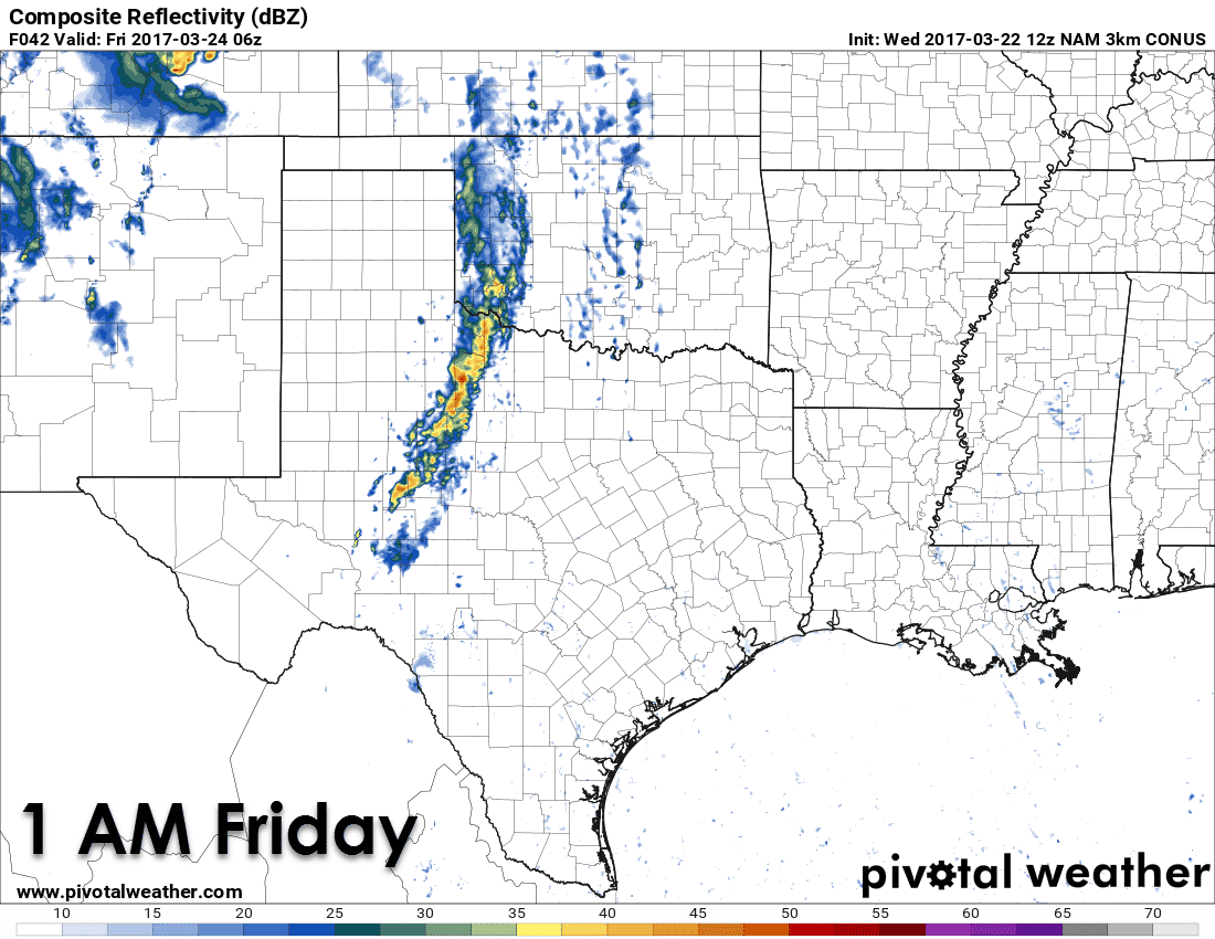
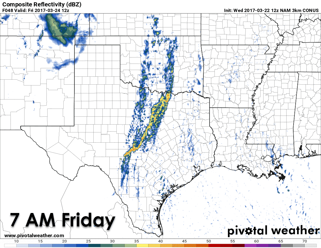
Friday remains a complicated forecast due to very strong lift and a weak cap. I do think we’ll see showers and thunderstorms move east Thursday Night and Friday Morning across Northwest Texas, the Big Country, into the Concho Valley. A line of storms may develop further south late Thursday Night and impact the Concho Valley and Hill Country. While timing aspects are probably going to have to be adjusted in later updates, this morning’s high resolution North American Model (NAM) has a line of showers and storms extending from near Sherman to D/FW to Gatesville to Kerrville. Some of these storms may be strong with gusty winds and small hail, but the threat of severe weather is uncertain as models have not been overly enthusiastic on intense updrafts within this line. I’m guessing we may have some gusty winds up to 40 MPH, but the gust front may undercut the storms, thus keeping them on the weaker side.
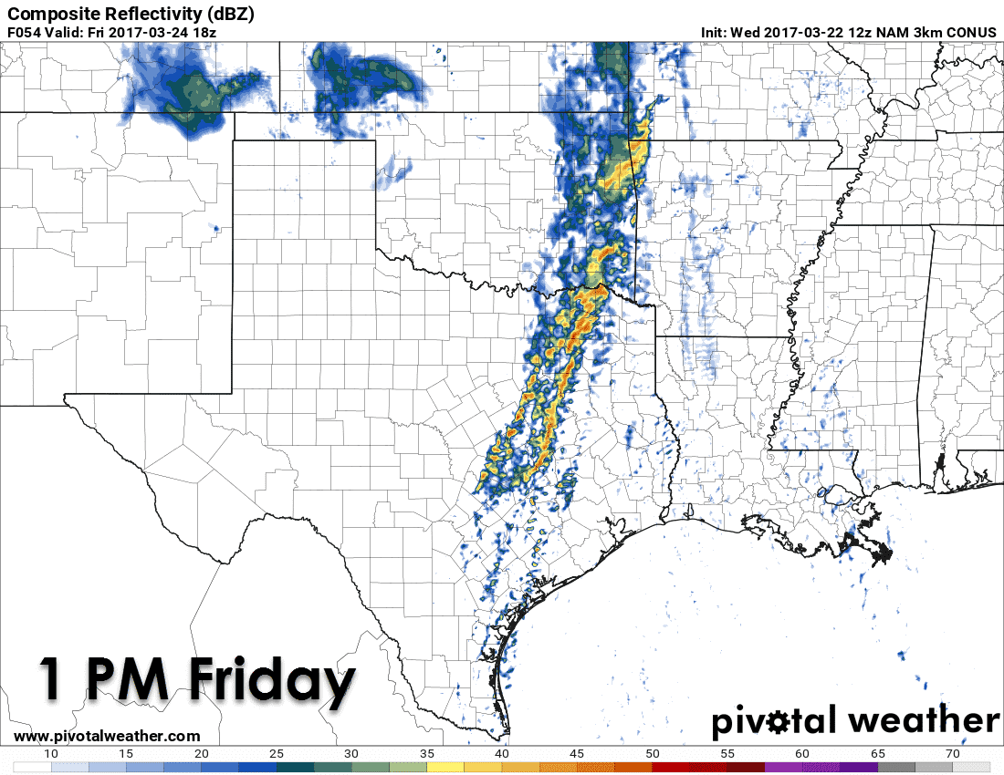
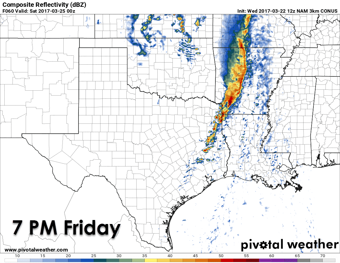
By early Friday afternoon the line of showers and storms should be moving into Northeast Texas and East Texas. By this point the atmosphere out ahead of the line should be more unstable, and we may see an intensification trend occur. This is where we’ll be watching for the possibility of some severe weather.
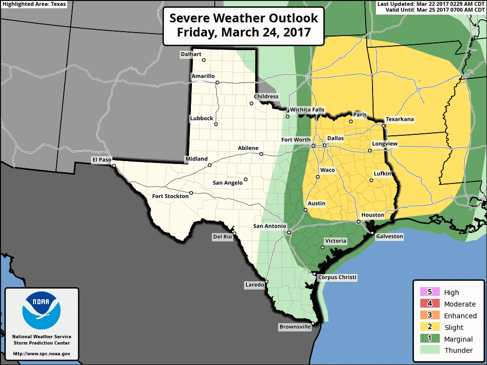
Damaging straight-line winds up to 65 MPH look like the primary threat at this point along with small hail. There is a low risk of a brief tornado in Northeast Texas where low-level wind shear is stronger, but that risk will remain limited if we don’t see any ‘discrete’ storms pop-up ahead of the squall line. Considering we’re still a couple days out I encourage you to check back for forecast updates. As we get closer to Friday we’ll be able to get a better handle on the specifics of the atmosphere and any sort of mischief potential. Storms should move east of Texas by the mid-evening hours Friday.
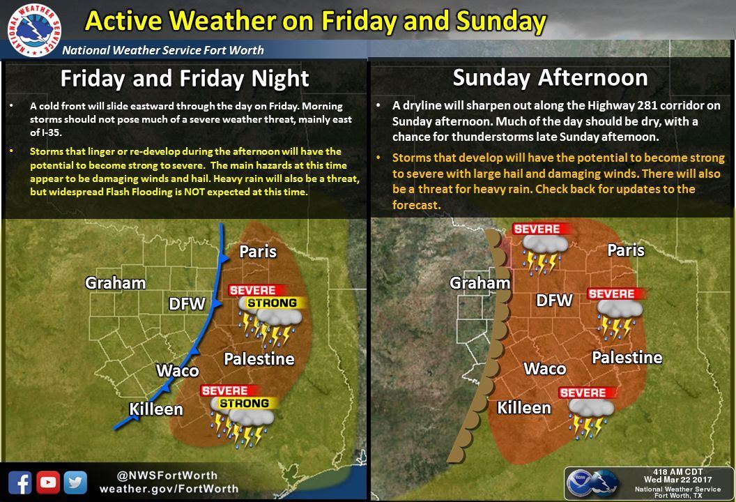
Saturday itself won’t feature any organized thunderstorm chances in Texas, but we only need to look ahead to Sunday. The Storm Prediction Center has highlighted a category two risk of severe weather in Texoma and portions of North Texas, generally north of Interstate 20. Unlike Thursday and Friday where widespread thunderstorms are expected, Sunday will feature a strong cap. Storm coverage may be low, as in only one or two storms south of the Red River, but those that do fire up could be supercellular with a threat of severe weather. Lets get through our first system and then we can focus on Sunday’s potential risk. Next week will feature active weather with several more upper level storm systems arriving – along with the risk of organized thunderstorms. Welcome to spring folks!


0 Comments