
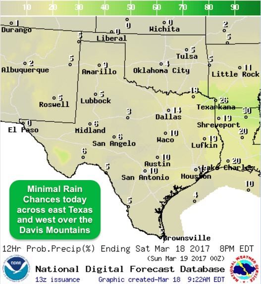
Temps will heat up this weekend and into early next week. Most areas will end up an average 10 degrees above normal with a few areas a good 15 degrees above normal. Yesterday’s cool front across the panhandle did little to knock temps down any, and another front creeping south through Oklahoma today will not provide much relief either as it stalls along the Red River. Rain chances are scant over the next several days, but we’ll have plenty of gulf moisture flowing northward across the state. This moisture will ultimately help to set the stage for thunderstorms late next week as our weather pattern is expected to become more active.
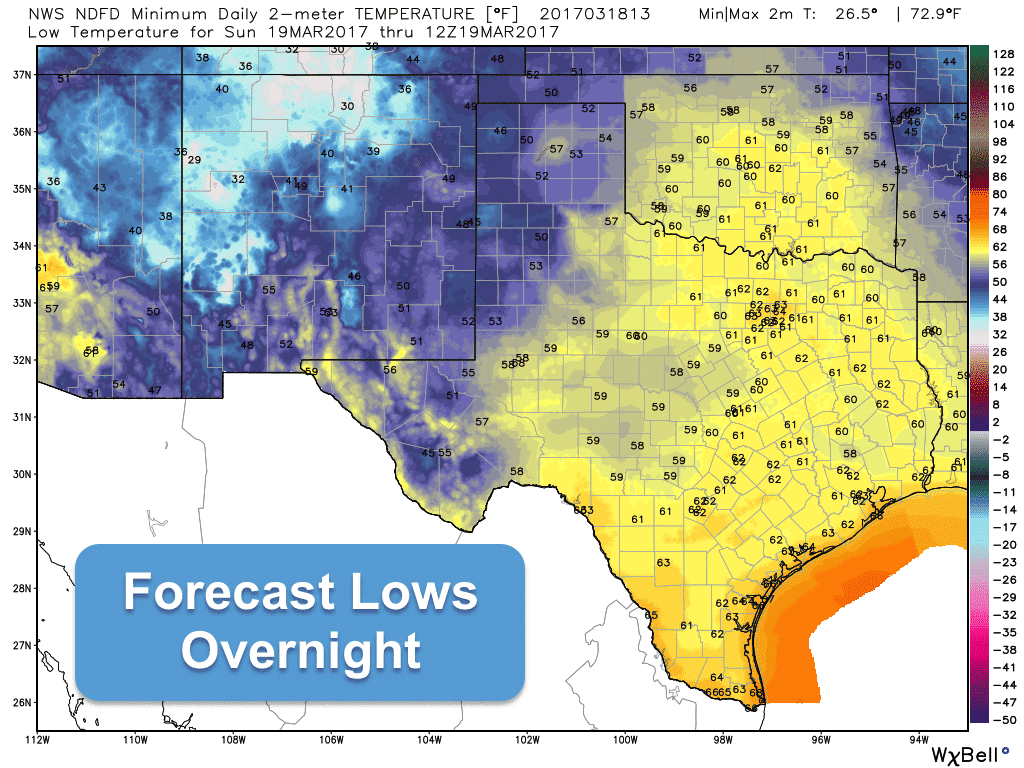
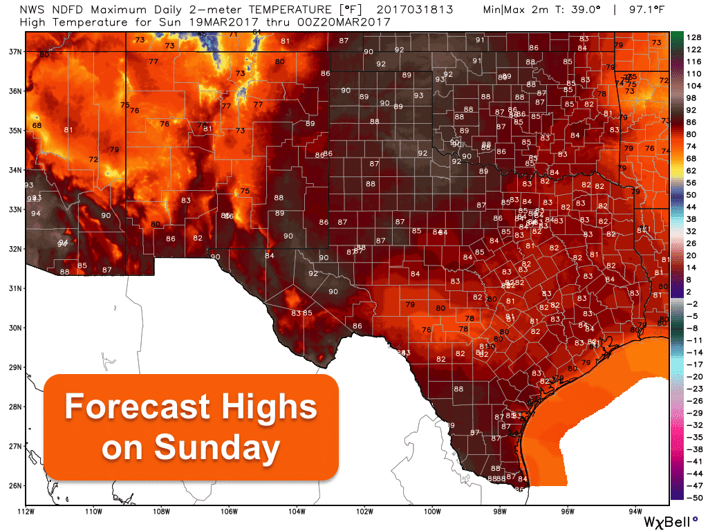
Highs today, quite warm and balmy for this time of the year. A little early in the season for feeling like there’s a warm damp blanket around you when you step outside, but it is what it is. Certainly not bad for those on spring break this week venturing out and about. For tonight, fog is expected to develop once again mainly along the coast and coastal plains of southeast and south central Texas. Highs tomorrow, a few degrees warmer with highs in the low 90s a possibility across parts of western north Texas, west Texas and the borderlands.
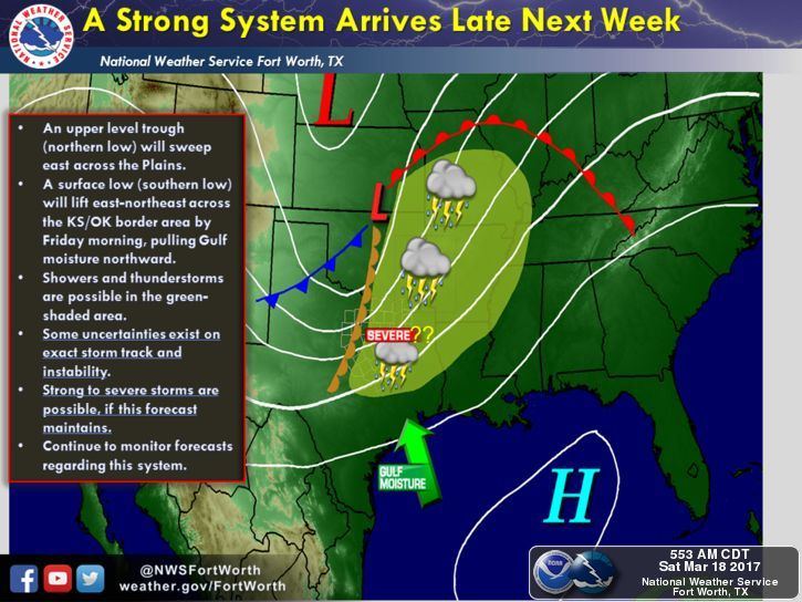
As we’ve been talking about for a few days now, we’re expecting a pattern change next week…more typical of early spring with an upper level pattern more favorable for rain and storm development. An upper level low pressure system is expected to approach from the west by the middle of the week which will provide lift needed for the development of rain and storms. A surface low is expected develop just north of the panhandle and a dryline will also set up across western north Texas. This surface low will draw even more moisture up into the region, and depending on the track of the upper level low as it develops to our west next week, along with the position of the dryline, we could see some threat of severe weather by late next week in the Thursday through Friday timeframe. As always, the location of the best area of lift with these upper level systems will determine where the better chances for severe weather development will be. If the better forcing is off to our north, then we’ll only receive a glancing blow. Right now, we are watching for this possibility across parts of north and northeast Texas up into eastern Oklahoma. Will it bring the threat of tornadoes or large hail? It’s too early to determine exact threats, but we will be keeping an eye on this as the forecast develops over the next several days and we’ll keep you up to date with the latest information.


0 Comments