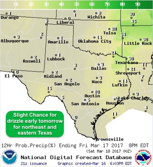
Other than a weak cold front moving into the panhandle region tomorrow, and an outside chance of a few storms across northeast Texas late Friday into Friday night, our weather remains rather uneventful for the next several days. Highs over the weekend, especially on Sunday, will be well above average with some areas reaching the upper 80s to low 90s. Light drizzle is possible tonight across northeast Texas, but other than that, no good rainfall is in the forecast through the weekend and into early next week as well.
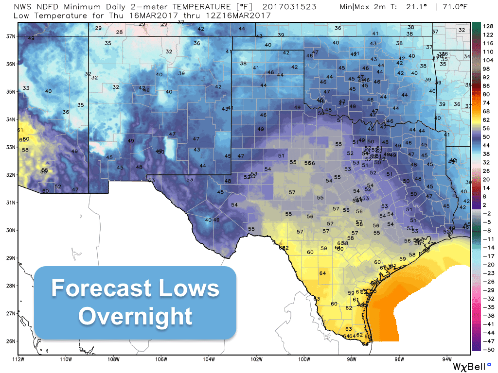
Cloud cover builds in overnight once again overnight as moisture continues to build into central and northern Texas. Light drizzle will be possible for some areas, but nothing too drastic. Where the air is much drier and less humid across the panhandle and western Texas, lows tonight will dip down into the 40s. Across central and south Texas where we have more moisture and humidity, plus increasing cloud cover, temps overnight will only drop down into the upper 50s to mid 60s.
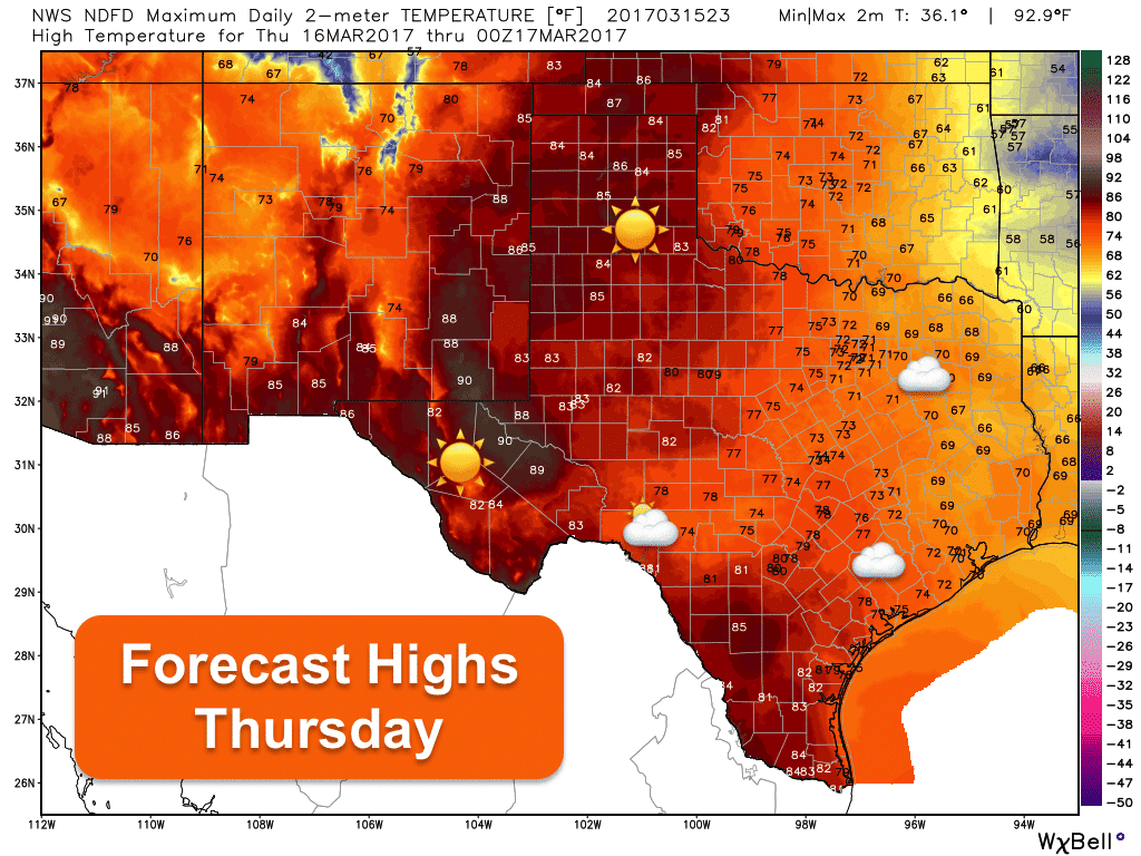
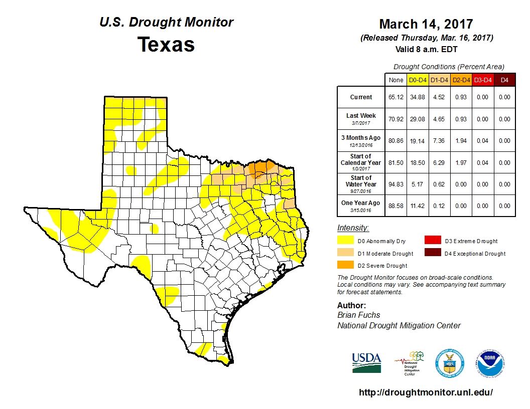
With the lack of rainfall we’ve had across all but the southern portions of the state over the past month, we’re seeing the return of drought conditions across many parts of the state. Our driest region is up near Paris where Severe Drought conditions are in place. We are no longer under the influence of La Nina, nor are we under the influence of El Nino. We’re in what is called an ENSO Neutral phase, and there are currently no clear signals one way or the other if we’ll be drier than normal or wetter than normal for the remainder of our Spring season.



0 Comments