
NOTE: I’m on my way back home after a conference in Denver. I will not be able to post frequent updates through 10 PM. Please utilize our interactive weather radar at texasstormchasers.com/radar and Your Local Weather at texasstormchasers.com/local for the latest information.
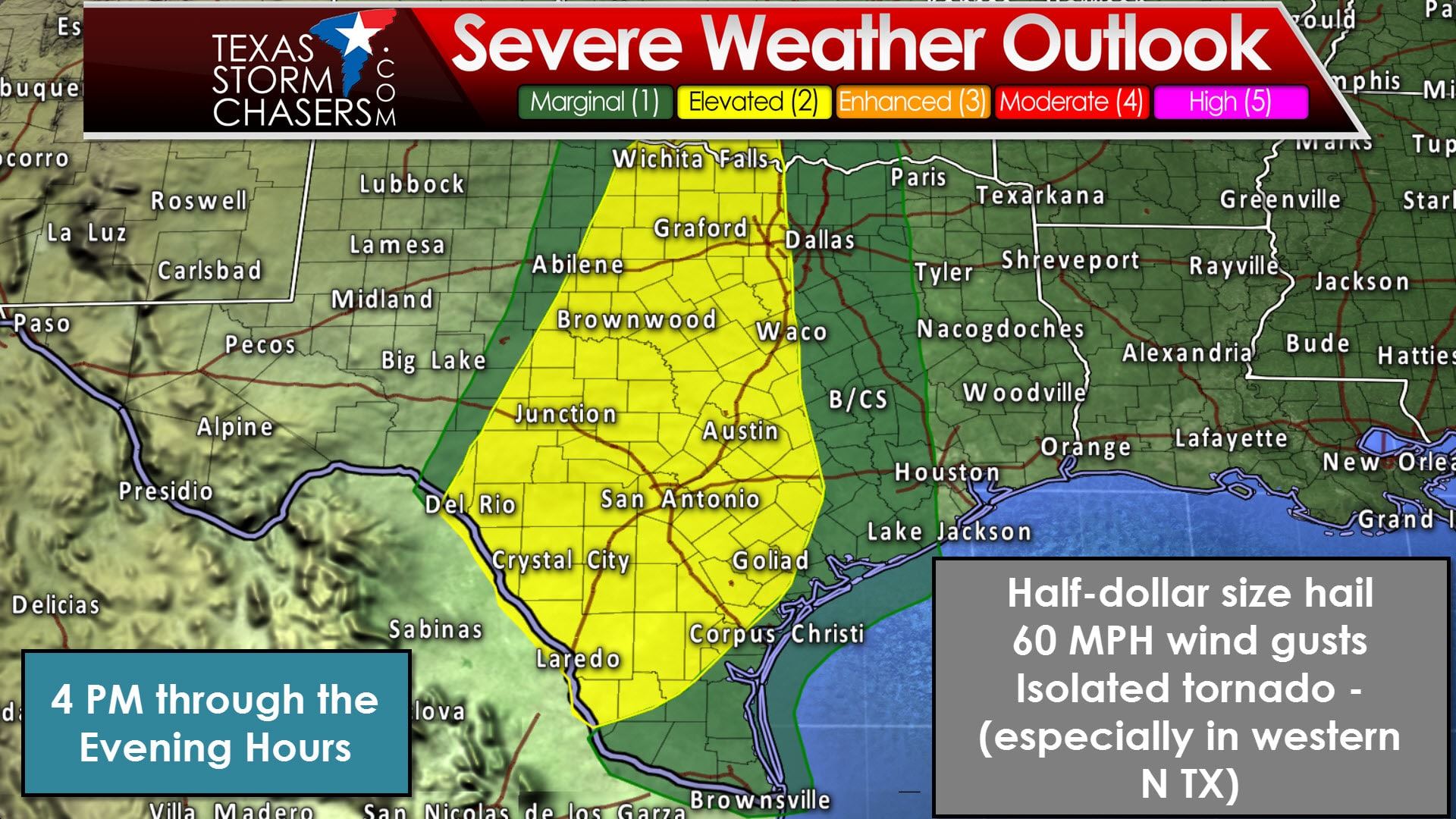
The Storm Prediction Center maintains a category 2 risk of severe weather across Southwest Texas, South Texas, South-Central Texas, Central Texas, the Hill Country, northward into the eastern Big Country, western North Texas, up into portions of Northwest Texas. A category 1 risk extends east into the remainder of North Texas, the Brazos Valley, into Southeast Texas, and down into the Rio Grande Valley.
Isolated thunderstorm initiation may occur within the next 2 hours across western sections of North Texas into Northwest Texas. The combination of strong wind shear and instability will support the possibility of a supercellular storm mode. The strongest of these storms may produce all modes of severe weather, including the threat for isolated tornadoes. This threat is highest west/northwest of the D/FW Metroplex up to around Wichita Falls. Jenny is out chasing and will report back with any severe weather she experiences.
By this evening a fairly solid line of showers and thunderstorms will evolve from North Texas south through the Concho Valley into Southwest Texas. This line will make eastward progress tonight through Monday morning. Some storms in the line may be strong with a threat of hail up to the size of quarters and localized damaging winds up to 60 MPH. Widespread severe weather is not expected. What will become the primary threat by Monday morning is heavy rainfall in the Brazos Valley and Southeast Texas where a flash flood watch is in effect. Localized rain totals of 3-5 inches in those two regions could create flooding problems late tonight and into Monday.


0 Comments