
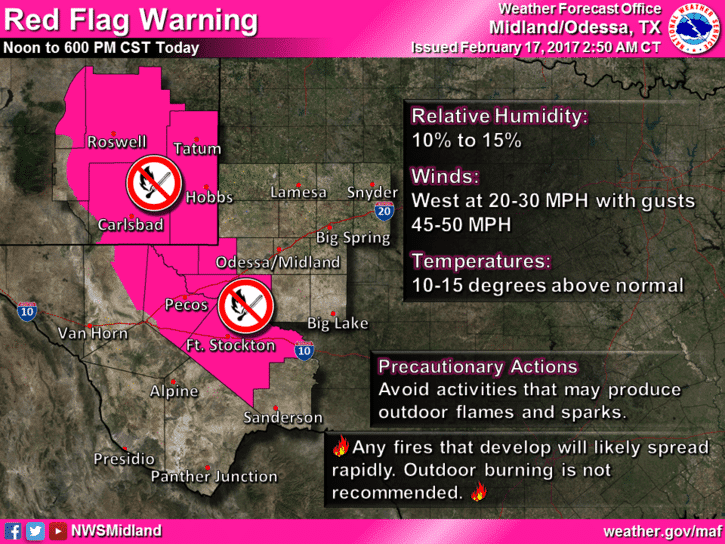
Fire danger will be critical across parts of the Permian Basin and Trans-pecos basin this afternoon where Red Flag Warnings are inf effect. There should be no outdoor burning and extreme caution exercised when working with equipment that can produce sparks. Any fires that develop will likely require significant resources to contain.
Scattered showers will continue to impact portions of Southeast Texas through the afternoon hours. This activity is not expected to become heavy or produce high-impact weather. A few locations may pick up a quarter inch of rain, but most will see between a trace and two-tenths of an inch. Precipitation should be outta the picture by this evening as our quick-hitter exits the stage. The real focus of this forecast will be our next big-whopper coming out of northern Mexico. This next system will have much more moisture to work with and will probably give us a surprise or two that isn’t anticipated in this forecast.

Precipitation chances will increase throughout the day Sunday across the western two-thirds of Texas. I think most of the heavier rains will hold off until Sunday Night, but it won’t be the nicest day.
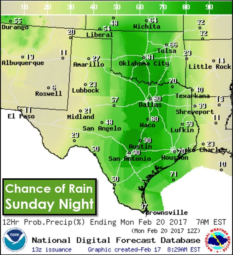
Rain chances go from scattered all the way up to near 100 percent by Sunday Night across Texoma, North Texas, Central Texas, South-Central Texas, with numerous/high chances in eastern sections of Northwest Texas, the eastern Concho Valley and eastern Big Country, into East TExas, Southeast Texas, and South Texas. Some rain during this timeframe may be heavy with a risk of localized flash flooding.
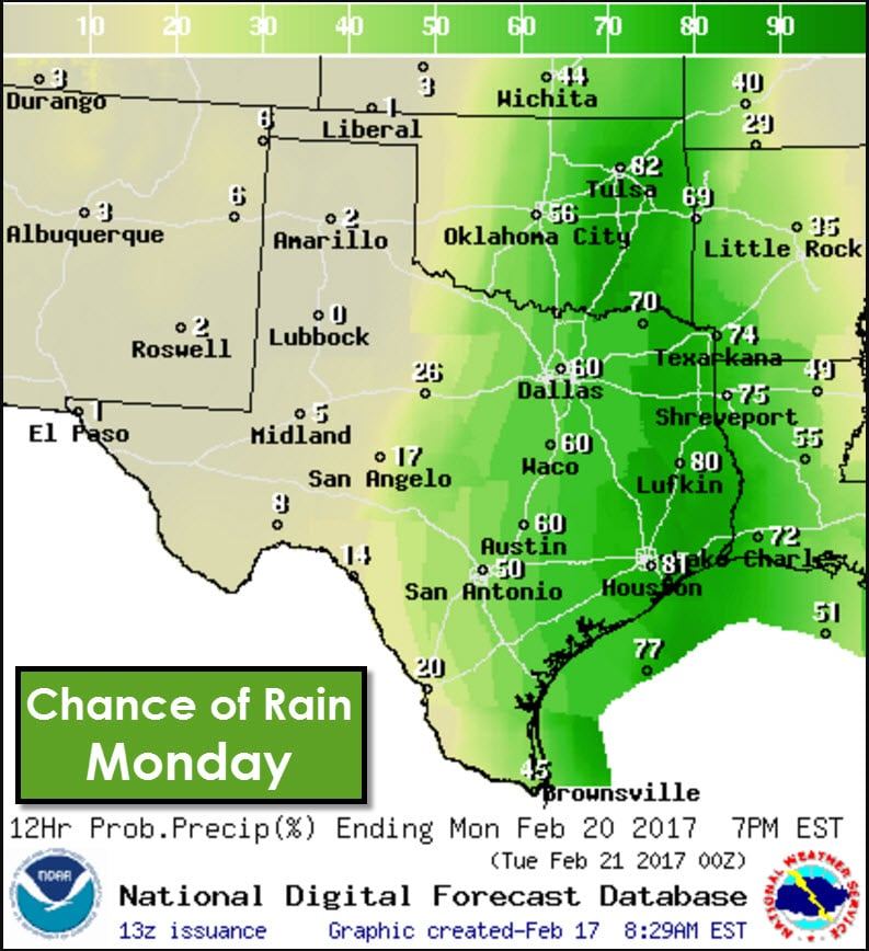
Rain chances will start to shift to the eastern half of Texas on Monday as numerous showers and thunderstorms continue. The western half of the state will be mostly dry by this point. Again, locally heavy rainfall will be possible with some of this activity.
Finally, by Monday Night into Tuesday, scattered showers will remain possible across Eastern and Southeastern sections of Texas. This activity should be less organized in terms of rainfall potential than on Sunday Night and Monday.
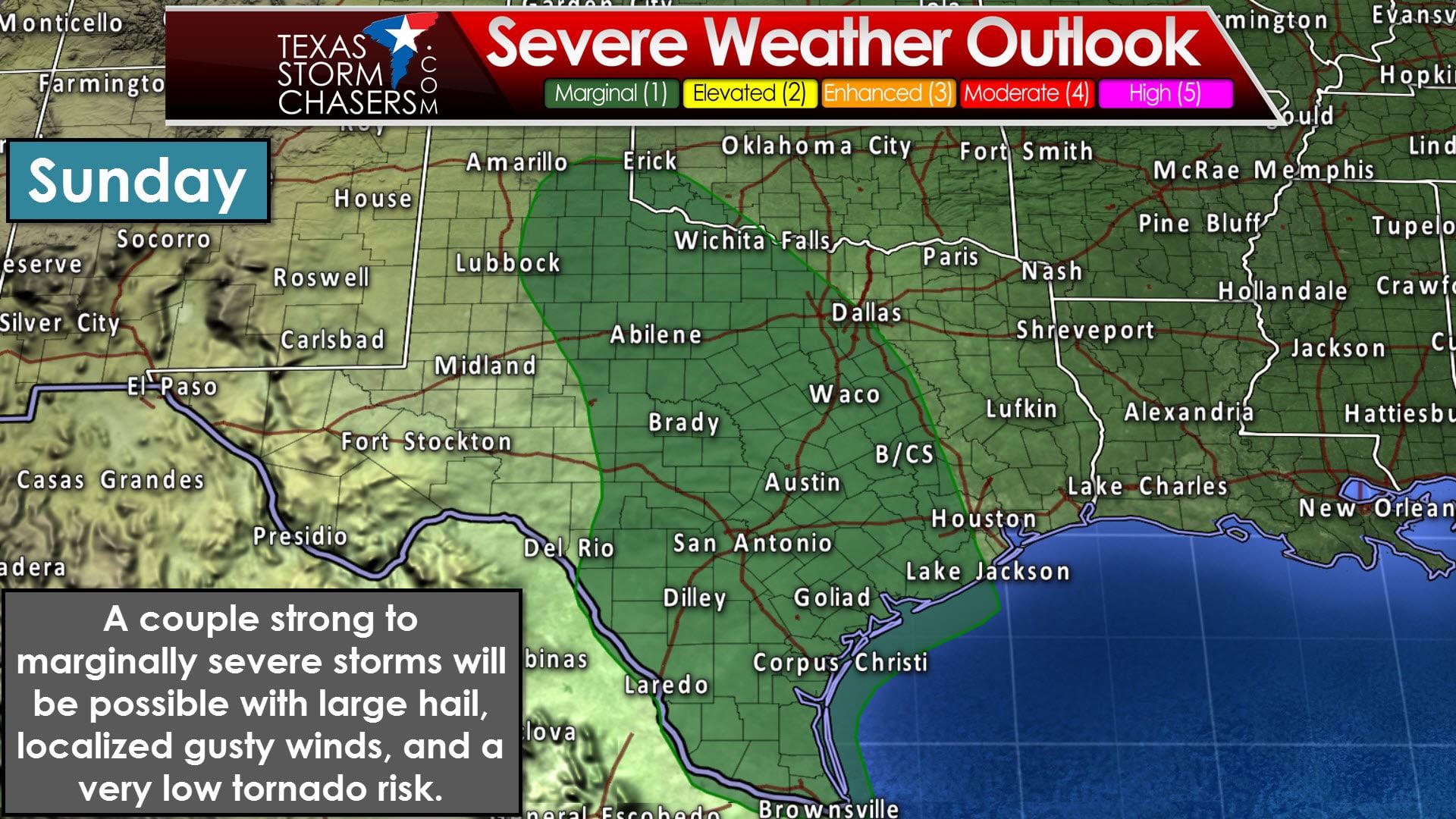
A couple strong to marginally severe storms will be possible on Sunday as our storm system starts to move in. A marginal risk of severe weather includes the Rio Grande Valley, Deep South Texas, the Middle Coast, the Brazos Valley, South-Central Texas, the Hill Country, Central Texas, Concho Valley, Big Country, North Texas, Northwest Texas, West-Central Texas, and the southeastern Texas Panhandle. This doesn’t look like a potent severe weather setup by any stretch of the imagination. However, we’ll have plenty of instability to work with and wind shear values will be increasing. At this juncture it seems that the primary threats with the stronger storms will be large hail and spotty wind gusts over 55 MPH. A very low risk of a tornado may develop, but that will depend on factors we simply can’t get a grasp on until we’re within 18-24 hours of the event.
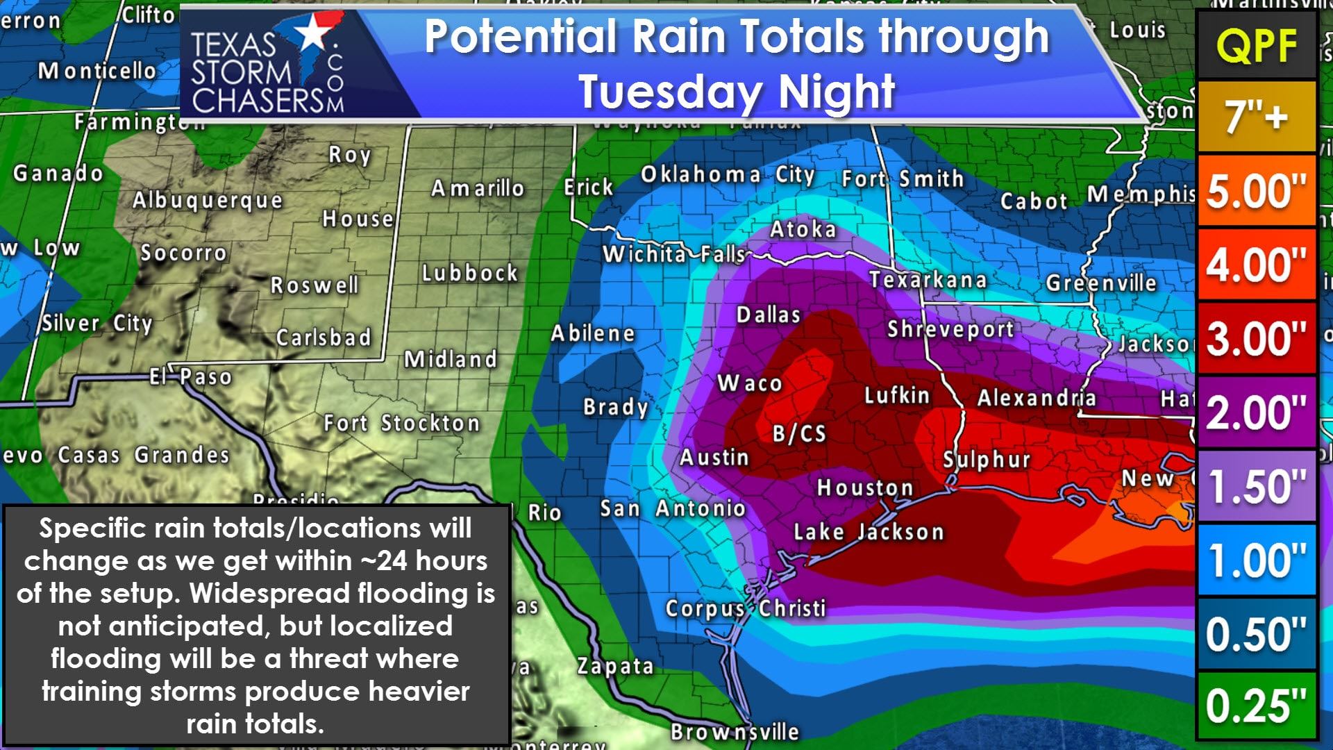
What will be the primary impact with our Sunday-Monday system is the potential for a frog-strangler across parts of Texas. Data continues to support the possibility of one to three inches of rain across the eastern half of Texas. Most of this would likely fall in the Sunday Night-Monday Night timeframe. We’ll have to watch for locally heavier rainfall amounts of 3 to 6 inches along and east of Interstate 35 from Hillsboro south to Austin east into the Brazos Valley and East Texas. Localized flash flooding may become a threat, so we’ll watch for any mesoscale factors that may enhance rainfall rates. There will be copious amounts of moisture available, so it won’t take too much to get some heavy rainfall totals.


0 Comments