
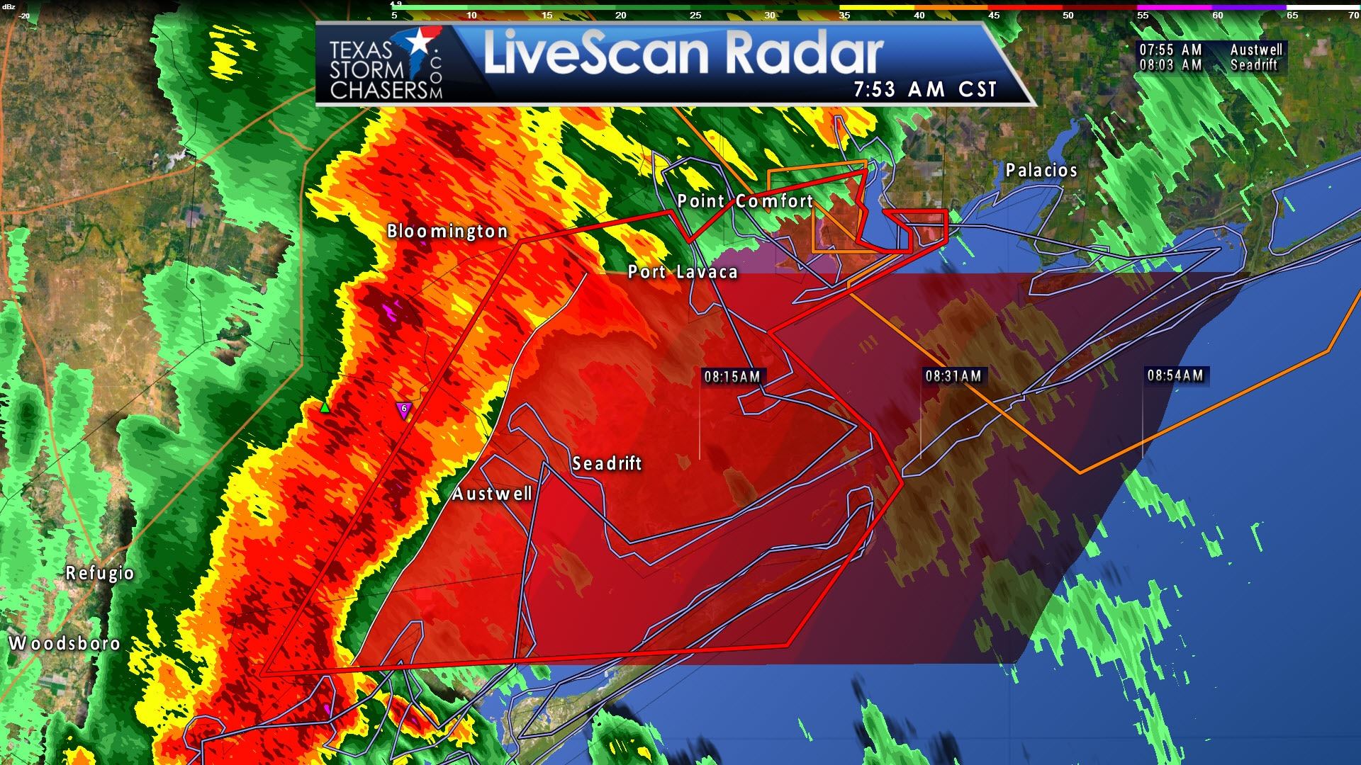
Tornado Warning for Calhoun, northeast Aransas, and northeast Refugio counties in South Texas until 815 AM. A line of thunderstorms capable of producing brief tornadoes extends from Port Lavaca to 2 miles west of Austwell to 6 miles north of Lamar. This line may produce weak, brief tornadoes as it moves east toward Magnolia Beach, Indianola, and Port O’Connor.
Tornado Warning
National Weather Service Corpus Christi TX
748 AM CST TUE FEB 14 2017
The National Weather Service in Corpus Christi has issued a
* Tornado Warning for…
Calhoun County in south Texas…
Northeastern Aransas County in south central Texas…
Northeastern Refugio County in south central Texas…
* Until 815 AM CST
* At 746 AM CST, line of strong thunderstorms capable of producing
brief tornadoes was located along a line extending from near Green
Lake to 9 miles north of Holiday Beach, moving east at 45 mph.
HAZARD…Tornado.
SOURCE…Radar indicated rotation.
IMPACT…Flying debris will be dangerous to those caught without
shelter. Mobile homes will be damaged or destroyed.
Damage to roofs, windows, and vehicles will occur. Tree
damage is likely.
* These dangerous storms will be near…
Green Lake around 750 AM CST.
Port Lavaca, Aransas National Wildlife Refuge and Alamo Beach
around 800 AM CST.
Point Comfort around 805 AM CST.
Seadrift, Olivia and Long Mott around 810 AM CST.
Port Alto and Schicke Point around 815 AM CST.
Other locations impacted by these tornadic storms include Austwell.


0 Comments