
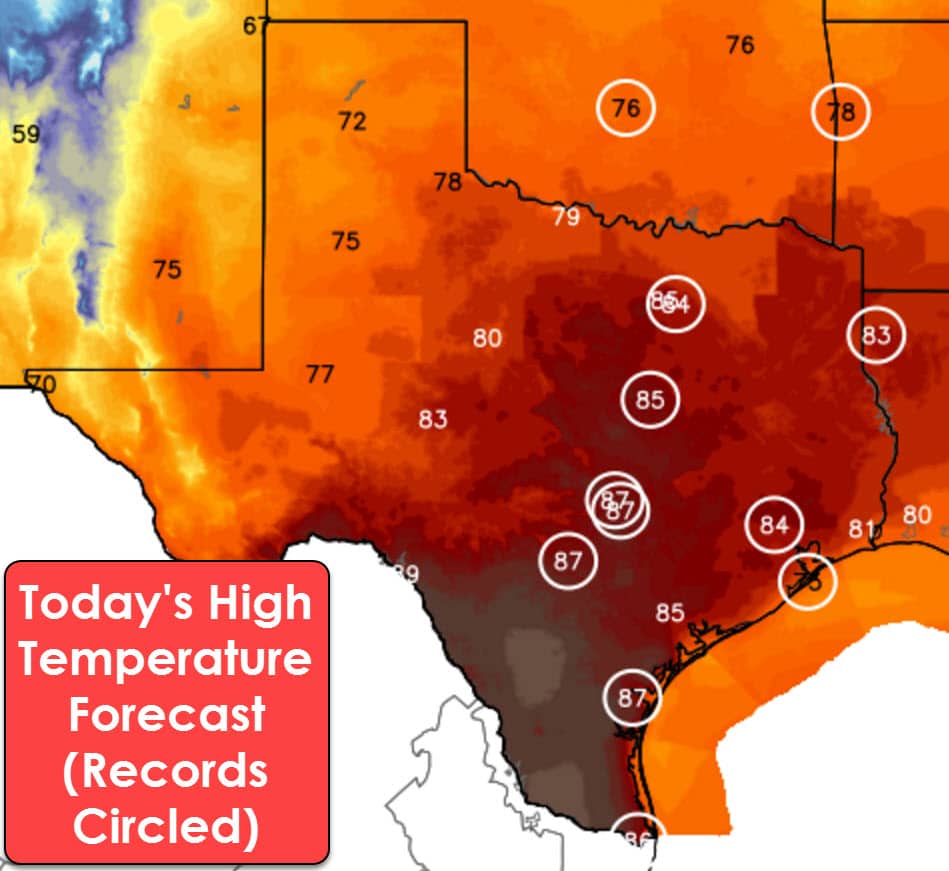
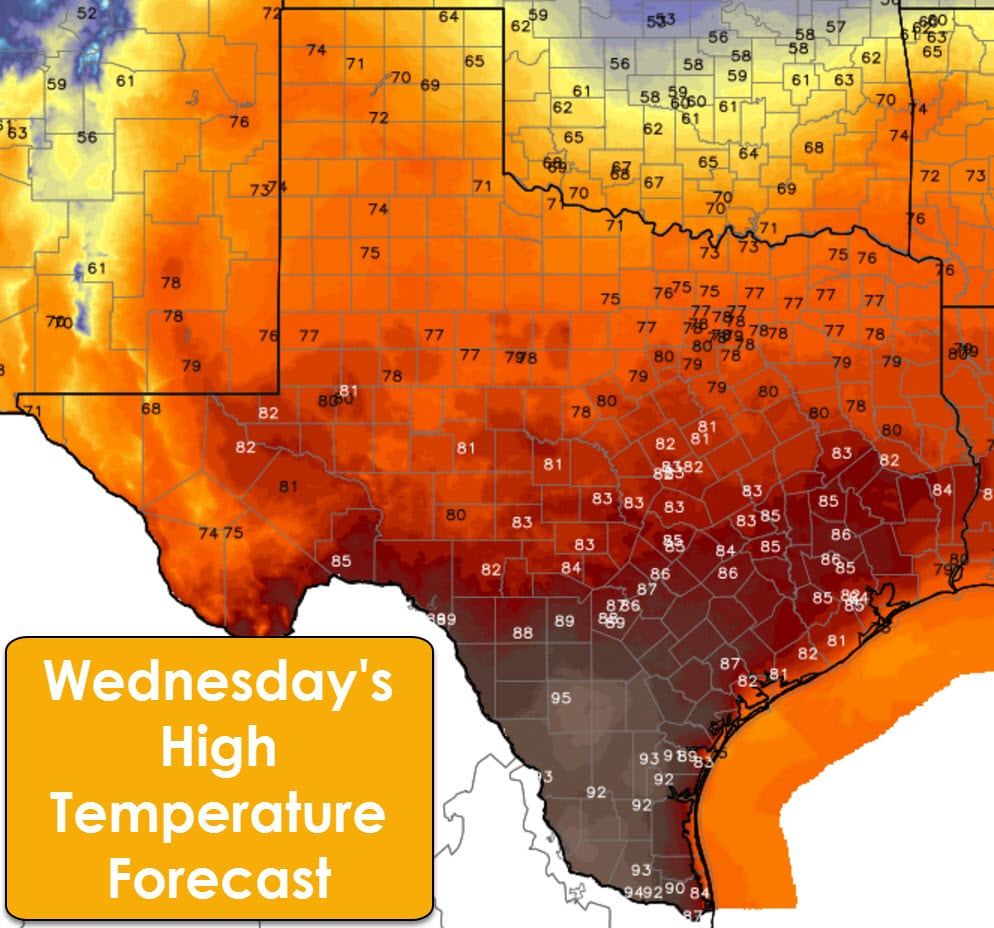
Dense fog is an issue across Southwest and South Texas again this morning. We should see it lift by mid to late morning as temperatures soar into the 80s and 90s. Until then, enjoy your brief respite from the “April” heat. Another day of record-high temperatures are forecast across parts of the state this afternoon. The Texas Panhandle, West Texas, into the Permian Basin, and Borderland, will all top out in the 70s this afternoon. That is around 20 degrees above average for this time of year for the Panhandle and West Texas, but no worries, you’ll be the ‘coolest’ spots in the state today. Further east and south we’ll see even warmer temperatures this afternoon. Highs will make it into the 80s across the eastern two-thirds of Texas today. Middle to upper 80s are forecast in Central Texas, South-Central Texas, with 90s in South Texas and Deep South Texas. East Texas, Northeast Texas, Southeast Texas, up into North Texas will make it into the middle 80s this afternoon. Several cities will easily set new record highs for today.
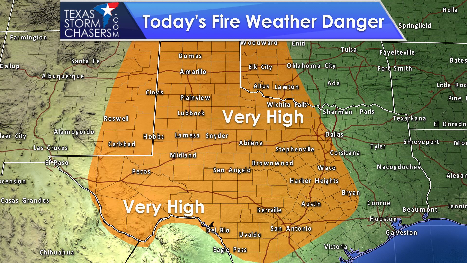
Record heat, very low humidity values, and dry surface fuels will allow for very high to near critical fire weather danger to develop by this across across the western two-thirds of Texas. The only saving grace from a wildfire outbreak will be that our winds should be on the tamer side, under 20 MPH for the most part. We’ll still see unpredictable fire behavior with any grass fires that start, and they’ll spread in a hurry. Fire officials will likely require increased resources to bring fires under control today.
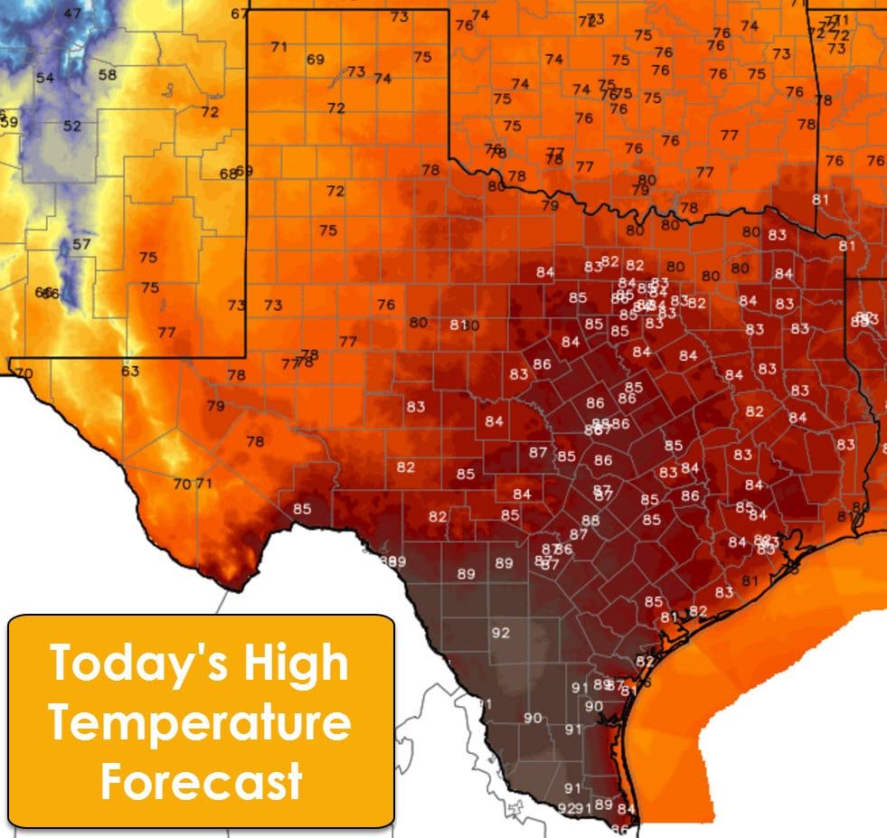
Tomorrow will be the same story temperature-wise, except the hottest temperatures will start to be shunted to the southern half of Texas. The northern half of the state will have highs in the 70s while the southern half of Texas gets to bask in the 80s and 90s. Some locations may get dangerously close to the upper 90s in South Texas tomorrow. I honestly wouldn’t be too surprised to see a 98 or 99 pop up, which is absolutely disgusting for early February. Not unprecedented, but just downright yucky – for the lack of a better word.
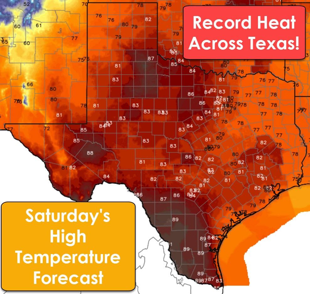
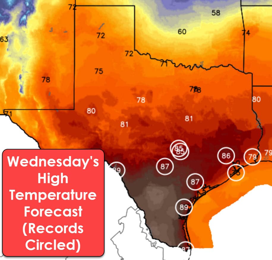
Thursday will be our coolest day in the forecast as high temperatures drop back into the 60s and 70s across Texas. Its sad I have to say the coolest day, because these values are still 10 to 20 degrees above where we should be for early February. We start to climb back up on Friday with downright hot temperatures forecast on Saturday. It is rather rare to have record heat forecast five days away, but that’s what we have already set for Saturday with highs ranging from the upper 70s to the 90s across Texas. Saturday won’t feel like an April day, it’ll be similiar to what we would see in May! A cold front finally arrives early next week which will knock our temperatures back down to near seasonal averages. In addition, there are indications we may have a fairly good soaking in store next week as a couple ingredients come together to support heavier, widespread rains. We’ll have to wait and see how that plays out in model-land.


0 Comments