
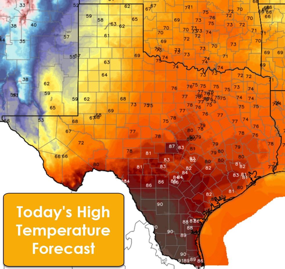
Record high temperatures are possible in portions of Texas this afternoon before a cold front arrives tonight into Wednesday. Houston, Austin, and several cities in South Texas are all forecast to approach record territory this afternoon with highs in the 80s. South Texas will likely see many 90s this afternoon. We’ll see at least 70s this afternoon across the eastern two-thirds of Texas with gusty winds. So we’ll definitely feel more like April versus January this afternoon. That changes for the second half of the week as a cold front knocks temperatures back down to seasonal norms for January.
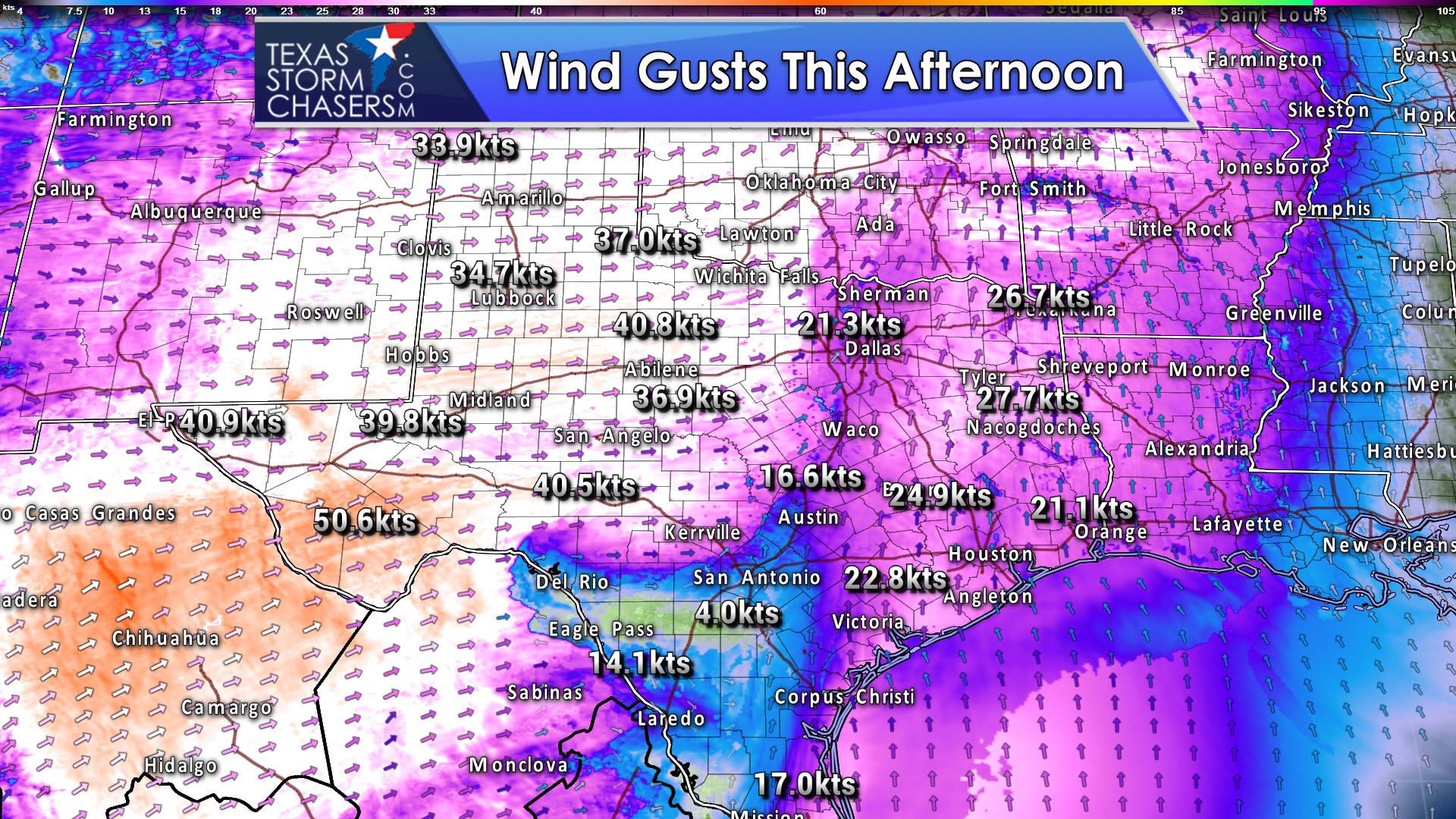
Winds will become gusty this afternoon as mostly sunny skies help mix down stronger winds a few thousand feet above the ground. The wind direction along and east of Interstate 35 should be out of the south up to 30 MPH. The Panhandle, southwest through the Borderland, and east through the Hill Country and Northwest Texas will see winds out of the west/southwest with gusts up to 45 MPH. The higher elevations around Alpine in far Southwest Texas could see winds gust as high as 60 MPH this afternoon. Some blowing dust is a good bet in West Texas.
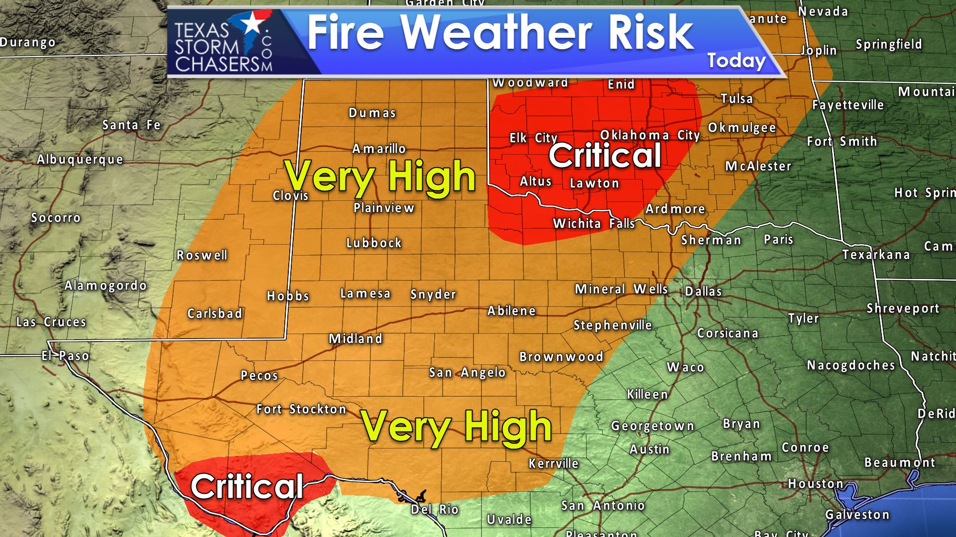
Unseasonably warm temperatures, a dry airmass, and strong winds will result in very high fire conditions across the Permian Basin, Concho Valley, Big Country, Hill Country, West Texas, the Texas Panhandle, western North Texas, and Northwest Texas. The highest fire danger today will be in far Southwest Texas and in Northwest Texas with critical fire weather concerns. Any wildland fire that develops today will likely spread at a rapid pace and require substantial resources to bring under control. If you see smoke please call your local authorities. Don’t assume someone else has already done so and don’t post it on Facebook first…


0 Comments