
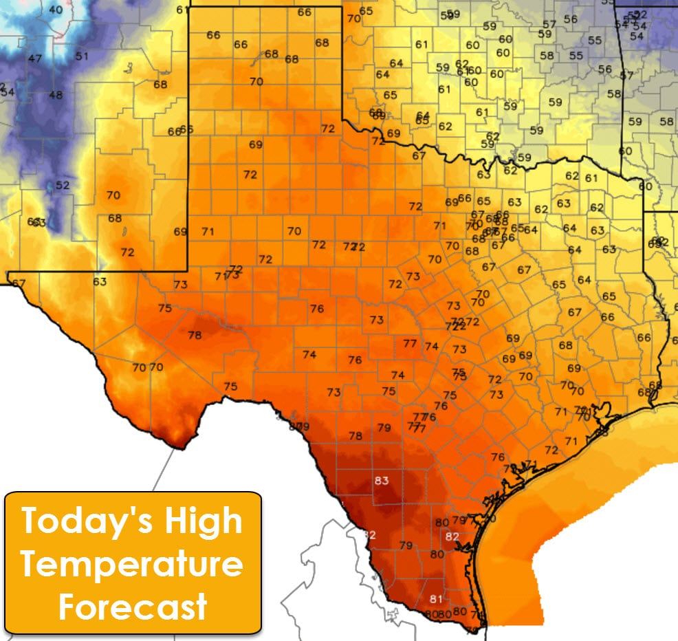
Conditions are much calmer this morning compared to Sunday when we had winds gusting up to 50 MPH across much of Texas. These strong winds were caused by a tight pressure gradient as a deep area of low pressure brought severe weather to the southeastern United States. That low pressure is now impacting the northeastern United States as a nor’easter. High temperatures this afternoon will top out in the 60s to 80s across Texas. The coolest locations will be in northeast Texas with lower 60s this afternoon. 70s are expected in Southeast Texas through the Concho Valley north into the Texas Panhandle. South Texas and the Rio Grande Valley will top out in the 80s.
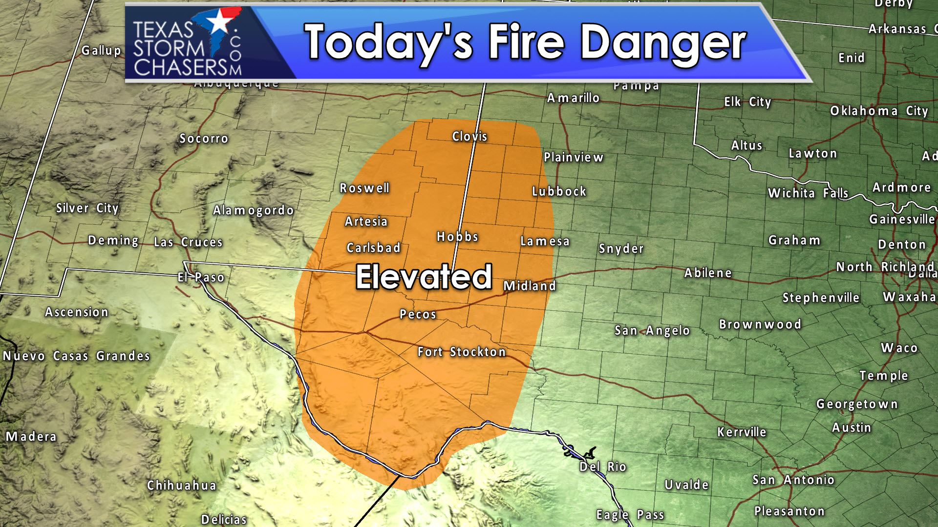
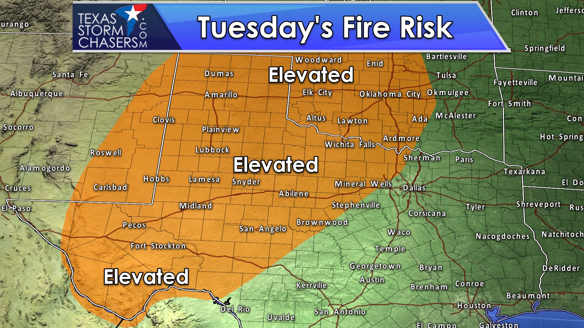
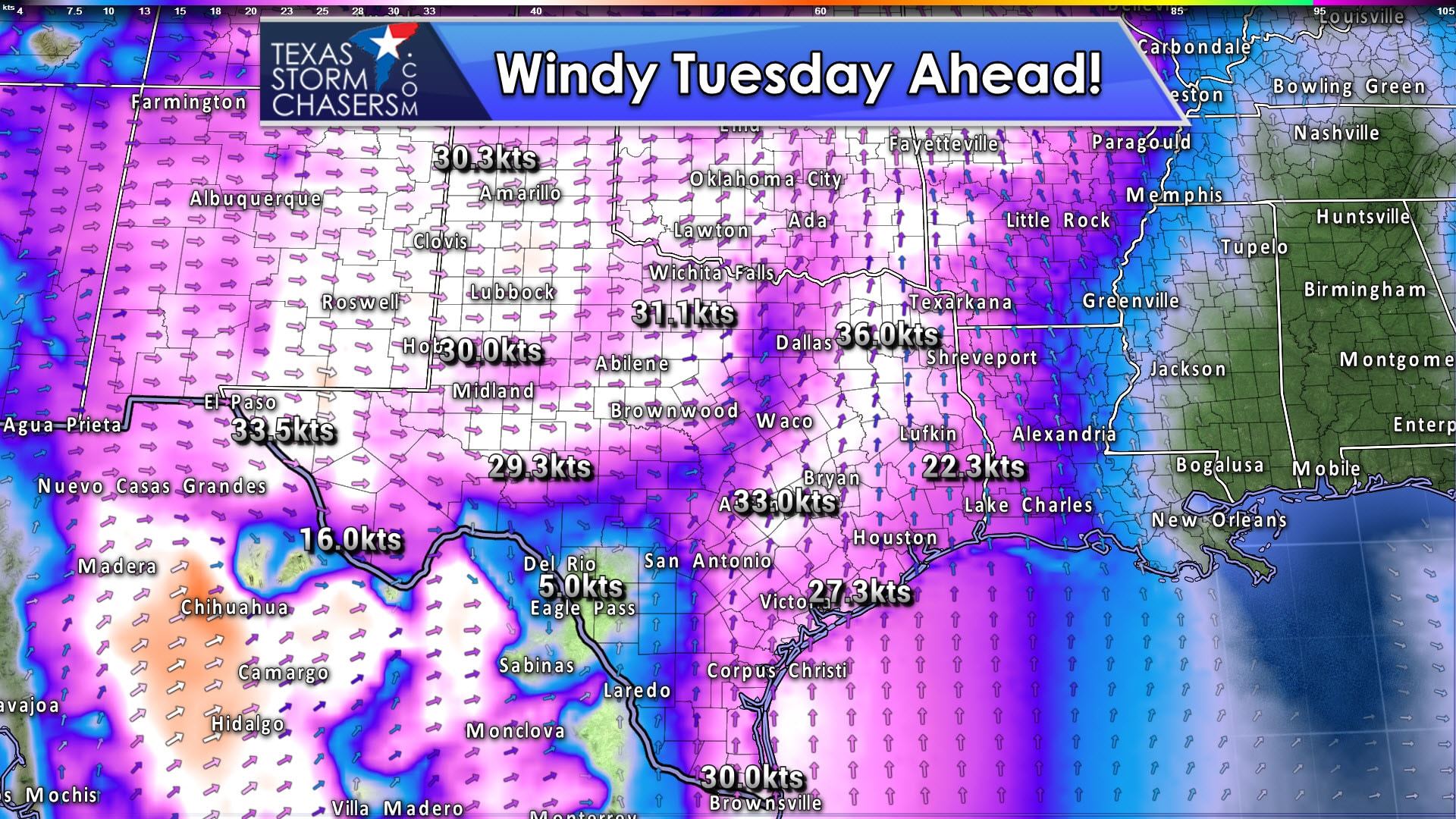
There will be an elevated risk of wildfires both today and especially on Tuesday. Winds will become gusty again this afternoon in West Texas, the Permian Basin, south into the Alpine area. Combined with a dry airmass and high temperatures in the 70s there will be a risk of fast-moving grass fires. The risk for wildfires is higher on Tuesday as gusty winds spread into more of Texas as a low pressure area passes to our north. Very warm temperatures and a dry airmass will create a pretty good setup for wildfire potential.
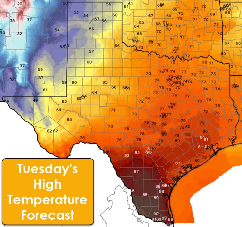
Near record-high temperatures are forecast on Tuesday in Southeast Texas, South Texas, and the Rio Grande Valley with 80s to lower 90s in the forecast. Cooler temperatures are expected in the Panhandle, West Texas, and the Borderland. 70s to right around 80 are forecast in Central Texas. A few showers are possible in Southeast Texas, but precipitation totals should remain light. No severe weather or flash flooding are in the forecast.
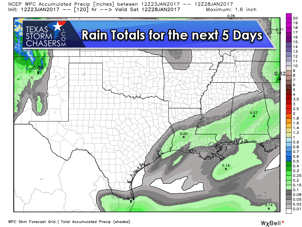
After the slight rain chance on Tuesday in Southeast Texas the next several days look dry. In fact, we may spend the next week without any major rain chances with seasonal temperatures.
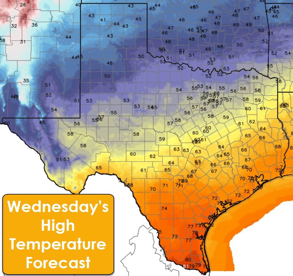
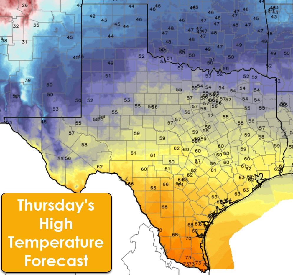
Temperatures on Wednesday and Thursday will return to seasonal averages for January as a cool front moves through Texas. We’re not talking about any arctic air, but temperatures will feel cooler thanks to the warm weather we’ve had of late. No significant weather hazards are in the forecast later this week as a relatively quiet pattern sets up over Texas.


0 Comments