
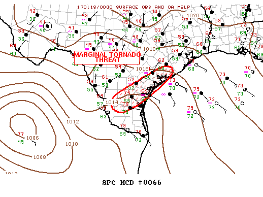
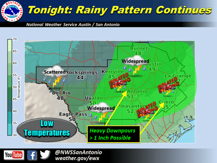
The weather highlights this evening will be the chances for scattered strong to severe storms with heavy rain overnight across the coastal plains south of San Antonio down to around Corpus Christi and east into the Houston/Galveston area by early morning. The old frontal boundary from Monday is currently draped along the coast in a line bisecting Houston then stretching west between Eagle Lake, Hallettsville, Karnes City and then dipping a bit southwest towards Laredo. The Storm Prediction Center issued a Mesoscale Discussion (MD) earlier this evening highlighting areas along and south of the frontal boundary near and along the central Texas coast with the chance for isolated severe storms tonight with a chance for a tornado or two. The tornado risk is not high, but it’s non-zero and worth watching into the overnight hours. Anticipated coverage of severe storms with tornado potential is too sparse to warrant a Tornado Watch across the area, but residents here should make sure they have a way to get weather warnings overnight.
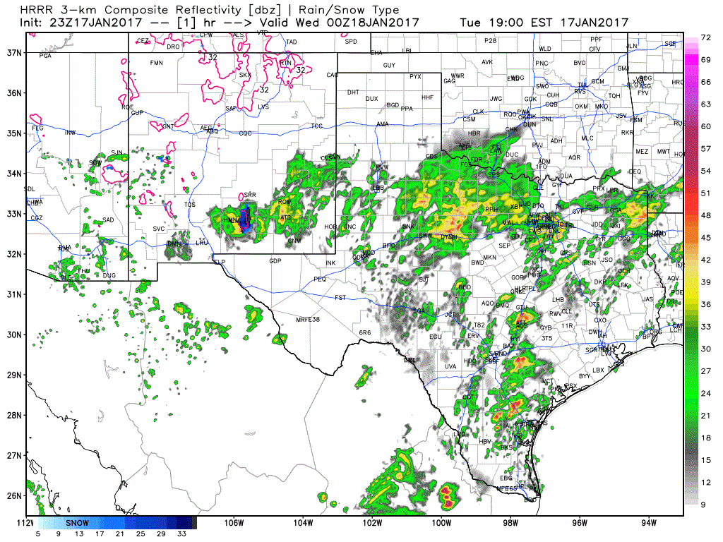
Further north up across north central, western north Texas and the rolling plains, a wide swath of elevated scattered storms will continue to move off to the northeast for a few more hours this evening bringing some beneficial rainfall across the region. These may contain a bit of thunder and lightning from time to time, but are not anticipated to become severe. By morning, most of the rain across the northern half of the state will have shifted east into northeast, east and north central Texas. Below, simulated radar through 11am tomorrow morning will give you an idea of what this forecast model thinks the radar will look like between now and then.


0 Comments