
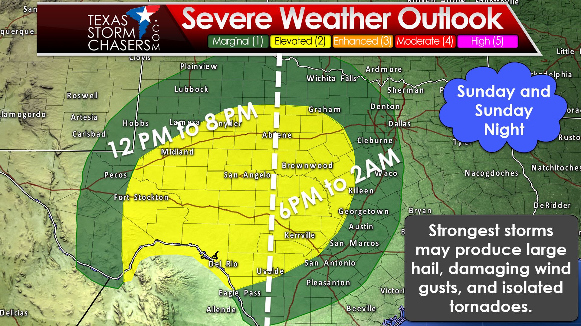
For those who have not been paying attention to the forecast we do indeed have a threat for severe thunderstorms on Sunday into Sunday Night. The Storm Prediction Center has placed the Permian Basin, Concho Valley, Big Country, Hill Country, and western sections of North and Central Texas in the standard category 2 risk for severe weather. A category 1 risk includes West Texas, Northwest Texas, and locations along and west of Interstate 35 from Gainvesille south through the D/FW Metroplex through Waco, to Austin and San Antonio. On a five-level risk scale one is the lowest and five is the highest. A category two risk is the ‘standard’ risk level we see during severe weather potential. Anything higher becomes more rare and the marginal risk is where isolated severe storms are possible. A squall line will race east tomorrow into tomorrow night across both risk areas with a risk of damaging straight-line winds, hail up to the size of ping-pong balls, and isolated tornadoes.
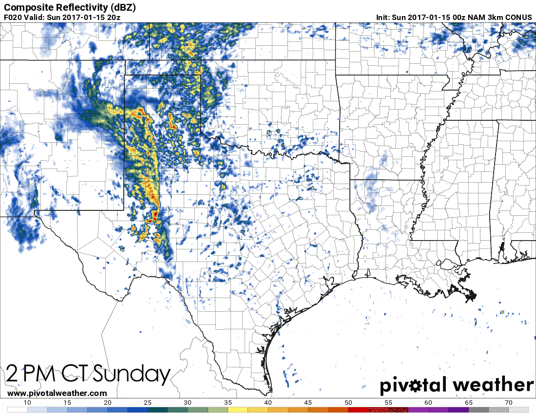
The timing aspect of tomorrow remains at moderate confidence. We should see a broken line of thunderstorms underway by early afternoon across the Permian Basin. Some of these storms may be strong with large hail and locally damaging wind gusts. An isolated tornado is not out of the question, but will be dependent on an organized supercell taking advantage of the local environment. Storms should grow upscale fairly quickly into a squall line. That squall line will race east at 35-45 MPH. By the early evening this line of storms will be moving east across the Big Country and Concho Valley. Some sections of the line will likely be strong with straight-line wind gusts near or exceeding 60 MPH. Brief tornadoes will be possible in more intense bowing segments of the line. Those bowing segments will also be where the highest straight-line winds will be located. The entire squall line will not produce damaging winds, but sections of it very well may. Current projections place the squall line near the D/FW Metroplex between 10 PM and 1 AM. It’ll be running out of instability at that point, but wind fields aloft will be very strong. It remains unclear how much ‘oomph’ the squall line will have by the time it reaches I-35, but we could very well still be dealing with damaging wind gusts and isolated tornadoes.

I encourage you to check back at various points on Sunday for updates on the severe weather outlook. I would not be surprised to see the category 1 and category 2 risk areas expanded a bit east in later outlooks. I’ve had many questions wondering how bad tomorrow’s severe weather risk could be or if it could be another December 26. Look, 12/26/15 was a very rare event. I don’t expect an outbreak of violent, long-track tornadoes tomorrow. However, if we see one tornado tomorrow and it comes down your block, it’ll be your December 26. That’s why keeping up with the latest severe weather information is imperative. Any increase in instability values tomorrow will result in a more significant severe weather risk. We’ll keep tabs on the latest and have a detailed blog update for you by mid-Sunday morning.


0 Comments