
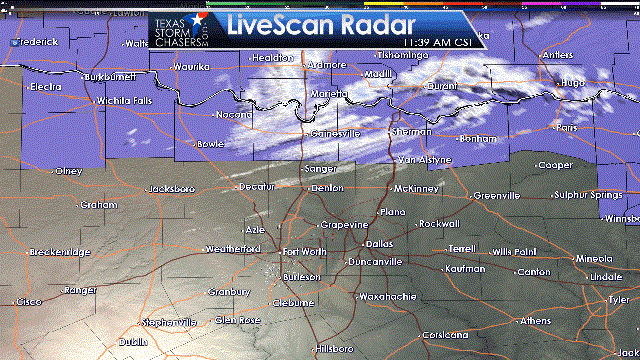
Bands of light sleet/snow have been moving over the D/FW metroplex for the past hour. This activity will likely continue through about 3 PM as upper level lift peaks overhead. After that point lift is expected to decrease along with a fairly quick end to the winter precipitation. The purple-shaded counties are where a winter weather advisory is in place. That is where surface temperatures are lowest and where up to one inch of snow may accumulate. We’ve received several reports of slick roads along the Red River. To the south in the D/FW Metroplex, the expectation is for about another hour to hour and a half of potential snow. We could see a dusting to maybe a quarter inch of snow in some locations. A few bridges and overpasses may develop slick spots, but the more widespread hazardous road conditions should remain closer to Highway 82 and north into Oklahoma. Most of the ‘heavier’ bands of snow with large flakes are narrow and only last over a location for a few minutes. That will prevent too much accumulation in North Texas this afternoon. Enjoy the brief winter weather but the cold will last into the night.


0 Comments