
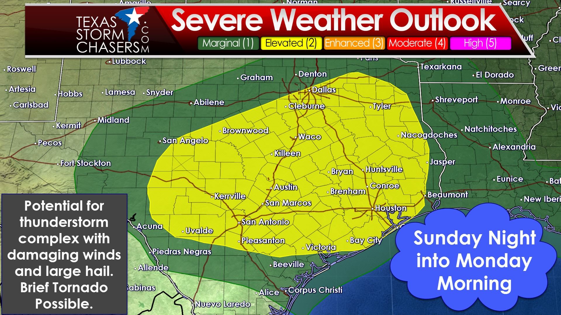
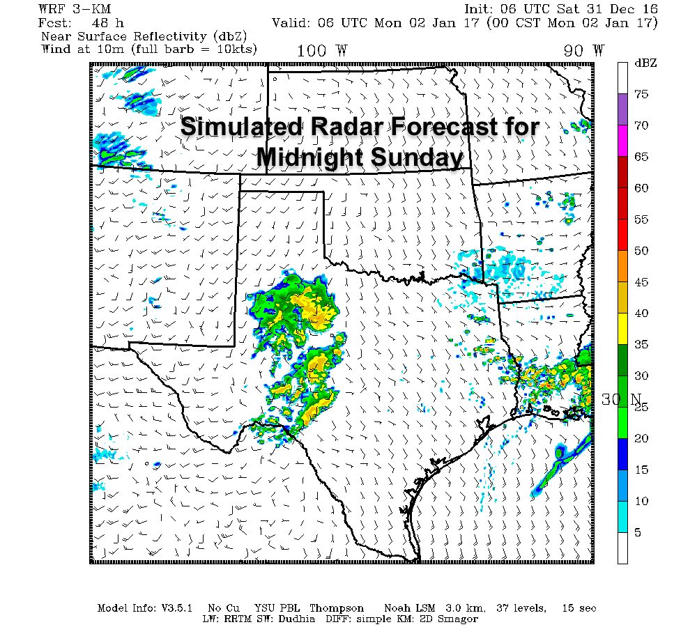
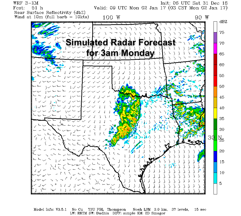
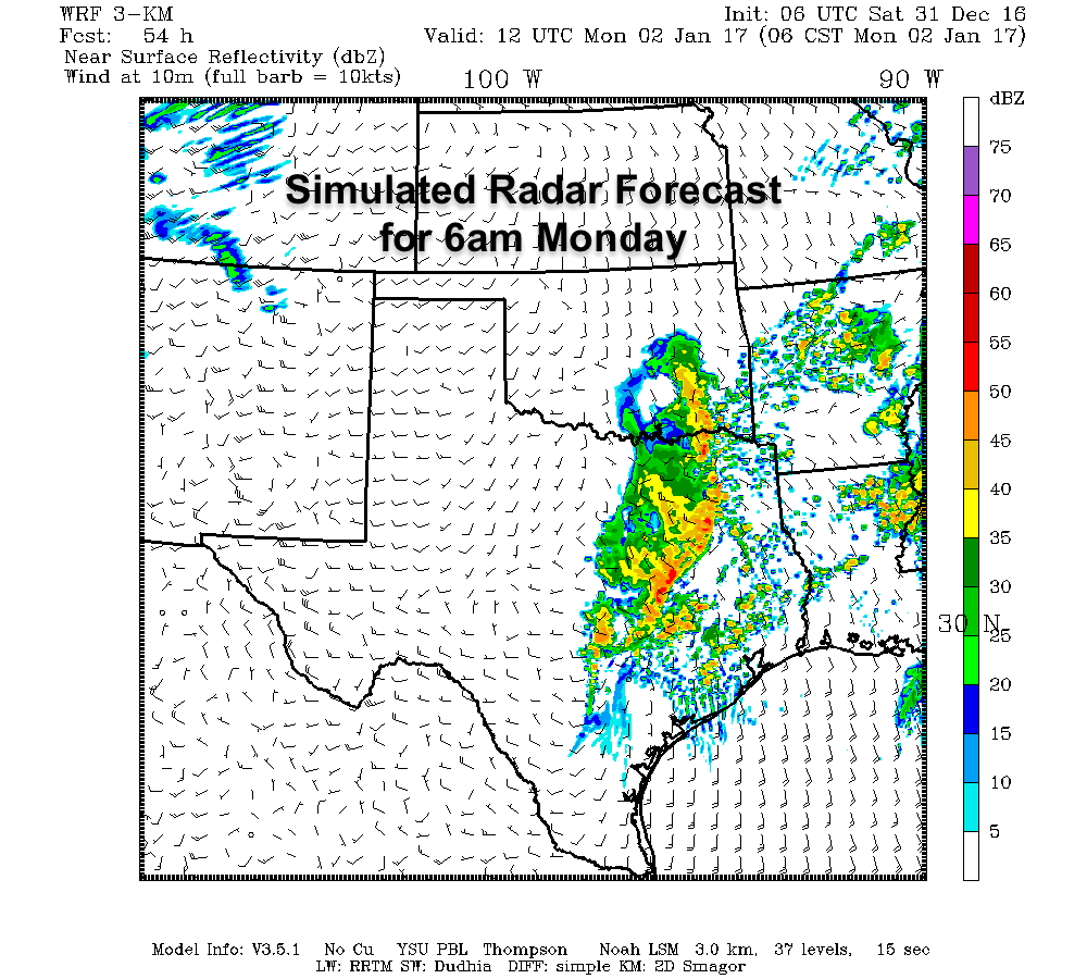
With tomorrow’s severe weather risk we’re not expecting anything during the daylight hours. A strong cap will keep any ongoing rain/storms well below severe limits. As upper level forcing increases tomorrow evening we should see a cluster of thunderstorms develop in western areas of the risk zone. That cluster of storms will move east through the nighttime hours Sunday and into the morning hours Monday. I’d say a window from 9 PM in the western zones (perhaps a bit later) up through 11 AM Monday in the eastern zones sounds like a good window for now. Some portions of this cluster, or squall line, could be severe with damaging wind gusts over 60 MPH. Higher instablity values south of Interstate 20 mean there will also be a potential for large hail in Central Texas, the Hill Country, Brazos Valley, into Southeast Texas with the thunderstorm cluster. Tornadoes are not expected to become a significant hazard with this event, but a brief tornado cannot be ruled out at this point. For more specific timing information please see Jenny’s blog from this morning here.
Here's our latest thinking on the timing as well as threats of rain/storms Sunday & Early Monday. #dfwwx #ctxwx #texomawx #etxwx #abilene pic.twitter.com/wovmuXZxg3
— NWS Fort Worth (@NWSFortWorth) December 31, 2016


0 Comments