
While we’ve been talking the past couple of days about the chances for Canada to pay us a visit and bring winter weather along for the ride, we have a few other issues to deal with before then. Chances for strong to severe storms overnight Sunday (New Year’s Day) into Monday are increasing. The Storm Prediction Center has placed a Slight Risk across much of the state for that time period with the greatest risks being large hail and damaging winds.
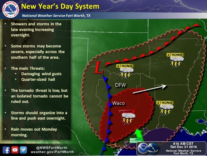
Instability will actually be on the increase beginning late Sunday afternoon with storms developing out across west Texas around sunset initially, then marching eastward across the state overnight into early Monday morning. The potential for a line of storms which then evolves into an elongated mesoscale convective system is likely as it continues to move east overnight into where better moisture and instability are available to sustain continued development. Large hail will be the main threat with the more robust storms. Damaging outflow winds will also be likely. The threat for tornadoes is low, but not zero either. As you head off to bed Sunday night, you’ll want to be sure you have a way to receive weather notifications should any Warnings be issued for your location overnight.
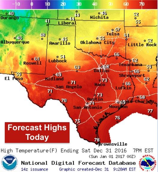
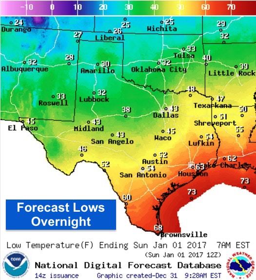
For today…mild temperatures return for most of the state and we’ll begin to see a rapid influx of moisture from the Gulf late today and overnight. Rain chances today are relegated to the southern half of the state, but that should be clearing out from west to east by later this afternoon. A weak cold front will work its way into north Texas today, but will quickly retreat north again overnight ahead of Sunday’s upper level disturbance. Overnight lows will be chilly, but nothing too extreme. Cool but pleasant and mostly rain-free conditions are expected this evening for those heading out to New Year’s Eve celebrations. You’ll still want to bring a jacket when you head out, especially for those in the northern half of the state.
As for winter weather chances next week, we still have some disagreement in the forecast models with regard to precipitation and whether or not it will be of the frozen variety. Models overnight came in much drier…basically a complete flip flop from previous model runs, so we really don’t have any more confidence today on what will happen. These systems are notoriously hard to predict, so for now, local forecasters are continuing to bring a chance of light wintry precip into the area later in the week ahead, but at this time it appears that any impacts will be low. At any rate, we’ll continue to watch and bring you the latest as this system develops.


0 Comments